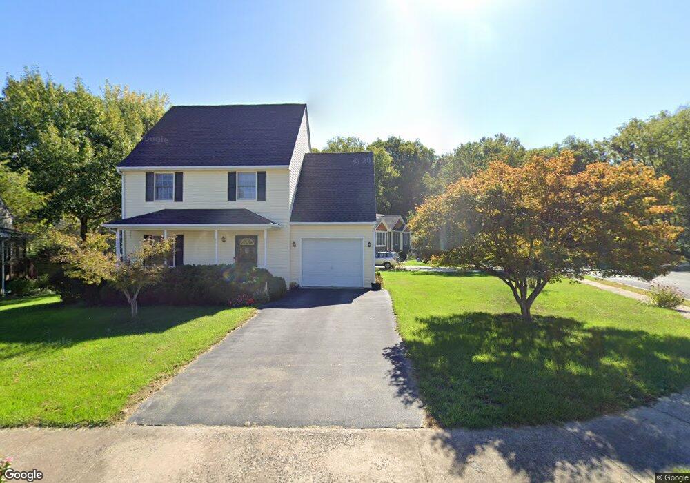
194 Hensel Dr Shepherdstown, WV 25443
Estimated Value: $291,000 - $350,000
3
Beds
3
Baths
1,363
Sq Ft
$235/Sq Ft
Est. Value
About This Home
This home is located at 194 Hensel Dr, Shepherdstown, WV 25443 and is currently estimated at $320,617, approximately $235 per square foot. 194 Hensel Dr is a home located in Jefferson County with nearby schools including Shepherdstown Elementary School, Shepherdstown Middle School, and Jefferson High School.
Ownership History
Date
Name
Owned For
Owner Type
Purchase Details
Closed on
Jun 6, 2005
Sold by
Page Adrian C and Branson Page Mary E
Bought by
Tinkler Alan S and Tinkler Barri E
Current Estimated Value
Home Financials for this Owner
Home Financials are based on the most recent Mortgage that was taken out on this home.
Original Mortgage
$33,000
Outstanding Balance
$24,758
Interest Rate
5.78%
Mortgage Type
Credit Line Revolving
Estimated Equity
$295,859
Create a Home Valuation Report for This Property
The Home Valuation Report is an in-depth analysis detailing your home's value as well as a comparison with similar homes in the area
Home Values in the Area
Average Home Value in this Area
Purchase History
| Date | Buyer | Sale Price | Title Company |
|---|---|---|---|
| Tinkler Alan S | $220,000 | None Available |
Source: Public Records
Mortgage History
| Date | Status | Borrower | Loan Amount |
|---|---|---|---|
| Open | Tinkler Alan S | $33,000 | |
| Open | Tinkler Alan S | $176,000 |
Source: Public Records
Tax History Compared to Growth
Tax History
| Year | Tax Paid | Tax Assessment Tax Assessment Total Assessment is a certain percentage of the fair market value that is determined by local assessors to be the total taxable value of land and additions on the property. | Land | Improvement |
|---|---|---|---|---|
| 2025 | $1,498 | $128,900 | $40,600 | $88,300 |
| 2024 | $1,365 | $116,600 | $40,600 | $76,000 |
| 2023 | $1,362 | $116,600 | $40,600 | $76,000 |
| 2022 | $1,152 | $96,700 | $29,600 | $67,100 |
| 2021 | $1,090 | $89,700 | $29,600 | $60,100 |
| 2020 | $1,029 | $90,400 | $29,600 | $60,800 |
| 2019 | $985 | $84,900 | $24,100 | $60,800 |
| 2018 | $981 | $83,500 | $24,100 | $59,400 |
| 2017 | $915 | $77,900 | $18,500 | $59,400 |
| 2016 | $921 | $78,600 | $18,500 | $60,100 |
| 2015 | $890 | $75,600 | $18,500 | $57,100 |
| 2014 | $889 | $75,600 | $18,500 | $57,100 |
Source: Public Records
Map
Nearby Homes
- LOt 9 Shepherds Cove Swift River Way
- 8285 Martinsburg Pike
- Lot 3 Martinsburg Pike
- Lot 2 Martinsburg Pike
- 332 W German St
- 99 Exeter Ct
- 300 W German St
- 7765 Martinsburg Pike
- 207 W High St
- 103 E New St
- 420 Starkeys Landing
- 115 Swearingen Way
- 302 Starkeys Landing
- 71 Cardinal Dr
- 51 Swearingen Way
- 8709 Shepherdstown Pike
- 95 Riderwood Way
- 55 Open Gate Ln
- 286 Starkeys Landing
- 36 Open Gate Ln
- 10 Wheat Ct
- 102 Rye Ct
- 25 Rye Ct
- 28 Wheat Ct
- 107 Rye Ct
- 189 Hensel Dr
- 170 Hensel Dr
- 35 Rye Ct
- 10 Briar Mountain Drive Lot 10
- 17 Briar Mountain Drive Lot 17
- 3 Briar Mountain Drive Lot 3
- 11 Briar Mountain Drive Lot 11
- 7 Briar Mountain Drive Lot 7
- 4 Dam Rd
- 0 Various Unit 1006107154
- 0 Rocky Marsh Rd Unit JF2039426
- 0 Rt 230 & Engle Moler Unit JF57705C
- 0 Rt 480 Unit JF2016388
- 0 Rocky Marsh Rd Unit JF58095C
- 0 Bones Wright St Unit JF7264225