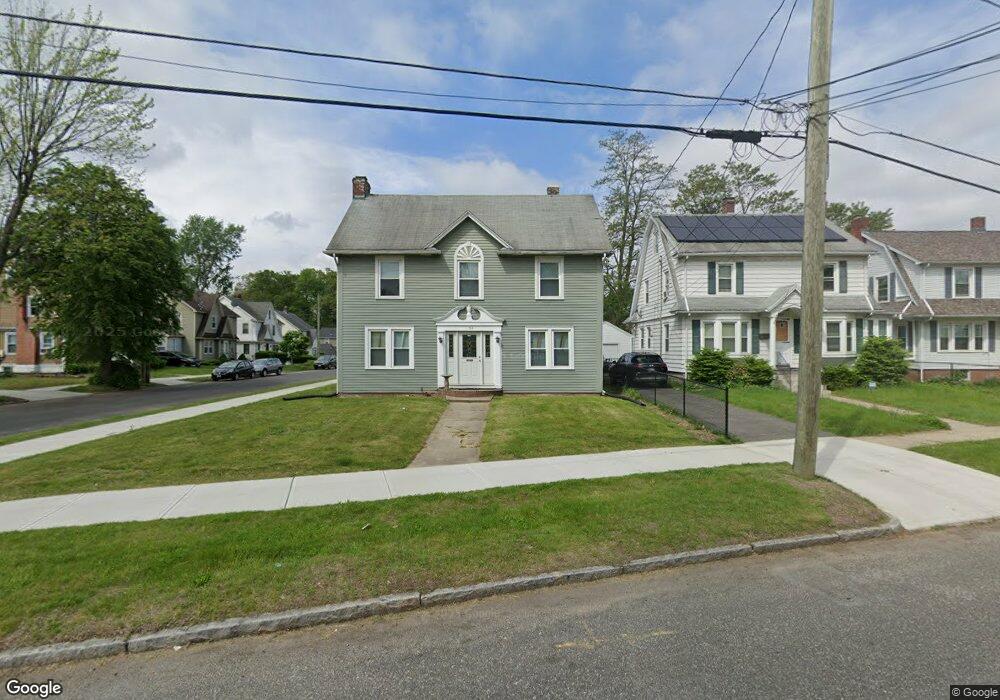
194 Middlesex St Springfield, MA 01109
Upper Hill NeighborhoodEstimated Value: $269,000 - $305,000
4
Beds
2
Baths
1,836
Sq Ft
$159/Sq Ft
Est. Value
About This Home
This home is located at 194 Middlesex St, Springfield, MA 01109 and is currently estimated at $291,667, approximately $158 per square foot. 194 Middlesex St is a home located in Hampden County with nearby schools including Daniel B Brunton, John J Duggan Middle, and Springfield High School of Science and Technology.
Ownership History
Date
Name
Owned For
Owner Type
Purchase Details
Closed on
Jan 29, 2010
Sold by
Watson Debra L
Bought by
Graduate Hsng Svcs Llc
Current Estimated Value
Purchase Details
Closed on
Jul 23, 2004
Sold by
Jreaswec Debra L and Watson Debra L
Bought by
Watson Debra L
Home Financials for this Owner
Home Financials are based on the most recent Mortgage that was taken out on this home.
Original Mortgage
$100,000
Interest Rate
6.28%
Mortgage Type
Purchase Money Mortgage
Purchase Details
Closed on
Mar 31, 1998
Sold by
Phelps Nancy L and Oneil Thomas J
Bought by
Jreaswec Debra L
Home Financials for this Owner
Home Financials are based on the most recent Mortgage that was taken out on this home.
Original Mortgage
$63,200
Interest Rate
6.96%
Mortgage Type
Purchase Money Mortgage
Create a Home Valuation Report for This Property
The Home Valuation Report is an in-depth analysis detailing your home's value as well as a comparison with similar homes in the area
Home Values in the Area
Average Home Value in this Area
Purchase History
| Date | Buyer | Sale Price | Title Company |
|---|---|---|---|
| Graduate Hsng Svcs Llc | $105,000 | -- | |
| Watson Debra L | -- | -- | |
| Jreaswec Debra L | $62,000 | -- |
Source: Public Records
Mortgage History
| Date | Status | Borrower | Loan Amount |
|---|---|---|---|
| Open | Jreaswec Debra L | $753,500 | |
| Previous Owner | Watson Debra L | $100,000 | |
| Previous Owner | Jreaswec Debra L | $16,047 | |
| Previous Owner | Jreaswec Debra L | $7,850 | |
| Previous Owner | Jreaswec Debra L | $63,200 |
Source: Public Records
Tax History
| Year | Tax Paid | Tax Assessment Tax Assessment Total Assessment is a certain percentage of the fair market value that is determined by local assessors to be the total taxable value of land and additions on the property. | Land | Improvement |
|---|---|---|---|---|
| 2025 | $3,853 | $245,700 | $31,300 | $214,400 |
| 2024 | $3,485 | $217,000 | $31,300 | $185,700 |
| 2023 | $3,511 | $205,900 | $28,400 | $177,500 |
| 2022 | $3,004 | $159,600 | $26,500 | $133,100 |
| 2021 | $3,005 | $159,000 | $18,800 | $140,200 |
| 2020 | $2,906 | $148,800 | $18,800 | $130,000 |
| 2019 | $2,970 | $150,900 | $16,000 | $134,900 |
| 2018 | $2,755 | $140,000 | $16,000 | $124,000 |
| 2017 | $2,593 | $131,900 | $15,100 | $116,800 |
| 2016 | $2,507 | $127,500 | $15,100 | $112,400 |
| 2015 | $2,490 | $126,600 | $15,100 | $111,500 |
Source: Public Records
Map
Nearby Homes
- 124-126 Westford Cir
- 135-137 Suffolk St
- 0 NS (24) Alden St
- 89 Bristol St
- 21 Westford Cir
- 62-64 Bristol St
- 111 Marlborough St
- 31-33 Suffolk St
- 867 Roosevelt Ave
- 189 Northampton Ave
- 11 Ina St
- 87 Fenwick St
- 19 Westford Ave
- 48-50 Dresden St
- 25 Dresden St
- 22 Amanda St
- 41 Olive St
- 44 Amanda St
- 290 Quincy St
- 46 Mapledell St
- 190 Middlesex St
- 22 Mortimer St
- 206 Middlesex St
- 184 Middlesex St
- 27 Mortimer St
- 178 Middlesex St
- 193 Middlesex St
- 23 Mortimer St
- 189 Middlesex St
- 16 Mortimer St
- 210 Middlesex St
- 135 Middlesex St
- 183 Middlesex St
- 17 Mortimer St
- 199 Middlesex St
- 187 Middlesex St
- 216 Middlesex St
- 216 Middlesex St
- 172 Middlesex St
- 11 Mortimer St
Your Personal Tour Guide
Ask me questions while you tour the home.