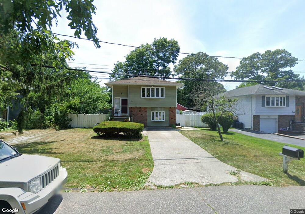
194 Mohawk St Ronkonkoma, NY 11779
Estimated Value: $633,000 - $714,000
5
Beds
3
Baths
2,082
Sq Ft
$328/Sq Ft
Est. Value
About This Home
This home is located at 194 Mohawk St, Ronkonkoma, NY 11779 and is currently estimated at $683,532, approximately $328 per square foot. 194 Mohawk St is a home located in Suffolk County with nearby schools including Cherokee Street Elementary School, Ronkonkoma Middle School, and Connetquot High School.
Ownership History
Date
Name
Owned For
Owner Type
Purchase Details
Closed on
Dec 10, 2019
Sold by
Walker Matthew and Walker David
Bought by
28 Hill Ave Llc
Current Estimated Value
Purchase Details
Closed on
May 10, 2017
Sold by
Thotam Liju and Thotam Mary S
Bought by
Walker Matthew and Walker David
Home Financials for this Owner
Home Financials are based on the most recent Mortgage that was taken out on this home.
Original Mortgage
$243,600
Interest Rate
4.08%
Mortgage Type
New Conventional
Purchase Details
Closed on
Nov 27, 2001
Sold by
Lauto John and Lauto Angeolina
Bought by
Thotam Liju and Thotam Mary S
Home Financials for this Owner
Home Financials are based on the most recent Mortgage that was taken out on this home.
Original Mortgage
$189,500
Interest Rate
6.1%
Create a Home Valuation Report for This Property
The Home Valuation Report is an in-depth analysis detailing your home's value as well as a comparison with similar homes in the area
Home Values in the Area
Average Home Value in this Area
Purchase History
| Date | Buyer | Sale Price | Title Company |
|---|---|---|---|
| 28 Hill Ave Llc | -- | None Available | |
| Walker Matthew | $304,500 | Safe Harbour Title Agency Lt | |
| Thotam Liju | $216,200 | Lawyers Title Insurance Corp |
Source: Public Records
Mortgage History
| Date | Status | Borrower | Loan Amount |
|---|---|---|---|
| Previous Owner | Walker Matthew | $243,600 | |
| Previous Owner | Thotam Liju | $189,500 |
Source: Public Records
Tax History Compared to Growth
Tax History
| Year | Tax Paid | Tax Assessment Tax Assessment Total Assessment is a certain percentage of the fair market value that is determined by local assessors to be the total taxable value of land and additions on the property. | Land | Improvement |
|---|---|---|---|---|
| 2024 | -- | $40,600 | $8,400 | $32,200 |
| 2023 | -- | $40,600 | $8,400 | $32,200 |
| 2022 | $9,681 | $40,600 | $8,400 | $32,200 |
| 2021 | $9,681 | $40,600 | $8,400 | $32,200 |
| 2020 | $10,023 | $40,600 | $8,400 | $32,200 |
| 2019 | $9,681 | $0 | $0 | $0 |
| 2018 | -- | $40,600 | $8,400 | $32,200 |
| 2017 | $9,694 | $40,600 | $8,400 | $32,200 |
| 2016 | $9,675 | $40,600 | $8,400 | $32,200 |
| 2015 | -- | $40,600 | $8,400 | $32,200 |
| 2014 | -- | $40,600 | $8,400 | $32,200 |
Source: Public Records
Map
Nearby Homes
- 159 Mohawk St
- 187 N Huron St
- 70 W 8th St
- 130 N Huron St
- 53 W 8th St
- 93 W 6th St
- 67 Richmond Blvd Unit 2A
- 45 Richmond Blvd Unit 4A
- 43 Richmond Blvd Unit 2A
- 48 W 5th St
- 99 Richmond Blvd Unit 3A
- 63 Richmond Blvd Unit 4B
- 57 Richmond Blvd Unit 2B
- 3 Broadway
- 87 Richmond Blvd Unit 2B
- 223 N 4th St
- 99 W 2nd St
- 28 Lakeview Ct
- 10 Canoe Place
- 370 Central Islip Blvd