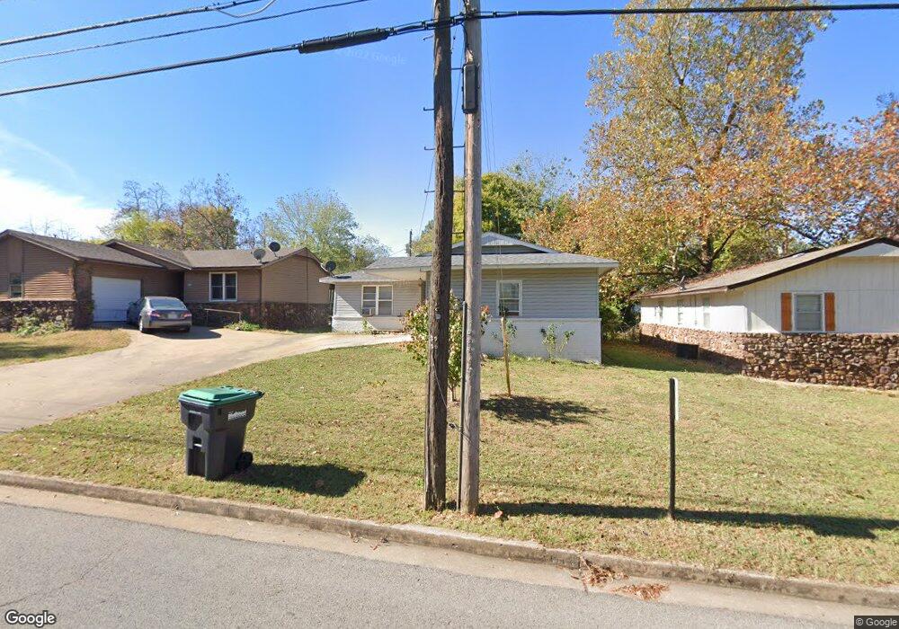
194 N Moccasin Ave Tahlequah, OK 74464
Estimated Value: $113,000 - $176,000
2
Beds
1
Bath
1,012
Sq Ft
$133/Sq Ft
Est. Value
About This Home
This home is located at 194 N Moccasin Ave, Tahlequah, OK 74464 and is currently estimated at $134,104, approximately $132 per square foot. 194 N Moccasin Ave is a home located in Cherokee County with nearby schools including Greenwood Elementary School, Cherokee Elementary School, and Tahlequah Middle School.
Ownership History
Date
Name
Owned For
Owner Type
Purchase Details
Closed on
Feb 17, 2005
Sold by
Denniston Mike and Denniston Lara
Bought by
Ruiz Juan and Ruiz Judith
Current Estimated Value
Home Financials for this Owner
Home Financials are based on the most recent Mortgage that was taken out on this home.
Original Mortgage
$60,000
Outstanding Balance
$30,213
Interest Rate
5.71%
Mortgage Type
New Conventional
Estimated Equity
$103,891
Purchase Details
Closed on
Aug 5, 1996
Sold by
Beverly and Charles Hooper
Bought by
Mike Denniston
Create a Home Valuation Report for This Property
The Home Valuation Report is an in-depth analysis detailing your home's value as well as a comparison with similar homes in the area
Home Values in the Area
Average Home Value in this Area
Purchase History
| Date | Buyer | Sale Price | Title Company |
|---|---|---|---|
| Ruiz Juan | $75,000 | Tahlequah Abstract Closing | |
| Mike Denniston | $44,900 | -- |
Source: Public Records
Mortgage History
| Date | Status | Borrower | Loan Amount |
|---|---|---|---|
| Open | Ruiz Juan | $60,000 |
Source: Public Records
Tax History Compared to Growth
Tax History
| Year | Tax Paid | Tax Assessment Tax Assessment Total Assessment is a certain percentage of the fair market value that is determined by local assessors to be the total taxable value of land and additions on the property. | Land | Improvement |
|---|---|---|---|---|
| 2025 | $722 | $7,390 | $679 | $6,711 |
| 2024 | $722 | $7,617 | $679 | $6,938 |
| 2023 | $722 | $8,650 | $674 | $7,976 |
| 2022 | $803 | $8,650 | $674 | $7,976 |
| 2021 | $805 | $8,650 | $674 | $7,976 |
| 2020 | $802 | $8,457 | $674 | $7,783 |
| 2019 | $757 | $8,054 | $674 | $7,380 |
| 2018 | $729 | $7,671 | $674 | $6,997 |
| 2017 | $728 | $7,671 | $674 | $6,997 |
| 2016 | $732 | $7,671 | $674 | $6,997 |
| 2015 | $777 | $7,338 | $674 | $6,664 |
| 2014 | $777 | $8,250 | $715 | $7,535 |
Source: Public Records
Map
Nearby Homes
- 104 S West Ave
- 807 W Choctaw St
- 0 W Choctaw St
- 610 W Delaware St
- 1025 W Fox St
- Tbd Unit West Fox Street Tahl
- 515 W Delaware St
- TBD W Fox St
- 702 N Jones Ave
- 516 W Fox St
- 615 Russell Ave
- 1998 W Allen Rd
- 321 W Shawnee St
- 317 W Morgan St
- 513 S State Ave
- 224 W Chickasaw St
- 510 S Cherokee Ave
- 1108 N Jones Ave
- 402 Minor St
- 916 Coy Ave
- 206 N Moccasin Ave
- 206 N Moccasin Ave
- 216 N Moccasin Ave
- 1205 Maple Place
- 162 N Moccasin Ave
- 230 N Moccasin Ave
- 1014 W Delaware St
- 236 N Moccasin Ave
- 278 N Moccasin Ave
- 151 N Moccasin Ave
- 110 Brewer Ave
- 108 Brewer Ave
- 108 Brewer Ave Unit 1
- 202 Brewer Ave
- 151 N Moccasin Ave
- 1206 W Choctaw St
- 1028 W Delaware St
- 100 Kupsick St
- 102 Kupsick St
- 204 Brewer Ave