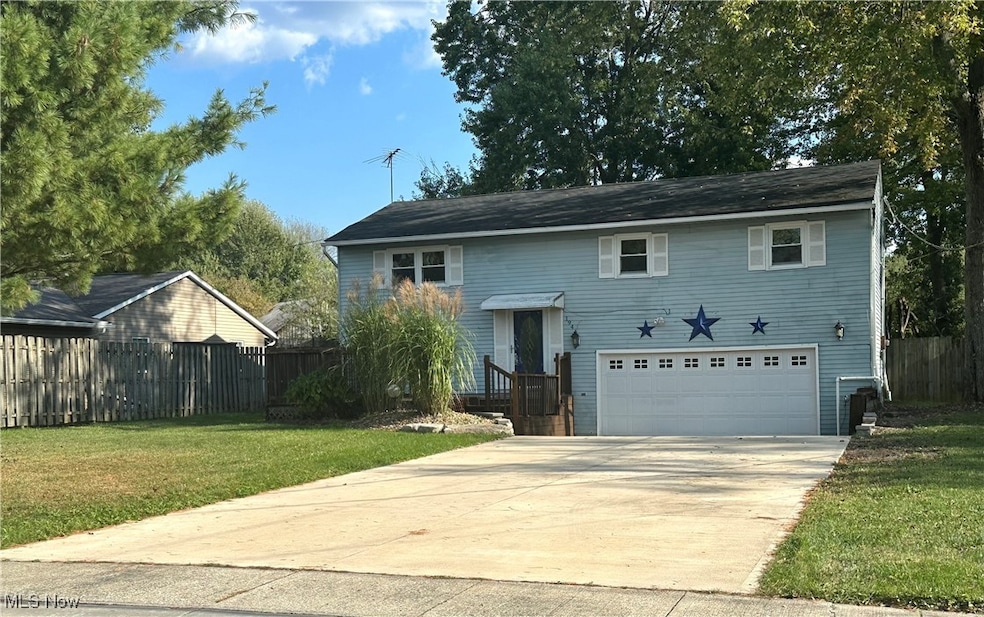
194 Railroad St Lagrange, OH 44050
Estimated payment $1,651/month
Highlights
- No HOA
- Front Porch
- Triple Pane Windows
- Wood Frame Window
- Eat-In Kitchen
- Entrance Foyer
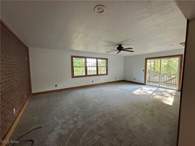
About This Home
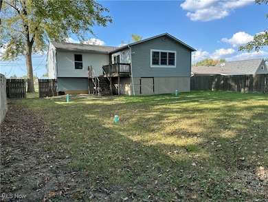
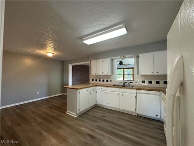
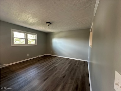
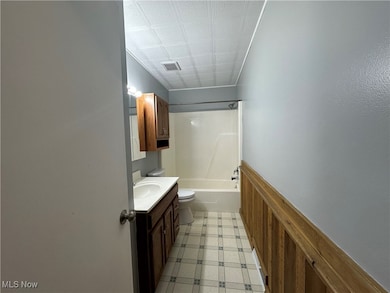
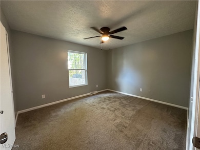
This charming 3 Bedroom 1 1/2 bath bi-level home is move-in ready in Keystone Schools. Offering comfort, style and convenience. Step inside to find a bright living room featuring newer carpet, perfect for relaxing or entertaining. Some newer vinyl flooring through the house for easy maintenance and style. Concrete in driveway has been redone. Nice size backyard for entertaining or just to chill. Walking distance to local shops and ball fields. Book your appt. today. Extra outdoor storage under the house.
Listing Agent
Northern Ohio Realty Brokerage Email: 440-366-0099, northernohiorealty@gmail.com License #2017003405 Listed on: 10/04/2025
Home Details
Home Type
- Single Family
Est. Annual Taxes
- $5,438
Year Built
- Built in 1978
Lot Details
- 0.25 Acre Lot
- Lot Dimensions are 66x165
- Wood Fence
Parking
- 2 Car Garage
- Driveway
Home Design
- Split Level Home
- Fiberglass Roof
- Vinyl Siding
Interior Spaces
- 1,832 Sq Ft Home
- 2-Story Property
- Triple Pane Windows
- Wood Frame Window
- Entrance Foyer
Kitchen
- Eat-In Kitchen
- Range
Bedrooms and Bathrooms
- 4 Bedrooms | 3 Main Level Bedrooms
Outdoor Features
- Front Porch
Utilities
- Central Air
- Heating Available
Community Details
- No Home Owners Association
Listing and Financial Details
- Assessor Parcel Number 15-00-055-104-075
Map
Home Values in the Area
Average Home Value in this Area
Tax History
| Year | Tax Paid | Tax Assessment Tax Assessment Total Assessment is a certain percentage of the fair market value that is determined by local assessors to be the total taxable value of land and additions on the property. | Land | Improvement |
|---|---|---|---|---|
| 2024 | $2,676 | $61,943 | $7,711 | $54,233 |
| 2023 | $2,986 | $57,698 | $8,271 | $49,427 |
| 2022 | $2,966 | $57,698 | $8,271 | $49,427 |
| 2021 | $2,967 | $57,698 | $8,271 | $49,427 |
| 2020 | $2,706 | $46,900 | $6,720 | $40,180 |
| 2019 | $2,691 | $46,900 | $6,720 | $40,180 |
| 2018 | $2,605 | $46,900 | $6,720 | $40,180 |
| 2017 | $2,534 | $42,720 | $4,930 | $37,790 |
| 2016 | $2,518 | $42,720 | $4,930 | $37,790 |
| 2015 | $2,515 | $42,720 | $4,930 | $37,790 |
| 2014 | $1,954 | $37,470 | $4,320 | $33,150 |
| 2013 | $1,898 | $37,470 | $4,320 | $33,150 |
Property History
| Date | Event | Price | List to Sale | Price per Sq Ft |
|---|---|---|---|---|
| 11/04/2025 11/04/25 | Pending | -- | -- | -- |
| 10/22/2025 10/22/25 | Price Changed | $226,900 | -4.7% | $124 / Sq Ft |
| 10/04/2025 10/04/25 | For Sale | $238,000 | -- | $130 / Sq Ft |
Purchase History
| Date | Type | Sale Price | Title Company |
|---|---|---|---|
| Sheriffs Deed | $102,000 | None Available | |
| Corporate Deed | $89,900 | Executive Title Agency Corp |
Mortgage History
| Date | Status | Loan Amount | Loan Type |
|---|---|---|---|
| Previous Owner | $95,250 | No Value Available |
Source: MLS Now
MLS Number: 5162319
APN: 15-00-055-104-075
Disclaimer: Certain information contained herein is derived from information provided by parties other than Homes.com. All information provided is deemed reliable, but is not guaranteed to be accurate and should be independently verified.
![]() IDX information is provided exclusively for personal, non-commercial use, and may not be used for any purpose other than to identify prospective properties consumers may be interested in purchasing. Information is deemed reliable but not guaranteed.
IDX information is provided exclusively for personal, non-commercial use, and may not be used for any purpose other than to identify prospective properties consumers may be interested in purchasing. Information is deemed reliable but not guaranteed.
- 0 Dill Ct Unit 5072837
- 110 Railroad St
- 302 N Center St
- 433 N Center St
- 516 Appomattox Ct
- 548 William St
- 607 Rundle St
- 614 Rundle St
- 128 Harvest Ct
- 171 Keywood Blvd
- 630 Rundle St
- 808 Buckingham Dr
- 800 Buckingham Dr
- 822 Robinson Dr
- 40725 Biggs Rd
- 756 N Center St
- 829 Robinson Dr
- 831 Robinson Dr
- 19045 Whitehead Rd
- 41635 Parsons Rd
