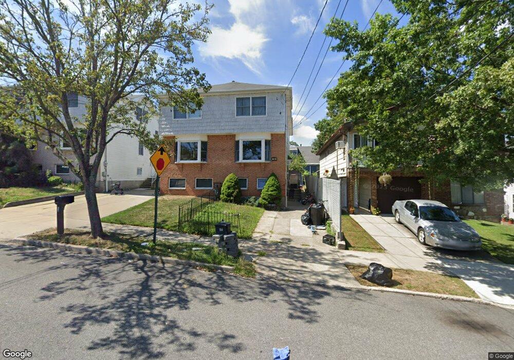
194 Suffolk Ave Staten Island, NY 10314
Manor Heights NeighborhoodEstimated Value: $708,837 - $802,000
--
Bed
4
Baths
1,620
Sq Ft
$466/Sq Ft
Est. Value
About This Home
This home is located at 194 Suffolk Ave, Staten Island, NY 10314 and is currently estimated at $755,459, approximately $466 per square foot. 194 Suffolk Ave is a home located in Richmond County with nearby schools including P.S. 54 Charles W Leng, Is 72 Rocco Laurie, and Susan E Wagner High School.
Ownership History
Date
Name
Owned For
Owner Type
Purchase Details
Closed on
Oct 30, 2017
Sold by
John Annamma A
Bought by
Shedrowitzky Simcha B and Shedrowitzky Rivkah
Current Estimated Value
Home Financials for this Owner
Home Financials are based on the most recent Mortgage that was taken out on this home.
Original Mortgage
$420,000
Outstanding Balance
$351,754
Interest Rate
3.83%
Mortgage Type
New Conventional
Estimated Equity
$403,705
Purchase Details
Closed on
Apr 13, 1995
Sold by
Calvanese Joseph
Bought by
John Annamma A
Create a Home Valuation Report for This Property
The Home Valuation Report is an in-depth analysis detailing your home's value as well as a comparison with similar homes in the area
Home Values in the Area
Average Home Value in this Area
Purchase History
| Date | Buyer | Sale Price | Title Company |
|---|---|---|---|
| Shedrowitzky Simcha B | $560,000 | Amtrust Title Insurance Comp | |
| John Annamma A | $78,000 | -- |
Source: Public Records
Mortgage History
| Date | Status | Borrower | Loan Amount |
|---|---|---|---|
| Open | Shedrowitzky Simcha B | $420,000 |
Source: Public Records
Tax History Compared to Growth
Tax History
| Year | Tax Paid | Tax Assessment Tax Assessment Total Assessment is a certain percentage of the fair market value that is determined by local assessors to be the total taxable value of land and additions on the property. | Land | Improvement |
|---|---|---|---|---|
| 2025 | $6,597 | $42,780 | $5,273 | $37,507 |
| 2024 | $6,597 | $43,560 | $4,886 | $38,674 |
| 2023 | $6,475 | $31,882 | $4,666 | $27,216 |
| 2022 | $6,365 | $38,940 | $6,480 | $32,460 |
| 2021 | $6,472 | $34,140 | $6,480 | $27,660 |
| 2020 | $6,141 | $37,200 | $6,480 | $30,720 |
| 2019 | $5,726 | $34,080 | $6,480 | $27,600 |
| 2018 | $5,416 | $26,568 | $5,739 | $20,829 |
| 2017 | $5,116 | $26,568 | $6,184 | $20,384 |
| 2016 | $4,813 | $25,627 | $6,137 | $19,490 |
| 2015 | $4,072 | $24,177 | $5,072 | $19,105 |
| 2014 | $4,072 | $22,809 | $5,291 | $17,518 |
Source: Public Records
Map
Nearby Homes
- 240 Harold St
- 153 Graves St
- 225 Wellbrook Ave
- 380 Gansevoort Blvd
- 243 Wellbrook Ave
- 236 Queen St
- 371 Bradley Ave
- 17 Bradley Ct Unit A
- 27 Duke Place
- 337 Gansevoort Blvd
- 33 Bradley Ct Unit A
- 99 Harold St
- 50 Bradley Ct Unit 52
- 343 Harold St Unit 3b
- 148 Roosevelt Ave
- 566 Buchanan Ave
- 566 Buchanan Ave Unit B
- 244 Gansevoort Blvd
- 15 Soren St
- 364 Elvin St
- 196 Suffolk Ave
- 190 Suffolk Ave
- 198 Suffolk Ave
- 200 Suffolk Ave
- 186 Suffolk Ave
- 191 Livingston Ave
- 202 Suffolk Ave
- 195 Livingston Ave Unit 1
- 195 Livingston Ave
- 187 Livingston Ave
- 182 Suffolk Ave
- 204 Suffolk Ave
- 180 Suffolk Ave
- 211 Portage Ave
- 185 Livingston Ave
- 178 Suffolk Ave
- 176 Suffolk Ave
- 191 Suffolk Ave
- 195 Suffolk Ave
- 183 Livingston Ave