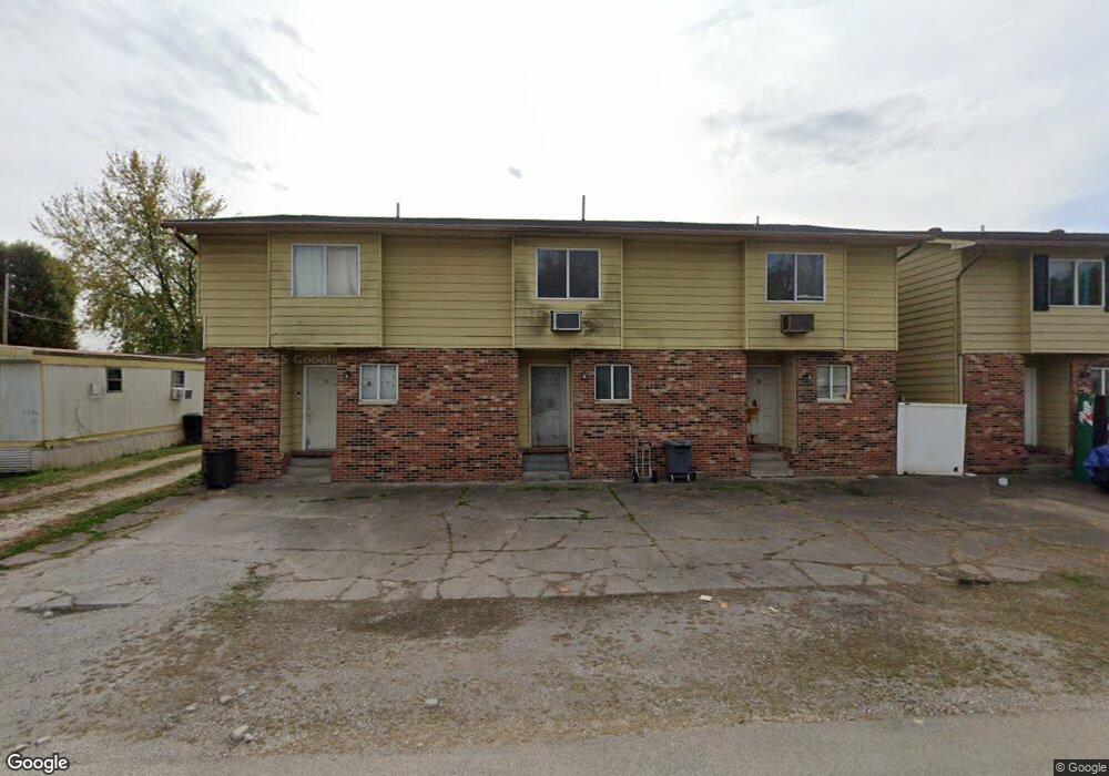
194 Township Road 1336 Unit TWP South Point, OH 45680
Burlington NeighborhoodEstimated Value: $103,000 - $201,000
6
Beds
6
Baths
3,456
Sq Ft
$44/Sq Ft
Est. Value
About This Home
This home is located at 194 Township Road 1336 Unit TWP, South Point, OH 45680 and is currently estimated at $152,000, approximately $43 per square foot. 194 Township Road 1336 Unit TWP is a home located in Lawrence County with nearby schools including South Point High School and Grace Christian School.
Ownership History
Date
Name
Owned For
Owner Type
Purchase Details
Closed on
Aug 23, 2001
Sold by
Raines Steven E and Raines Jenni
Bought by
Raines Steven E
Current Estimated Value
Purchase Details
Closed on
Nov 10, 1999
Sold by
Alberts Althaliene
Bought by
Raines Steven E and Raines Jenni
Purchase Details
Closed on
Jun 8, 1990
Sold by
Randall Randall L L and Randall Althaliene A
Bought by
Alberts Althaliene
Purchase Details
Closed on
Dec 30, 1986
Sold by
Butcher Rodney E Whitt,Ne
Bought by
Randall Randall L and Randall Althaliene A
Create a Home Valuation Report for This Property
The Home Valuation Report is an in-depth analysis detailing your home's value as well as a comparison with similar homes in the area
Home Values in the Area
Average Home Value in this Area
Purchase History
| Date | Buyer | Sale Price | Title Company |
|---|---|---|---|
| Raines Steven E | -- | -- | |
| Raines Steven E | $55,000 | -- | |
| Alberts Althaliene | -- | -- | |
| Randall Randall L | $45,000 | -- |
Source: Public Records
Tax History Compared to Growth
Tax History
| Year | Tax Paid | Tax Assessment Tax Assessment Total Assessment is a certain percentage of the fair market value that is determined by local assessors to be the total taxable value of land and additions on the property. | Land | Improvement |
|---|---|---|---|---|
| 2024 | -- | $51,730 | $4,480 | $47,250 |
| 2023 | $1,307 | $51,730 | $4,480 | $47,250 |
| 2022 | $1,315 | $51,730 | $4,480 | $47,250 |
| 2021 | $1,132 | $43,990 | $3,950 | $40,040 |
| 2020 | $1,146 | $43,990 | $3,950 | $40,040 |
| 2019 | $1,140 | $43,990 | $3,950 | $40,040 |
| 2018 | $1,000 | $39,200 | $3,870 | $35,330 |
| 2017 | $999 | $39,200 | $3,870 | $35,330 |
| 2016 | $929 | $39,200 | $3,870 | $35,330 |
| 2015 | $1,016 | $41,370 | $3,670 | $37,700 |
| 2014 | $1,014 | $41,370 | $3,670 | $37,700 |
| 2013 | $1,012 | $41,370 | $3,670 | $37,700 |
Source: Public Records
Map
Nearby Homes
- 320 Township Road 1086
- 6944 County Road 1
- 6478 County Road 1
- 161 Township Road 1020
- 4812 Parkside Place
- 4618 Sunset Dr
- 158 1st St W
- 4226 Magazine Ave
- 0 Township Road 135
- 4328 Hughes St
- 4322 Hughes St
- 404 Township Road 135
- 4307 Hughes St
- 41 Township Rd
- 63 Township Rd
- 260 Kentucky St
- 0 Twp R 135
- 1110 N Jefferson Dr
- 283 High St Unit 283 High Street, CER
- 1543 N Jefferson Dr
- 212 Township Road 1336 Unit TWP
- 163 Township Road 1336 Unit TWP
- 195 Township Road 1335 Unit TWP
- 209 Township Road 1335 Unit TWP
- 240 Township Road 1336
- 240 Township Road 1336 Unit TWP
- 151 Township Road 1336 Unit TWP
- 252 Township Road 1336
- 252 Township Road 1336 Unit TWP
- 162 Township Road 1031
- 230 Township Road 1086 Unit TWP
- 230 Township Road 1086
- 238 Township Road 1031
- 250 Township Road 1031 Unit FO-2
- 189 Township Road 1086 Unit IO-11
- 189 Township Road 1086 Unit TWP
- 134 Twp Rd 510n
- 134 Top St Unit 1031
- 134 Twp Rd 1060
- 117 Township Road 1336 Unit TWP