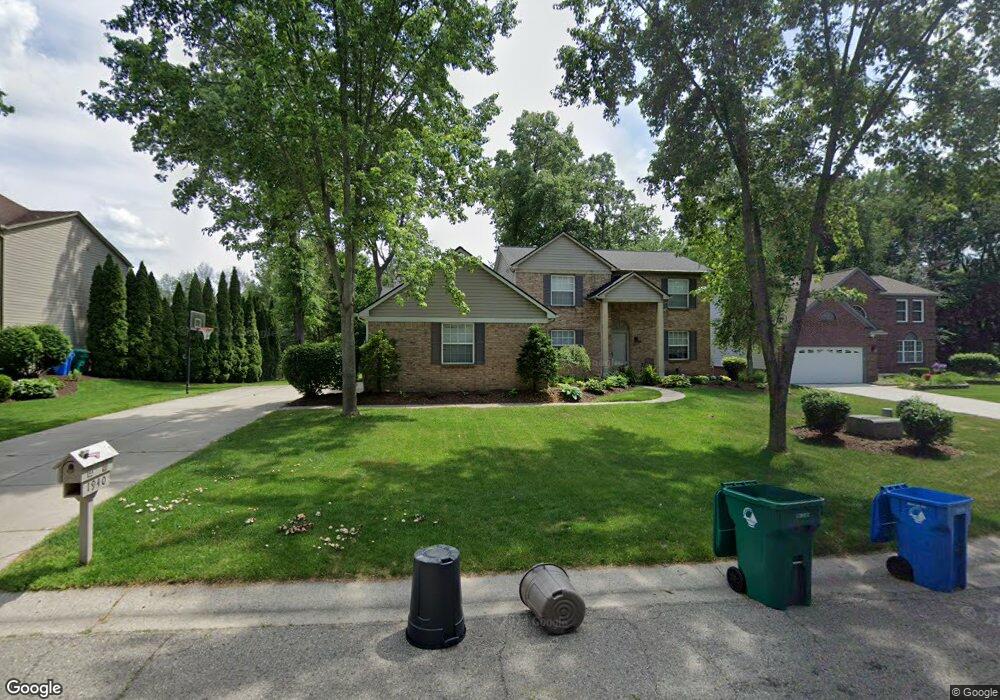
1940 Blue Stone Ln Unit 61 Commerce Township, MI 48390
Estimated Value: $508,711 - $533,000
4
Beds
3
Baths
2,408
Sq Ft
$216/Sq Ft
Est. Value
About This Home
This home is located at 1940 Blue Stone Ln Unit 61, Commerce Township, MI 48390 and is currently estimated at $519,678, approximately $215 per square foot. 1940 Blue Stone Ln Unit 61 is a home located in Oakland County with nearby schools including Walled Lake Central High School, St. Matthew Lutheran School, and St. William School.
Ownership History
Date
Name
Owned For
Owner Type
Purchase Details
Closed on
Dec 28, 2004
Sold by
Tiemann Barbara
Bought by
Selais Craig and Selais Nicole
Current Estimated Value
Purchase Details
Closed on
Sep 15, 2004
Sold by
Warhover Scott G and Warhover Millie C
Bought by
Landamerica Onestop Inc and Executive Relocation Corp
Purchase Details
Closed on
May 26, 1999
Sold by
Livermore David B
Bought by
Warhover Scott G
Home Financials for this Owner
Home Financials are based on the most recent Mortgage that was taken out on this home.
Original Mortgage
$205,600
Interest Rate
7.06%
Create a Home Valuation Report for This Property
The Home Valuation Report is an in-depth analysis detailing your home's value as well as a comparison with similar homes in the area
Home Values in the Area
Average Home Value in this Area
Purchase History
| Date | Buyer | Sale Price | Title Company |
|---|---|---|---|
| Selais Craig | $317,500 | -- | |
| Landamerica Onestop Inc | $317,500 | -- | |
| Warhover Scott G | $257,000 | -- |
Source: Public Records
Mortgage History
| Date | Status | Borrower | Loan Amount |
|---|---|---|---|
| Previous Owner | Warhover Scott G | $205,600 |
Source: Public Records
Tax History Compared to Growth
Tax History
| Year | Tax Paid | Tax Assessment Tax Assessment Total Assessment is a certain percentage of the fair market value that is determined by local assessors to be the total taxable value of land and additions on the property. | Land | Improvement |
|---|---|---|---|---|
| 2024 | $2,874 | $215,700 | $0 | $0 |
| 2023 | $2,710 | $194,200 | $0 | $0 |
| 2022 | $4,177 | $179,140 | $0 | $0 |
| 2021 | $4,100 | $179,870 | $0 | $0 |
| 2020 | $2,678 | $166,860 | $0 | $0 |
| 2019 | $3,910 | $155,950 | $0 | $0 |
| 2018 | $3,885 | $149,770 | $0 | $0 |
| 2017 | $3,828 | $149,770 | $0 | $0 |
| 2016 | $3,779 | $140,870 | $0 | $0 |
| 2015 | -- | $131,560 | $0 | $0 |
| 2014 | -- | $119,540 | $0 | $0 |
| 2011 | -- | $113,990 | $0 | $0 |
Source: Public Records
Map
Nearby Homes
- 3165 Jennella Dr
- 4278 Arbour Dr
- 4079 Cumberland Ct
- 9255 Richardson Rd
- 8102 Heron Hills Dr
- 2994 Lankford Ln
- 1131 Indianwood Trail Unit 12
- 2450 S Commerce Rd
- Cascade Plan at Townes at Merrill Park
- Ashton Plan at Townes at Merrill Park
- 1570 Addison Cir
- 1047 Addison Cir
- 1569 Addison Cir
- 103 Addison Cir
- 101 Addison Cir
- 2124 Welch Rd
- 2551 Oakview Dr
- 1904 Meadow Ridge Dr
- 2130 Park Place Dr
- 2144 Park Place Dr
- 1950 Blue Stone Ln
- 1930 Blue Stone Ln Unit 60
- 2005 Glencoe St
- 1960 Blue Stone Ln Unit 63
- 1905 Blue Stone Ln
- 1920 Blue Stone Ln
- 1955 Blue Stone Ln
- 1910 Blue Stone Ln
- 1970 Blue Stone Ln
- 1965 Blue Stone Ln Unit 56
- 2075 Glencoe St
- 1900 Blue Stone Ln
- 2050 Moss Glenn
- 3096 Gateway Ledge
- 1975 Blue Stone Ln Unit 55
- 1890 Blue Stone Ln
- 3106 Gateway Ledge
- 1980 Blue Stone Ln
- 1910 Viking Cir
- 1904 Viking Cir