Estimated Value: $190,743 - $238,000
4
Beds
2
Baths
2,016
Sq Ft
$108/Sq Ft
Est. Value
About This Home
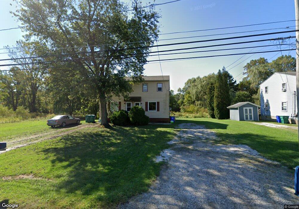
This home is located at 1940 E Summit St, Kent, OH 44240 and is currently estimated at $218,436, approximately $108 per square foot. 1940 E Summit St is a home located in Portage County with nearby schools including Walls Elementary School, Stanton Middle School, and Theodore Roosevelt High School.
Ownership History
Date
Name
Owned For
Owner Type
Purchase Details
Closed on
Sep 11, 2019
Sold by
Dorazio Dean Brian M and Dorazio Dean Pamela A
Bought by
Seaholts John M and Seaholts Charles D
Current Estimated Value
Home Financials for this Owner
Home Financials are based on the most recent Mortgage that was taken out on this home.
Original Mortgage
$102,200
Outstanding Balance
$91,100
Interest Rate
4.5%
Mortgage Type
Adjustable Rate Mortgage/ARM
Estimated Equity
$127,336
Purchase Details
Closed on
Apr 25, 2003
Sold by
Noble Steven M and Windover Amy K
Bought by
Dean Brian M and Dorazio Dean Pamela A
Home Financials for this Owner
Home Financials are based on the most recent Mortgage that was taken out on this home.
Original Mortgage
$128,981
Interest Rate
5.86%
Mortgage Type
FHA
Purchase Details
Closed on
Jul 6, 1992
Bought by
Noble Steven M
Create a Home Valuation Report for This Property
The Home Valuation Report is an in-depth analysis detailing your home's value as well as a comparison with similar homes in the area
Home Values in the Area
Average Home Value in this Area
Purchase History
| Date | Buyer | Sale Price | Title Company |
|---|---|---|---|
| Seaholts John M | $146,000 | Buckeye Reserve Title Agency | |
| Dean Brian M | $130,000 | -- | |
| Noble Steven M | $76,000 | -- |
Source: Public Records
Mortgage History
| Date | Status | Borrower | Loan Amount |
|---|---|---|---|
| Open | Seaholts John M | $102,200 | |
| Previous Owner | Dean Brian M | $128,981 |
Source: Public Records
Tax History Compared to Growth
Tax History
| Year | Tax Paid | Tax Assessment Tax Assessment Total Assessment is a certain percentage of the fair market value that is determined by local assessors to be the total taxable value of land and additions on the property. | Land | Improvement |
|---|---|---|---|---|
| 2024 | $2,504 | $48,090 | $8,190 | $39,900 |
| 2023 | $2,649 | $41,300 | $8,190 | $33,110 |
| 2022 | $2,626 | $41,300 | $8,190 | $33,110 |
| 2021 | $2,592 | $41,300 | $8,190 | $33,110 |
| 2020 | $2,846 | $37,240 | $8,190 | $29,050 |
| 2019 | $2,811 | $37,240 | $8,190 | $29,050 |
| 2018 | $2,859 | $40,390 | $8,190 | $32,200 |
| 2017 | $2,859 | $40,390 | $8,190 | $32,200 |
| 2016 | $2,807 | $40,390 | $8,190 | $32,200 |
| 2015 | $2,853 | $40,390 | $8,190 | $32,200 |
| 2014 | $2,727 | $39,170 | $8,190 | $30,980 |
| 2013 | $2,707 | $39,170 | $8,190 | $30,980 |
Source: Public Records
Map
Nearby Homes
- 1024E Cedar Ridge Dr
- 1024A Cedar Ridge Dr
- 1523 Whitehall Blvd
- 5205 Cline Rd Unit A
- 5123 Troyer Dr
- 1426 Loop Rd Unit 1426
- 2014 Sugar Maple Dr
- 1755 Honeychuck Ln
- 2262 Willyard Ave
- 4891 Edson Rd
- 2105 Sugar Maple Dr
- 1737 Holly Dr
- 2092 Sugar Maple Dr
- 5044 Sherman Wood Dr
- 1587 Chadwick Rd
- 2182 Sugar Maple Dr
- 0 Meloy Rd Unit 5162435
- 720 Ivan Dr
- 4938 Brower Tree Ln
- 703 Avondale St
- 1944 E Summit St
- 1936 E Summit St
- 1948 E Summit St
- 1950 E Summit St
- 5438 Burnett Rd
- 1932 E Summit St
- 5436 Burnett Rd
- 5408 Burnett Rd
- 5439 Burnett Rd
- 5380 Burnett Rd
- 1846 Gemini Ct
- 1844 Gemini Ct
- 1842 Gemini Ct
- 1840 Gemini Ct
- 1837 Aries Ct
- 1831 Aries Ct
- 1838 Gemini Ct
- 1835 Aries Ct
- 1836 Gemini Ct
- 1819 Gemini Ct