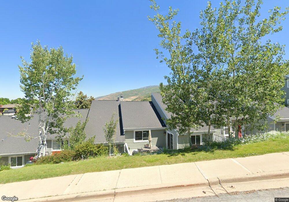
1940 High Pointe Dr Bountiful, UT 84010
Estimated Value: $490,000 - $611,000
3
Beds
3
Baths
2,424
Sq Ft
$221/Sq Ft
Est. Value
About This Home
This home is located at 1940 High Pointe Dr, Bountiful, UT 84010 and is currently estimated at $536,769, approximately $221 per square foot. 1940 High Pointe Dr is a home located in Davis County with nearby schools including Valley View School, Mueller Park Junior High School, and Bountiful High School.
Ownership History
Date
Name
Owned For
Owner Type
Purchase Details
Closed on
Oct 18, 2018
Sold by
Gonzaga Amanda and Gooch Amanda
Bought by
Atwood Ryan and Atwood Melissa
Current Estimated Value
Home Financials for this Owner
Home Financials are based on the most recent Mortgage that was taken out on this home.
Original Mortgage
$313,405
Outstanding Balance
$273,889
Interest Rate
4.6%
Mortgage Type
New Conventional
Estimated Equity
$262,880
Purchase Details
Closed on
Aug 9, 2016
Sold by
Gooch Amanda and Gonzaga Pablo
Bought by
Gooch Amanda
Purchase Details
Closed on
Dec 29, 2010
Sold by
Ince Julia T
Bought by
Gooch Amanda
Home Financials for this Owner
Home Financials are based on the most recent Mortgage that was taken out on this home.
Original Mortgage
$154,530
Interest Rate
4.34%
Mortgage Type
FHA
Purchase Details
Closed on
May 31, 1996
Sold by
Ince William L and Ince Julia T
Bought by
Ince William L and Ince Julia T
Create a Home Valuation Report for This Property
The Home Valuation Report is an in-depth analysis detailing your home's value as well as a comparison with similar homes in the area
Purchase History
| Date | Buyer | Sale Price | Title Company |
|---|---|---|---|
| Atwood Ryan | -- | North American Title | |
| Gooch Amanda | -- | Ravenswood Title | |
| Gooch Amanda | -- | Integrated Title Insurance S | |
| Ince William L | -- | -- |
Source: Public Records
Mortgage History
| Date | Status | Borrower | Loan Amount |
|---|---|---|---|
| Open | Atwood Ryan | $313,405 | |
| Previous Owner | Gooch Amanda | $154,530 |
Source: Public Records
Tax History
| Year | Tax Paid | Tax Assessment Tax Assessment Total Assessment is a certain percentage of the fair market value that is determined by local assessors to be the total taxable value of land and additions on the property. | Land | Improvement |
|---|---|---|---|---|
| 2025 | $2,574 | $256,300 | $106,150 | $150,150 |
| 2024 | $2,484 | $251,350 | $88,550 | $162,800 |
| 2023 | $2,519 | $253,550 | $89,650 | $163,900 |
| 2022 | $2,479 | $452,000 | $168,000 | $284,000 |
| 2021 | $2,355 | $362,000 | $155,000 | $207,000 |
| 2020 | $2,141 | $333,000 | $125,000 | $208,000 |
| 2019 | $2,087 | $317,000 | $125,000 | $192,000 |
| 2018 | $1,831 | $275,000 | $139,120 | $135,880 |
| 2016 | $1,855 | $151,085 | $37,400 | $113,685 |
| 2015 | $1,796 | $138,380 | $37,400 | $100,980 |
| 2014 | $1,794 | $141,416 | $18,333 | $123,083 |
| 2013 | -- | $112,048 | $24,475 | $87,573 |
Source: Public Records
Map
Nearby Homes
- 1820 S High Pointe Dr
- 1987 Mapleview Dr
- 1475 Mueller Park Rd
- 1735 S Temple Ct Unit 203
- 1785 1450 E Unit 604
- 1596 E Millbrook Way
- 1878 E Ridge Point Dr
- 1676 E Mueller Park Rd
- 2091 Windsor Park Cir
- 0 Bountiful Blvd
- 1087 Arlington Way
- 2136 Elaine Dr
- 842 E 2150 S
- 0 Lot Bountiful Blvd
- 795 Abby Ln Unit 5
- 626 E 2150 S
- 861 E Millbrook Way
- 631 E 1700 S
- 3252 Sunset Hollow Dr
- 1886 S Jeri Dr
- 1930 High Pointe Dr
- 1950 S High Pointe Dr
- 1950 High Pointe Dr
- 1920 S High Pointe Dr
- 1920 High Pointe Dr
- 1960 High Pointe Dr Unit 22
- 1960 High Pointe Dr
- 1910 High Pointe Dr
- 1960 Cave Hollow Way
- 1887 High Pointe Dr
- 1885 High Pointe Dr Unit 10
- 1889 High Pointe Dr
- 1889 High Pointe Dr Unit 31
- 1970 High Pointe Dr
- 1910 S High Pointe Dr
- 1980 High Pointe Dr
- 1980 High Pointe Dr
- 1990 High Pointe Dr
- 1850 S High Pointe Dr
- 1990 High Pointe Dr
Your Personal Tour Guide
Ask me questions while you tour the home.