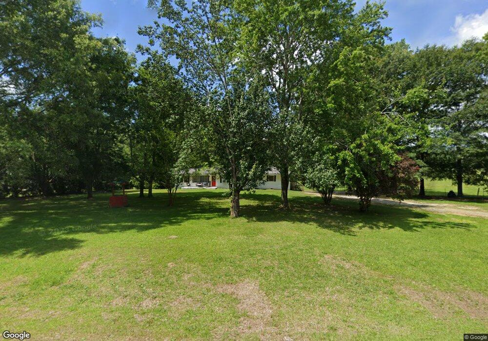
1940 Highway 77 N Union Point, GA 30669
Estimated Value: $182,941 - $214,000
4
Beds
2
Baths
1,800
Sq Ft
$113/Sq Ft
Est. Value
About This Home
This home is located at 1940 Highway 77 N, Union Point, GA 30669 and is currently estimated at $203,485, approximately $113 per square foot. 1940 Highway 77 N is a home located in Greene County with nearby schools including Greene County High School.
Ownership History
Date
Name
Owned For
Owner Type
Purchase Details
Closed on
Jun 22, 2018
Sold by
Mixon Joann C
Bought by
Rodriguez Jose
Current Estimated Value
Home Financials for this Owner
Home Financials are based on the most recent Mortgage that was taken out on this home.
Original Mortgage
$100,642
Outstanding Balance
$87,233
Interest Rate
4.6%
Mortgage Type
FHA
Estimated Equity
$116,252
Purchase Details
Closed on
Sep 3, 1998
Sold by
Mixon Joann C
Bought by
Mixon Joann C -Corrective
Purchase Details
Closed on
Oct 15, 1997
Sold by
Martin Lena Mrs
Bought by
Mixon Joann C
Purchase Details
Closed on
May 30, 1995
Sold by
Martin Lena
Bought by
Martin Lena Mrs
Purchase Details
Closed on
Jan 1, 1958
Bought by
Martin Lena
Create a Home Valuation Report for This Property
The Home Valuation Report is an in-depth analysis detailing your home's value as well as a comparison with similar homes in the area
Home Values in the Area
Average Home Value in this Area
Purchase History
| Date | Buyer | Sale Price | Title Company |
|---|---|---|---|
| Rodriguez Jose | $102,500 | -- | |
| Mixon Joann C -Corrective | -- | -- | |
| Mixon Joann C | $45,000 | -- | |
| Martin Lena Mrs | -- | -- | |
| Martin Lena | -- | -- |
Source: Public Records
Mortgage History
| Date | Status | Borrower | Loan Amount |
|---|---|---|---|
| Open | Rodriguez Jose | $100,642 |
Source: Public Records
Tax History Compared to Growth
Tax History
| Year | Tax Paid | Tax Assessment Tax Assessment Total Assessment is a certain percentage of the fair market value that is determined by local assessors to be the total taxable value of land and additions on the property. | Land | Improvement |
|---|---|---|---|---|
| 2024 | $1,232 | $62,600 | $6,720 | $55,880 |
| 2023 | $1,168 | $59,160 | $5,600 | $53,560 |
| 2022 | $847 | $37,560 | $4,280 | $33,280 |
| 2021 | $810 | $33,400 | $4,280 | $29,120 |
| 2020 | $639 | $22,280 | $3,080 | $19,200 |
| 2019 | $654 | $22,280 | $3,080 | $19,200 |
| 2018 | $623 | $21,880 | $2,680 | $19,200 |
| 2017 | $592 | $21,920 | $2,702 | $19,218 |
| 2016 | $602 | $22,434 | $2,702 | $19,732 |
| 2015 | $577 | $22,434 | $2,702 | $19,732 |
| 2014 | $546 | $20,335 | $2,702 | $17,633 |
Source: Public Records
Map
Nearby Homes
- 1251 Adams Rd
- 0 Washington Hwy Unit 7276060
- 1010 Orear Rd
- 0 S Rhodes St Unit 10618488
- 324 N Rhodes St
- 606 Bryan Ave
- 202 Veazey St
- 504 Crawfordville Rd
- 0 Woodland Ct Unit 1027434
- 0 Woodland Ct Unit 10543600
- 0 Old Union Point Rd Unit 1 10557753
- 1241 Old Siloam Rd
- 1180 Moody St
- 1041 Hillcrest Dr
- 1860 Washington Hwy
- 1251 Brick House Rd
- 1251 Brickhouse Rd
- 1211 Peachtree Ave W
- 0 Cunningham Rd
- 2260 Cunningham Rd
- 1940 Hwy 77n
- 1920 Highway 77 N
- 1900 Highway 77 N
- 2030 Highway 77 N
- 1110 Adams Rd
- 0 Adams Rd
- 1101 Adams Rd
- 1800 N Highway 77 N
- 4013 Hensley Rd
- 2081 Highway 77 N Unit 1030000450
- 2081 Highway 77 N
- 2081 Highway 77 N
- 1170 Adams Rd
- 0 Georgia 77 Unit 20144286
- 0 Georgia 77 Unit 20145135
- 0 Georgia 77 Unit 6.3 Acres 8932717
- 0 Georgia 77 Unit 7099215
- 2100 Highway 77 N
- 1290 Adams Rd
- 1590 Highway 77 N