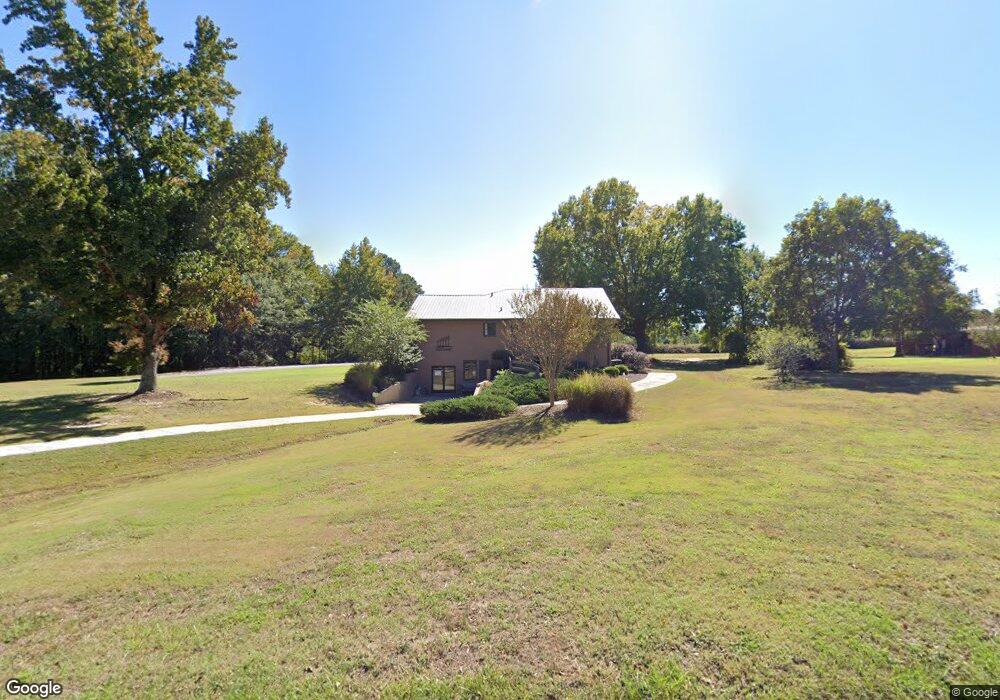
1940 Highway 81 Loganville, GA 30052
Walnut Grove NeighborhoodEstimated Value: $511,000 - $697,000
3
Beds
4
Baths
2,689
Sq Ft
$233/Sq Ft
Est. Value
About This Home
This home is located at 1940 Highway 81, Loganville, GA 30052 and is currently estimated at $625,397, approximately $232 per square foot. 1940 Highway 81 is a home located in Walton County with nearby schools including Youth Elementary School, Youth Middle School, and Walnut Grove High School.
Ownership History
Date
Name
Owned For
Owner Type
Purchase Details
Closed on
Feb 21, 2023
Sold by
Orchard United Methodist Church Inc
Bought by
Rheitta Roberts Real Estate Llc
Current Estimated Value
Home Financials for this Owner
Home Financials are based on the most recent Mortgage that was taken out on this home.
Original Mortgage
$480,200
Outstanding Balance
$457,449
Interest Rate
6.13%
Mortgage Type
Mortgage Modification
Estimated Equity
$167,948
Purchase Details
Closed on
Jul 29, 2011
Sold by
Sasser Harold W
Bought by
Orchard United Methodist Ch In
Home Financials for this Owner
Home Financials are based on the most recent Mortgage that was taken out on this home.
Original Mortgage
$585,000
Interest Rate
4.52%
Mortgage Type
Purchase Money Mortgage
Create a Home Valuation Report for This Property
The Home Valuation Report is an in-depth analysis detailing your home's value as well as a comparison with similar homes in the area
Home Values in the Area
Average Home Value in this Area
Purchase History
| Date | Buyer | Sale Price | Title Company |
|---|---|---|---|
| Rheitta Roberts Real Estate Llc | $565,000 | -- | |
| Orchard United Methodist Ch In | $375,000 | -- |
Source: Public Records
Mortgage History
| Date | Status | Borrower | Loan Amount |
|---|---|---|---|
| Open | Rheitta Roberts Real Estate Llc | $480,200 | |
| Previous Owner | Orchard United Methodist Ch In | $585,000 |
Source: Public Records
Tax History Compared to Growth
Tax History
| Year | Tax Paid | Tax Assessment Tax Assessment Total Assessment is a certain percentage of the fair market value that is determined by local assessors to be the total taxable value of land and additions on the property. | Land | Improvement |
|---|---|---|---|---|
| 2024 | $6,258 | $212,280 | $55,240 | $157,040 |
| 2023 | $4,965 | $197,520 | $52,400 | $145,120 |
| 2022 | $4,965 | $148,480 | $47,440 | $101,040 |
| 2021 | $4,203 | $125,680 | $37,000 | $88,680 |
| 2020 | $3,987 | $119,240 | $32,000 | $87,240 |
| 2019 | $3,653 | $109,240 | $28,440 | $80,800 |
| 2018 | $3,764 | $109,240 | $28,440 | $80,800 |
| 2017 | $3,689 | $107,080 | $28,440 | $78,640 |
| 2016 | $3,200 | $92,880 | $24,760 | $68,120 |
| 2015 | -- | $87,400 | $24,840 | $62,560 |
| 2014 | -- | $82,680 | $19,120 | $63,560 |
Source: Public Records
Map
Nearby Homes
- 1746 Malachi Ct
- 0 Brookview Dr Unit 10595786
- 0 Brookview Dr Unit 7642211
- 1206 James Walter Dr
- 3545 Brookview Dr
- 1227 Blue Springs Dr
- 1729 Brandi Ln
- 3601 Youth Monroe Rd
- 3573 Plantation Place
- 1769 Brandi Ln
- 4010 Grove Trail
- 4060 Grove Trail
- 1504 Cleveland Ct
- 1503 Cleveland Ct
- 1025 Lakehaven Ln
- 3457 Natalie Ct
- 1205 Kristen Ln
- 1920 Highway 81
- 2000 Highway 81
- 1921 Highway 81
- 4019 Center Hill Church Rd
- 4000 Center Hill Church Rd
- 1829 Highway 81
- 3611 Brookview Dr
- 3757 Malachi Way Unit 3
- 3757 Malachi Way
- 3621 Brookview Dr
- 0 Malachi Way Unit 8522438
- 0 Malachi Way Unit 8806048
- 0 Malachi Way Unit 8843419
- 0 Malachi Way Unit 8929080
- 0 Malachi Way Unit 7135480
- 0 Malachi Way Unit 7348457
- 0 Malachi Way Unit 7472446
- 0 Malachi Way Unit 7523483
- 0 Malachi Way Unit 8073921
- 3777 Malachi Way