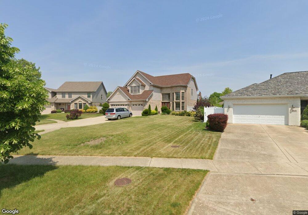
1940 Lancaster Ln Woodridge, IL 60517
South Woodridge NeighborhoodEstimated Value: $620,000 - $707,000
--
Bed
1
Bath
3,097
Sq Ft
$215/Sq Ft
Est. Value
About This Home
This home is located at 1940 Lancaster Ln, Woodridge, IL 60517 and is currently estimated at $666,844, approximately $215 per square foot. 1940 Lancaster Ln is a home located in DuPage County with nearby schools including Oakwood School, River Valley School, and Old Quarry Middle School.
Ownership History
Date
Name
Owned For
Owner Type
Purchase Details
Closed on
Jun 14, 2004
Sold by
Standard Bank & Trust Co
Bought by
Estilo Nelson B and Estilo Pilar Maria
Current Estimated Value
Home Financials for this Owner
Home Financials are based on the most recent Mortgage that was taken out on this home.
Original Mortgage
$318,063
Interest Rate
6.37%
Mortgage Type
Balloon
Create a Home Valuation Report for This Property
The Home Valuation Report is an in-depth analysis detailing your home's value as well as a comparison with similar homes in the area
Home Values in the Area
Average Home Value in this Area
Purchase History
| Date | Buyer | Sale Price | Title Company |
|---|---|---|---|
| Estilo Nelson B | $386,500 | Ctic |
Source: Public Records
Mortgage History
| Date | Status | Borrower | Loan Amount |
|---|---|---|---|
| Closed | Estilo Nelson B | $318,063 |
Source: Public Records
Tax History Compared to Growth
Tax History
| Year | Tax Paid | Tax Assessment Tax Assessment Total Assessment is a certain percentage of the fair market value that is determined by local assessors to be the total taxable value of land and additions on the property. | Land | Improvement |
|---|---|---|---|---|
| 2024 | $9,593 | $195,010 | $62,429 | $132,581 |
| 2023 | $11,876 | $179,270 | $57,390 | $121,880 |
| 2022 | $11,567 | $176,380 | $56,770 | $119,610 |
| 2021 | $10,003 | $174,370 | $56,120 | $118,250 |
| 2020 | $11,074 | $170,920 | $55,010 | $115,910 |
| 2019 | $10,622 | $164,000 | $52,780 | $111,220 |
| 2018 | $9,362 | $164,580 | $52,480 | $112,100 |
| 2017 | $10,558 | $158,370 | $50,500 | $107,870 |
| 2016 | $10,683 | $151,150 | $48,200 | $102,950 |
| 2015 | $10,067 | $142,210 | $45,350 | $96,860 |
| 2014 | $9,997 | $138,270 | $44,090 | $94,180 |
| 2013 | $9,569 | $137,620 | $43,880 | $93,740 |
Source: Public Records
Map
Nearby Homes
- 10S241 Wallace Dr
- 8843 Oxford St
- 9014 Gloucester Rd
- Fremont Plan at Farmingdale Village
- Eden Plan at Farmingdale Village
- Danbury Plan at Farmingdale Village
- Calysta Plan at Farmingdale Village
- Briarcliffe Plan at Farmingdale Village
- Amberwood Plan at Farmingdale Village
- 9005 Gloucester Rd
- 9032 Lemont Rd
- 11S100 Carpenter St
- 20W260 Meadow Ln
- 312 Homestead Dr
- 8551 Sperry Ct
- 3145 Hillside Ln
- 12193 Curragh Meadow Way
- 8498 Cornelia Ln
- 8505 Woodward Ave Unit 204
- 1850 Fulton St
- 1920 Lancaster Ln
- 1935 Westminster Dr
- 1925 Westminster Dr
- 1960 Lancaster Ln
- 1860 Lancaster Ln
- 1945 Westminster Dr
- 20W565 Westminster Dr
- 9004 Witham Ln
- 1859 Lancaster Ln
- 1840 Lancaster Ln
- 1955 Westminster Dr
- 9008 Witham Ln
- 20W555 Westminster Dr
- 1839 Lancaster Ln
- 9011 Witham Ln
- 9133 Chatham Ct
- 9012 Witham Ln
- 1820 Lancaster Ln
- 10S628 Dunham Dr
- 9134 Chatham Ct