Estimated Value: $905,000 - $1,029,000
Studio
--
Bath
8,916
Sq Ft
$109/Sq Ft
Est. Value
About This Home
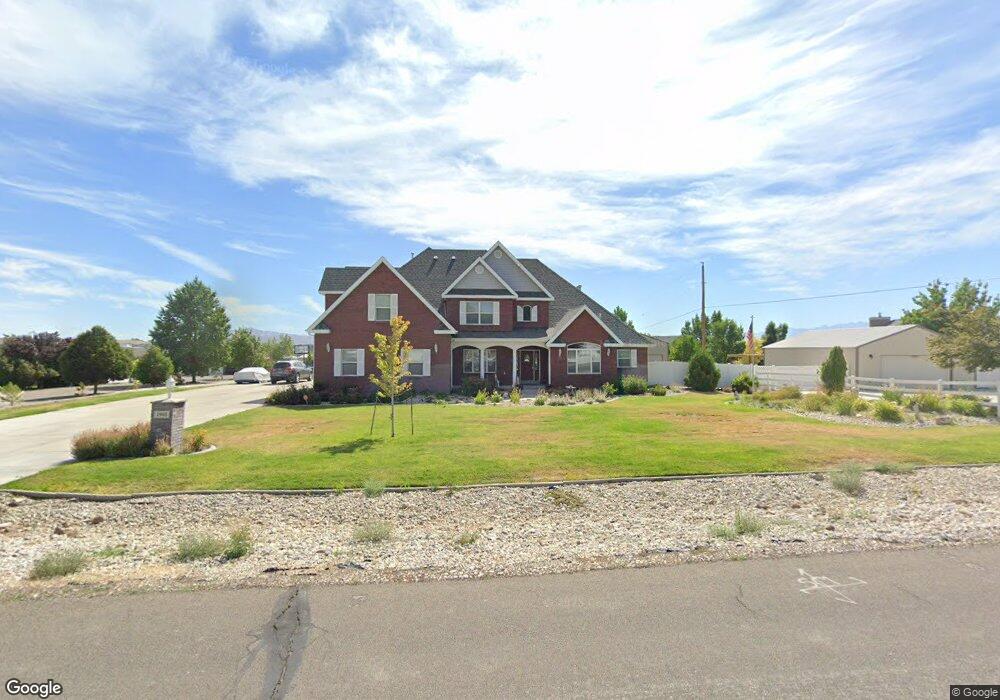
This home is located at 1940 Royal Crest Dr, Elko, NV 89801 and is currently estimated at $973,783, approximately $109 per square foot. 1940 Royal Crest Dr is a home located in Elko County with nearby schools including Mountain View Elementary School, Adobe Middle School, and Flagview Intermediate School.
Ownership History
Date
Name
Owned For
Owner Type
Purchase Details
Closed on
Dec 15, 2025
Sold by
Groff John L and Groff John Lawrence
Bought by
Groff Family Trust and Groff
Current Estimated Value
Purchase Details
Closed on
Aug 6, 2007
Sold by
Groff Marian Z and Groff John L S
Bought by
Groff John L and Groff Marian Z
Home Financials for this Owner
Home Financials are based on the most recent Mortgage that was taken out on this home.
Original Mortgage
$400,000
Interest Rate
6.65%
Mortgage Type
New Conventional
Purchase Details
Closed on
Jul 14, 2006
Sold by
M & P Development Llc
Bought by
Groff John L S and Groff Marian Z
Create a Home Valuation Report for This Property
The Home Valuation Report is an in-depth analysis detailing your home's value as well as a comparison with similar homes in the area
Purchase History
| Date | Buyer | Sale Price | Title Company |
|---|---|---|---|
| Groff Family Trust | -- | None Listed On Document | |
| Groff John L | -- | Stewart Title | |
| Groff John L S | $90,000 | Stewart Title |
Source: Public Records
Mortgage History
| Date | Status | Borrower | Loan Amount |
|---|---|---|---|
| Previous Owner | Groff John L | $400,000 |
Source: Public Records
Tax History
| Year | Tax Paid | Tax Assessment Tax Assessment Total Assessment is a certain percentage of the fair market value that is determined by local assessors to be the total taxable value of land and additions on the property. | Land | Improvement |
|---|---|---|---|---|
| 2025 | $10,516 | $329,165 | $41,300 | $287,865 |
| 2024 | $10,516 | $321,001 | $29,750 | $291,251 |
| 2023 | $9,586 | $301,980 | $29,750 | $272,230 |
| 2022 | $9,307 | $260,235 | $29,750 | $230,485 |
| 2021 | $9,036 | $254,187 | $29,750 | $224,437 |
| 2020 | $8,772 | $267,909 | $29,750 | $238,159 |
| 2019 | $8,517 | $244,538 | $29,750 | $214,788 |
| 2018 | $8,538 | $245,146 | $29,750 | $215,396 |
| 2017 | $8,399 | $241,158 | $29,750 | $211,408 |
| 2016 | $8,505 | $239,796 | $29,750 | $210,046 |
| 2015 | $8,257 | $235,094 | $29,750 | $205,344 |
| 2014 | $7,985 | $225,105 | $29,750 | $195,355 |
Source: Public Records
Map
Nearby Homes
- 3803 Boulder Creek
- 3926 Snowy River
- 3688 Snowy River
- 3050 Mountain City Hwy
- 3320 Mountain City Hwy
- TBD Mountain City Hwy
- 3170 Newcastle Cir
- 3221 Jennings Way
- 2908 Aria Way
- 2934 Aria Way
- 2939 Aria Way
- 2943 Aria Way
- 2946 Aria Way
- 1375 Chaparral Dr Unit 1
- 2953 Aria Way
- 2914 Aria Way
- 2963 Aria Way
- 2918 Aria Way
- 2966 Aria Way
- 2970 Aria Way
- 1910 Royal Crest Dr
- 1910 Royal Crest Dr
- 1970 Royal Crest Dr
- 1945 Royal Crest Dr
- 3721 Sundance Dr
- 2000 Royal Crest Dr
- 1935 Royal Crest Dr
- 1975 Royal Crest Dr
- 1880 Royal Crest Dr
- 1925 Royal Crest Dr
- 2005 Royal Crest Dr
- 3713 Sundance Dr
- 2030 Royal Crest Dr
- 1905 Royal Crest Dr
- 1850 Royal Crest Dr
- 2035 Royal Credt Dr
- 1915 Royal Crest Dr
- 1875 Royal Crest Dr
- 1529 Tamarack Rd
- 1523 Tamarack Rd
Your Personal Tour Guide
Ask me questions while you tour the home.