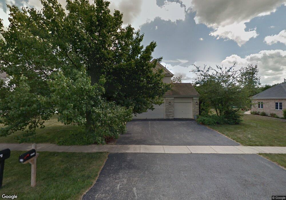
1940 Talon Dr New Lenox, IL 60451
Estimated Value: $506,024 - $598,000
4
Beds
4
Baths
--
Sq Ft
--
Built
About This Home
This home is located at 1940 Talon Dr, New Lenox, IL 60451 and is currently estimated at $552,006. 1940 Talon Dr is a home located in Will County with nearby schools including Spencer Trail, Spencer Pointe, and Spencer Crossing Intermediate School.
Ownership History
Date
Name
Owned For
Owner Type
Purchase Details
Closed on
Sep 23, 2009
Sold by
Fiebig Friedrich H and Fiebig Jennifer L
Bought by
Pasek Jennifer J
Current Estimated Value
Home Financials for this Owner
Home Financials are based on the most recent Mortgage that was taken out on this home.
Original Mortgage
$290,800
Outstanding Balance
$192,009
Interest Rate
5.38%
Mortgage Type
New Conventional
Estimated Equity
$359,997
Purchase Details
Closed on
Apr 20, 2001
Sold by
Sipowicz William and Sipowicz Jennifer
Bought by
Fiebig Friedrich H and Fiebig Jennifer L
Purchase Details
Closed on
Oct 16, 1996
Sold by
Marquette National Bank
Bought by
Sipowicz William and Sipowicz Jennifer
Home Financials for this Owner
Home Financials are based on the most recent Mortgage that was taken out on this home.
Original Mortgage
$198,000
Interest Rate
8%
Create a Home Valuation Report for This Property
The Home Valuation Report is an in-depth analysis detailing your home's value as well as a comparison with similar homes in the area
Home Values in the Area
Average Home Value in this Area
Purchase History
| Date | Buyer | Sale Price | Title Company |
|---|---|---|---|
| Pasek Jennifer J | $363,500 | Chicago Title Insurance Co | |
| Fiebig Friedrich H | $232,000 | Ticor Title | |
| Sipowicz William | $215,000 | Chicago Title Insurance Co |
Source: Public Records
Mortgage History
| Date | Status | Borrower | Loan Amount |
|---|---|---|---|
| Open | Pasek Jennifer J | $290,800 | |
| Previous Owner | Sipowicz William | $198,000 |
Source: Public Records
Tax History Compared to Growth
Tax History
| Year | Tax Paid | Tax Assessment Tax Assessment Total Assessment is a certain percentage of the fair market value that is determined by local assessors to be the total taxable value of land and additions on the property. | Land | Improvement |
|---|---|---|---|---|
| 2024 | $11,104 | $144,830 | $36,393 | $108,437 |
| 2023 | $11,104 | $132,024 | $33,175 | $98,849 |
| 2022 | $10,005 | $121,625 | $30,562 | $91,063 |
| 2021 | $9,499 | $114,385 | $28,743 | $85,642 |
| 2020 | $9,230 | $110,303 | $27,717 | $82,586 |
| 2019 | $8,834 | $106,883 | $26,858 | $80,025 |
| 2018 | $8,631 | $103,199 | $25,932 | $77,267 |
| 2017 | $8,202 | $100,232 | $25,186 | $75,046 |
| 2016 | $7,962 | $97,549 | $24,512 | $73,037 |
| 2015 | $7,709 | $94,478 | $23,740 | $70,738 |
| 2014 | $7,709 | $93,312 | $23,447 | $69,865 |
| 2013 | $7,709 | $94,570 | $23,763 | $70,807 |
Source: Public Records
Map
Nearby Homes
- 1535 Glenbrooke Ln
- 701 Bishops Gate
- 611 Princeton Ln
- 214 Somerset Ct
- 2171 Wellington Ct
- 1351 E Lincoln Hwy
- 2019 Royalglen Dr
- 1851 Glenlake Ct
- 1595 Glenbrooke Ln
- 1587 Glenbrooke Ln
- 1583 Glenbrooke Ln
- 320 Garfield Ave
- 1738 Orchard Ln
- 1750 Orchard Ln
- 190 Pottawatomie Ln
- 500 E Laraway Rd
- 550 E Laraway Rd
- 1501 Glenbrooke Ln
- 1212 Georgias Way
- 1245 Georgias Way
- 1960 Talon Dr
- 1920 Talon Dr
- 1900 Talon Dr
- 1980 Talon Dr
- 1935 Talon Dr
- 1921 Talon Dr
- 1965 Talon Dr
- 1915 Talon Dr
- 1890 Talon Dr
- 1901 Talon Dr
- 1990 Talon Dr
- 833 S Schoolhouse Rd
- 1930 Eagle Cir
- 901 S Schoolhouse Rd
- 1931 Constitution Rd
- 1921 Constitution Rd
- 1947 Eagle Cir
- 1889 Talon Dr
- 1900 Eagle Cir
- 1841 Constitution Rd