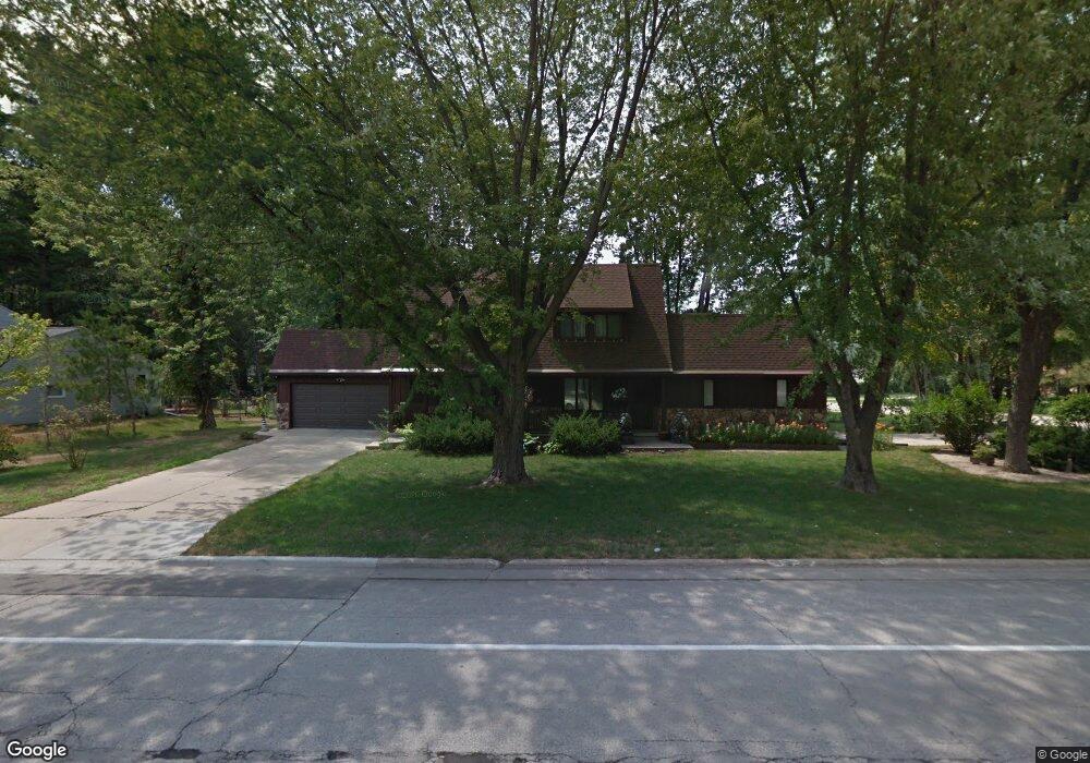
1940 Wood Ln Unit 1942 Green Bay, WI 54304
MacArthur Heights NeighborhoodEstimated Value: $310,000 - $364,000
--
Bed
--
Bath
--
Sq Ft
0.29
Acres
About This Home
This home is located at 1940 Wood Ln Unit 1942, Green Bay, WI 54304 and is currently estimated at $333,000. 1940 Wood Ln Unit 1942 is a home located in Brown County with nearby schools including MacArthur Elementary School, Lombardi Middle School, and Southwest High School.
Ownership History
Date
Name
Owned For
Owner Type
Purchase Details
Closed on
May 28, 2021
Sold by
Rymer Delores L and Rymer Delores L
Bought by
Wegner Mark C
Current Estimated Value
Home Financials for this Owner
Home Financials are based on the most recent Mortgage that was taken out on this home.
Original Mortgage
$182,000
Outstanding Balance
$164,778
Interest Rate
2.9%
Mortgage Type
New Conventional
Estimated Equity
$168,222
Create a Home Valuation Report for This Property
The Home Valuation Report is an in-depth analysis detailing your home's value as well as a comparison with similar homes in the area
Home Values in the Area
Average Home Value in this Area
Purchase History
| Date | Buyer | Sale Price | Title Company |
|---|---|---|---|
| Wegner Mark C | $260,000 | First American Title Ins Co |
Source: Public Records
Mortgage History
| Date | Status | Borrower | Loan Amount |
|---|---|---|---|
| Open | Wegner Mark C | $182,000 |
Source: Public Records
Tax History Compared to Growth
Tax History
| Year | Tax Paid | Tax Assessment Tax Assessment Total Assessment is a certain percentage of the fair market value that is determined by local assessors to be the total taxable value of land and additions on the property. | Land | Improvement |
|---|---|---|---|---|
| 2024 | $4,771 | $254,200 | $44,000 | $210,200 |
| 2023 | $4,565 | $254,200 | $44,000 | $210,200 |
| 2022 | $4,458 | $254,200 | $44,000 | $210,200 |
| 2021 | $4,280 | $185,000 | $36,900 | $148,100 |
| 2020 | $4,316 | $185,000 | $36,900 | $148,100 |
| 2019 | $4,187 | $185,000 | $36,900 | $148,100 |
| 2018 | $4,086 | $185,000 | $36,900 | $148,100 |
| 2017 | $4,026 | $185,000 | $36,900 | $148,100 |
| 2016 | $3,965 | $185,000 | $36,900 | $148,100 |
| 2015 | $4,057 | $185,000 | $36,900 | $148,100 |
| 2014 | $4,196 | $185,000 | $36,900 | $148,100 |
| 2013 | $4,196 | $185,000 | $36,900 | $148,100 |
Source: Public Records
Map
Nearby Homes
- 1973 Knotty Pine Dr
- 2466 Parkwood Dr
- 2441 Matchwood Ln
- 2060 Trissino Way
- 1921 Beech Tree Dr
- 1514 Ashley Ct
- 2439 W Point Rd
- 2044 Ann Ln
- 1471 Parkway Dr
- 1450 Woodmont Way
- 2031 Bradbury Ln
- 2060 Wintergreen Ct
- 2550 He Nis Ra Ln
- 1570 Mesa Dr
- 2640 He Nis Ra Ln
- 1306 Nelson St Unit 1308
- 1307 Blue Ridge Dr
- 1779 9th St
- 1522 Argonne Dr
- 1680 Cormier Rd
- 2413 Shady Oak Dr
- 2415 Shady Oak Dr
- 1954 Wood Ln
- 2400 Shady Oak Dr Unit BLOCK
- 2419 Shady Oak Dr
- 1941 Wood Ln
- 1945 Wood Ln
- 1930 Wood Ln Unit 1932
- 1939 Wood Ln
- 1951 Wood Ln
- 0 Shady Oak Dr
- 1966 Wood Ln
- 2425 Shady Oak Dr
- 1931 Wood Ln
- 1963 Wood Ln
- 1927 Wood Ln
- 1946 Knotty Pine Dr
- 1950 Knotty Pine Dr
- 2420 Shady Oak Dr
- 1938 Knotty Pine Dr