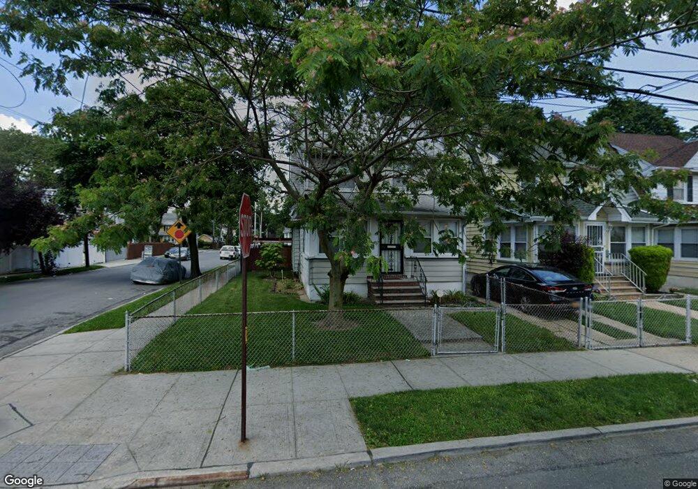
19401 115th Rd Saint Albans, NY 11412
Saint Albans NeighborhoodEstimated Value: $616,383 - $808,000
--
Bed
--
Bath
1,670
Sq Ft
$425/Sq Ft
Est. Value
About This Home
This home is located at 19401 115th Rd, Saint Albans, NY 11412 and is currently estimated at $710,096, approximately $425 per square foot. 19401 115th Rd is a home located in Queens County with nearby schools including P.S. 136 Roy Wilkins, I.S. 192 The Linden, and Riverton Street Charter School.
Ownership History
Date
Name
Owned For
Owner Type
Purchase Details
Closed on
Jul 28, 2023
Sold by
Hicks Brenda
Bought by
Brenda Hicks Trust Dated July 28 2023 and Erica M Santelmo Trustee
Current Estimated Value
Purchase Details
Closed on
Jan 3, 2022
Sold by
Hicks Sheldon
Bought by
Hicks Brenda
Purchase Details
Closed on
Apr 4, 2005
Sold by
Hicks Gladys and Hicks Sheldon
Bought by
Hicks Sheldon
Create a Home Valuation Report for This Property
The Home Valuation Report is an in-depth analysis detailing your home's value as well as a comparison with similar homes in the area
Home Values in the Area
Average Home Value in this Area
Purchase History
| Date | Buyer | Sale Price | Title Company |
|---|---|---|---|
| Brenda Hicks Trust Dated July 28 2023 | -- | -- | |
| Brenda Hicks Trust Dated July 28 2023 | -- | -- | |
| Hicks Brenda | -- | -- | |
| Hicks Brenda | -- | -- | |
| Hicks Sheldon | -- | -- | |
| Hicks Sheldon | -- | -- |
Source: Public Records
Tax History Compared to Growth
Tax History
| Year | Tax Paid | Tax Assessment Tax Assessment Total Assessment is a certain percentage of the fair market value that is determined by local assessors to be the total taxable value of land and additions on the property. | Land | Improvement |
|---|---|---|---|---|
| 2025 | $5,029 | $25,229 | $7,902 | $17,327 |
| 2024 | $5,029 | $25,039 | $7,695 | $17,344 |
| 2023 | $4,797 | $23,622 | $6,147 | $17,475 |
| 2022 | $4,449 | $37,860 | $11,820 | $26,040 |
| 2021 | $4,425 | $39,960 | $11,820 | $28,140 |
| 2020 | $4,428 | $34,380 | $11,820 | $22,560 |
| 2019 | $4,365 | $29,460 | $11,820 | $17,640 |
| 2018 | $4,013 | $19,685 | $7,725 | $11,960 |
| 2017 | $3,786 | $18,571 | $9,285 | $9,286 |
| 2016 | $3,502 | $18,571 | $9,285 | $9,286 |
| 2015 | $2,378 | $20,040 | $13,140 | $6,900 |
| 2014 | $2,378 | $19,567 | $12,830 | $6,737 |
Source: Public Records
Map
Nearby Homes
- 194-19 115th Rd
- 191-68 115th Rd
- 191-47 114th Dr
- 194-34 115th Rd
- 191-34 114th Rd
- 194-23 114th Rd
- 19431 114th Rd
- 191-16 114th Rd
- 194-42 Murdock Ave
- 194-56 Murdock Ave
- 11620 194th St
- 19427 Murdock Ave
- 11608 196th St
- 114-22 197th St
- 115-37 197th St
- 19445 Murdock Ave
- 19432 113th Rd
- 196-10 116th Ave
- 114-64 198th St
- 19705 116th Ave
- 19405 115th Rd
- 19407 115th Rd
- 19167 115th Rd
- 19409 115th Rd
- 19402 115th Ave
- 19406 115th Ave
- 19408 115th Ave
- 19165 115th Rd
- 19411 115th Rd
- 194-08 115th Ave
- 19410 115th Ave
- 19154 115th Ave
- 19154 115th Ave
- 19161 115th Rd
- 19415 115th Rd
- 19412 115th Ave
- 11529 194th St
- 19150 115th Ave
- 19168 115th Rd
- 19168 115th Rd