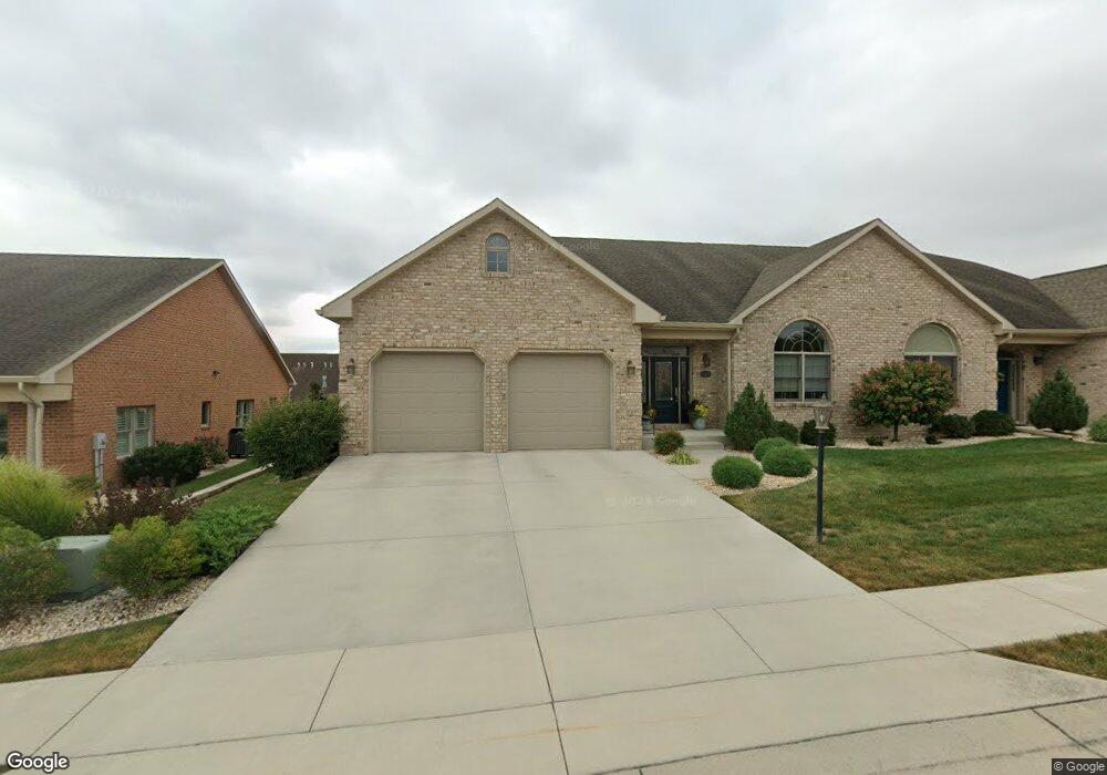
19403 Moonstone Dr Hagerstown, MD 21742
Estimated Value: $524,000 - $620,000
--
Bed
3
Baths
3,552
Sq Ft
$164/Sq Ft
Est. Value
About This Home
This home is located at 19403 Moonstone Dr, Hagerstown, MD 21742 and is currently estimated at $583,000, approximately $164 per square foot. 19403 Moonstone Dr is a home located in Washington County with nearby schools including Paramount Elementary School, Otsego West Campus High School, and Northern Middle School.
Ownership History
Date
Name
Owned For
Owner Type
Purchase Details
Closed on
Jun 11, 2014
Sold by
Emerald Pointe Inc
Bought by
Nycum David and Nycum Debra
Current Estimated Value
Home Financials for this Owner
Home Financials are based on the most recent Mortgage that was taken out on this home.
Original Mortgage
$300,000
Outstanding Balance
$228,101
Interest Rate
4.19%
Mortgage Type
New Conventional
Estimated Equity
$354,899
Create a Home Valuation Report for This Property
The Home Valuation Report is an in-depth analysis detailing your home's value as well as a comparison with similar homes in the area
Home Values in the Area
Average Home Value in this Area
Purchase History
| Date | Buyer | Sale Price | Title Company |
|---|---|---|---|
| Nycum David | $375,000 | None Available |
Source: Public Records
Mortgage History
| Date | Status | Borrower | Loan Amount |
|---|---|---|---|
| Open | Nycum David | $300,000 |
Source: Public Records
Tax History Compared to Growth
Tax History
| Year | Tax Paid | Tax Assessment Tax Assessment Total Assessment is a certain percentage of the fair market value that is determined by local assessors to be the total taxable value of land and additions on the property. | Land | Improvement |
|---|---|---|---|---|
| 2025 | $4,602 | $493,800 | $0 | $0 |
| 2024 | $4,602 | $448,500 | $70,000 | $378,500 |
| 2023 | $4,426 | $448,500 | $70,000 | $378,500 |
| 2022 | $4,240 | $448,500 | $70,000 | $378,500 |
| 2021 | $4,142 | $467,900 | $60,000 | $407,900 |
| 2020 | $3,747 | $434,367 | $0 | $0 |
| 2019 | $3,747 | $400,833 | $0 | $0 |
| 2018 | $3,550 | $367,300 | $50,000 | $317,300 |
| 2017 | $3,200 | $340,267 | $0 | $0 |
| 2016 | -- | $313,233 | $0 | $0 |
| 2015 | -- | $286,200 | $0 | $0 |
| 2014 | -- | $282,867 | $0 | $0 |
Source: Public Records
Map
Nearby Homes
- 20111 Regent Cir
- 20122 Regent Cir
- 13336 Marquise Dr
- TBD Turquoise Dr Unit V221
- 19554 Turquoise Dr Unit V219
- 19702 Portsmouth Dr
- 19446 Sapphire Dr
- 19703 Portsmouth Dr
- 13366 Marquise Dr
- 0 Diamond Pointe Dr Unit V120
- 13350 Diamond Pointe Dr Unit V227
- 13430 Marquise Dr Unit 80
- 19310 Smallwood Terrace
- TBB Poppy Ct Unit STARLING II
- 19330 Longmeadow Rd
- 13511 Cherry Tree Cir
- TBB Longmeadow Rd Unit FINCH
- Starling II Plan at Rosehill Manor Villas - Rosehill Manor 55+ Active Adult Homes
- Crimson Plan at Rosehill Manor Villas - Rosehill Manor 55+ Active Adult Homes
- Finch Plan at Rosehill Manor Villas - Rosehill Manor 55+ Active Adult Homes
- 19401 Moonstone Dr
- 19407 Moonstone Dr
- 13319 Marquise Dr
- 0 Marquise Dr Unit 1004007133
- 0 Marquise Dr Unit V16 1003997457
- 0 Marquise Dr Unit V43 1003997525
- 0 Marquise Dr Unit V9 1003997485
- 0 Marquise Dr Unit V43 1003997471
- 13317 Marquise Dr
- 13317 Marquise Dr Unit V27
- 0 Marquise Dr Unit WA9566164
- 13315 Marquise Dr
- 13336 Marquise Dr Unit V13
- 13338 Marquise Dr
- 13338 Marquise Dr Unit V14
- Marquise Dr Unit V16
- 19402 Moonstone Dr
- 13332 Marquise Dr
- 13332 Marquise Dr Unit V12
- 19404 Moonstone Dr