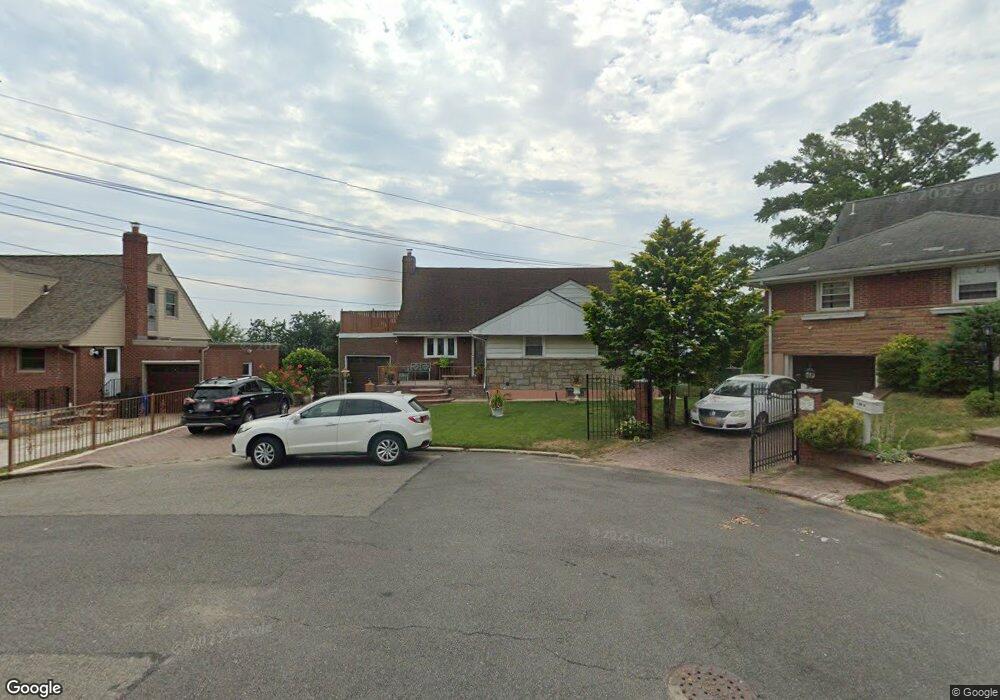
19406 87th Rd Hollis, NY 11423
Holliswood NeighborhoodEstimated Value: $831,660 - $1,379,000
--
Bed
--
Bath
1,588
Sq Ft
$715/Sq Ft
Est. Value
About This Home
This home is located at 19406 87th Rd, Hollis, NY 11423 and is currently estimated at $1,135,915, approximately $715 per square foot. 19406 87th Rd is a home located in Queens County with nearby schools including P.S. 35 Nathaniel Woodhull, I.S. 238 Susan B Anthony Academy, and The Wellspring Schools.
Ownership History
Date
Name
Owned For
Owner Type
Purchase Details
Closed on
Oct 31, 1995
Sold by
Beredjick Nicky and Beredjick Esther
Bought by
Major Vibert and Major Cheryl
Current Estimated Value
Home Financials for this Owner
Home Financials are based on the most recent Mortgage that was taken out on this home.
Original Mortgage
$210,000
Outstanding Balance
$2,901
Interest Rate
7.47%
Estimated Equity
$1,133,014
Create a Home Valuation Report for This Property
The Home Valuation Report is an in-depth analysis detailing your home's value as well as a comparison with similar homes in the area
Home Values in the Area
Average Home Value in this Area
Purchase History
| Date | Buyer | Sale Price | Title Company |
|---|---|---|---|
| Major Vibert | $290,000 | -- |
Source: Public Records
Mortgage History
| Date | Status | Borrower | Loan Amount |
|---|---|---|---|
| Open | Major Vibert | $210,000 |
Source: Public Records
Tax History Compared to Growth
Tax History
| Year | Tax Paid | Tax Assessment Tax Assessment Total Assessment is a certain percentage of the fair market value that is determined by local assessors to be the total taxable value of land and additions on the property. | Land | Improvement |
|---|---|---|---|---|
| 2025 | $9,192 | $49,994 | $18,347 | $31,647 |
| 2024 | $6,740 | $47,165 | $16,266 | $30,899 |
| 2023 | $8,656 | $44,496 | $14,322 | $30,174 |
| 2022 | $8,596 | $54,000 | $18,540 | $35,460 |
| 2021 | $8,998 | $47,040 | $18,540 | $28,500 |
| 2020 | $8,523 | $51,720 | $18,540 | $33,180 |
| 2019 | $7,929 | $48,660 | $18,540 | $30,120 |
| 2018 | $7,261 | $37,080 | $18,540 | $18,540 |
| 2017 | $8,192 | $41,658 | $18,415 | $23,243 |
| 2016 | $7,547 | $41,658 | $18,415 | $23,243 |
| 2015 | $4,669 | $39,600 | $20,580 | $19,020 |
| 2014 | $4,669 | $39,122 | $20,362 | $18,760 |
Source: Public Records
Map
Nearby Homes
- 19633 Foothill Ave
- 196-33 Foothill Ave
- 196- 17 Dunton Ave Unit 2
- 19332 Foothill Ave
- 196-35 Dunton Ave Unit 1
- 87-24 Marengo St Unit 2B
- 87-16 Marengo St Unit 2B
- 88-27 196th St
- 19127 Foothill Ave
- 198-02 Pompeii Ave Unit 1 B
- 198-31 Pompeii Ave
- 8716 Palo Alto St
- 89-48 196th St
- 19615 Como Ave
- 88-38 201st St
- 88-38 191st St
- 19624 90th Ave
- 86-55 Santiago St
- 8714 Santiago St
- 8844 202nd St
- 86 01 Marengo
- 19402 87th Rd
- 19410 87th Rd
- 194-02 87th Rd Unit 1st FL
- 194-02 87th Rd
- 19615 Foothill Ave
- 19609 Foothill Ave
- 19621 Foothill Ave
- 19401 87th Rd
- 19616 Dunton Ave
- 87-25 Clover Place
- 19627 Foothill Ave
- 8731 Clover Place
- 8731 Clover Place
- 8725 Clover Place
- 200 Mclaughlin Ave
- 200 Mclaughlin Ave Unit NA
- 199-02 Epsom
- 191-37 SE Foothill Ave Ave SE
- 88-52 195 Place