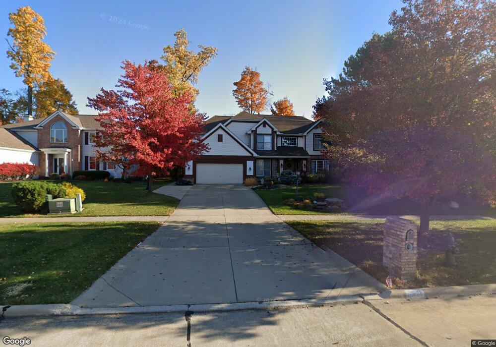
19407 Saratoga Trail Strongsville, OH 44136
Estimated Value: $408,000 - $549,000
4
Beds
3
Baths
3,020
Sq Ft
$159/Sq Ft
Est. Value
About This Home
This home is located at 19407 Saratoga Trail, Strongsville, OH 44136 and is currently estimated at $479,393, approximately $158 per square foot. 19407 Saratoga Trail is a home located in Cuyahoga County with nearby schools including Strongsville High School and Saint Ambrose Catholic School.
Ownership History
Date
Name
Owned For
Owner Type
Purchase Details
Closed on
May 11, 2006
Sold by
Bronish Daniel G and Bronish Joanne M
Bought by
Witte Timothy J and Witte Erin K
Current Estimated Value
Home Financials for this Owner
Home Financials are based on the most recent Mortgage that was taken out on this home.
Original Mortgage
$40,400
Interest Rate
6.68%
Mortgage Type
Unknown
Purchase Details
Closed on
May 26, 1995
Sold by
Parkview Corp
Bought by
Bronish Daniel G and Bronish Joanne M
Home Financials for this Owner
Home Financials are based on the most recent Mortgage that was taken out on this home.
Original Mortgage
$175,000
Interest Rate
8.01%
Mortgage Type
New Conventional
Purchase Details
Closed on
Dec 18, 1990
Bought by
Kingswood Group ,Inc.
Purchase Details
Closed on
May 12, 1982
Bought by
Planterra Corp
Purchase Details
Closed on
Jan 1, 1980
Bought by
North East Land Co
Create a Home Valuation Report for This Property
The Home Valuation Report is an in-depth analysis detailing your home's value as well as a comparison with similar homes in the area
Home Values in the Area
Average Home Value in this Area
Purchase History
| Date | Buyer | Sale Price | Title Company |
|---|---|---|---|
| Witte Timothy J | $281,900 | Revere | |
| Bronish Daniel G | $233,483 | -- | |
| Kingswood Group ,Inc. | -- | -- | |
| Planterra Corp | -- | -- | |
| North East Land Co | -- | -- |
Source: Public Records
Mortgage History
| Date | Status | Borrower | Loan Amount |
|---|---|---|---|
| Closed | Witte Timothy J | $40,400 | |
| Previous Owner | Witte Timothy J | $225,500 | |
| Previous Owner | Bronish Daniel G | $175,000 |
Source: Public Records
Tax History Compared to Growth
Tax History
| Year | Tax Paid | Tax Assessment Tax Assessment Total Assessment is a certain percentage of the fair market value that is determined by local assessors to be the total taxable value of land and additions on the property. | Land | Improvement |
|---|---|---|---|---|
| 2024 | $7,017 | $149,450 | $30,345 | $119,105 |
| 2023 | $7,286 | $113,890 | $23,940 | $89,950 |
| 2022 | $7,079 | $113,890 | $23,940 | $89,950 |
| 2021 | $7,024 | $113,890 | $23,940 | $89,950 |
| 2020 | $7,217 | $103,530 | $21,770 | $81,760 |
| 2019 | $7,005 | $295,800 | $62,200 | $233,600 |
| 2018 | $6,358 | $103,530 | $21,770 | $81,760 |
| 2017 | $6,344 | $95,630 | $18,660 | $76,970 |
| 2016 | $6,292 | $95,630 | $18,660 | $76,970 |
| 2015 | $6,381 | $95,630 | $18,660 | $76,970 |
| 2014 | $6,381 | $95,630 | $18,660 | $76,970 |
Source: Public Records
Map
Nearby Homes
- 16711 Beech Cir
- 3550 Boston Rd
- 196 Pinnacle Dr
- 97 Weathervane Ln
- 18411 Yorktown Oval
- 328 Crestway Oval
- 18848 Pearl Rd
- 362 Brantley Ln
- 338 Delaware Dr
- 15604-REAR Boston Rd
- 16486 S Red Rock Dr
- 17934 Cambridge Oval
- 278 Sheri Dr
- 19694 Benbow Rd
- 19740 Benbow Rd
- 17682 Drake Rd
- 4139 Beverly Hills Dr
- 18229 Howe Rd
- 18294 Drake Rd
- 17130 Golden Star Dr
- 19383 Saratoga Trail
- 19476 Timber Creek Cir
- 19440 Timber Creek Cir
- 19359 Saratoga Trail
- 17573 Pioneers Creek Cir
- 19384 Timber Creek Cir
- 19370 Saratoga Trail
- 17531 Pioneers Creek Cir
- 19418 Saratoga Trail
- 19398 Saratoga Trail
- 19358 Timber Creek Cir
- 19454 Saratoga Trail
- 17499 Pioneers Creek Cir
- 19342 Saratoga Trail
- 19332 Timber Creek Cir
- 19329 Saratoga Trail
- 19455 Timber Creek Cir
- 19490 Saratoga Trail
- 19429 Timber Creek Cir
- 19481 Timber Creek Cir