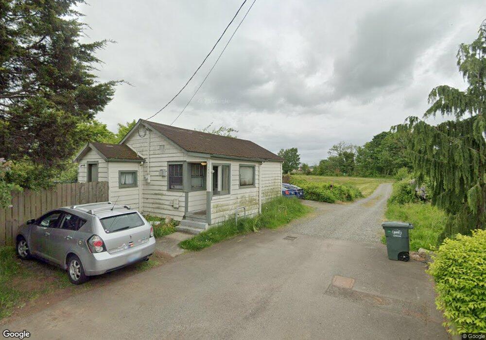
1941 Baker St Ferndale, WA 98248
Estimated Value: $314,000 - $425,000
2
Beds
1
Bath
621
Sq Ft
$557/Sq Ft
Est. Value
About This Home
This home is located at 1941 Baker St, Ferndale, WA 98248 and is currently estimated at $345,836, approximately $556 per square foot. 1941 Baker St is a home located in Whatcom County with nearby schools including Central Elementary School, Vista Middle School, and Ferndale High School.
Ownership History
Date
Name
Owned For
Owner Type
Purchase Details
Closed on
May 28, 2019
Sold by
Dimitrios David Zourkos Trust
Bought by
Zourkos Dminuis
Current Estimated Value
Purchase Details
Closed on
Apr 16, 2009
Sold by
Zourkos Dimitrios
Bought by
Zourkos David and Zourkos Ourania
Purchase Details
Closed on
Apr 27, 2004
Sold by
Zourkos Ourania
Bought by
Zourkos Dimitrios
Purchase Details
Closed on
Jan 28, 2004
Sold by
Zourkos David
Bought by
Zourkos Dimitrios
Create a Home Valuation Report for This Property
The Home Valuation Report is an in-depth analysis detailing your home's value as well as a comparison with similar homes in the area
Home Values in the Area
Average Home Value in this Area
Purchase History
| Date | Buyer | Sale Price | Title Company |
|---|---|---|---|
| Zourkos Dminuis | -- | None Available | |
| Zourkos David | -- | None Available | |
| Zourkos Dimitrios | -- | First American Title Ins Co | |
| Zourkos Dimitrios | -- | First American Title Ins Co |
Source: Public Records
Tax History Compared to Growth
Tax History
| Year | Tax Paid | Tax Assessment Tax Assessment Total Assessment is a certain percentage of the fair market value that is determined by local assessors to be the total taxable value of land and additions on the property. | Land | Improvement |
|---|---|---|---|---|
| 2024 | $1,841 | $262,227 | $174,600 | $87,627 |
| 2023 | $1,841 | $264,257 | $180,000 | $84,257 |
| 2022 | $1,611 | $217,733 | $131,082 | $86,651 |
| 2021 | $1,623 | $179,944 | $108,332 | $71,612 |
| 2020 | $1,571 | $166,619 | $100,310 | $66,309 |
| 2019 | $1,208 | $145,120 | $87,367 | $57,753 |
| 2018 | $1,409 | $132,679 | $79,877 | $52,802 |
| 2017 | $1,146 | $116,273 | $70,000 | $46,273 |
| 2016 | $1,077 | $102,293 | $55,120 | $47,173 |
| 2015 | $1,079 | $96,455 | $52,185 | $44,270 |
| 2014 | -- | $94,403 | $51,000 | $43,403 |
| 2013 | -- | $92,931 | $50,000 | $42,931 |
Source: Public Records
Map
Nearby Homes
- 1991 Alder St Unit 204
- 1564 Main St
- 5608 1st Ave
- 2029 Maple St
- 5604 3rd Ave
- 0 Riverside Dr Unit NWM2356867
- 5786 Portal Way
- 5802 2nd Ave
- 5685 Correll Dr
- 5675 Rosemary Ave
- 5879 Anderson Ave
- 5873 Anderson Ave
- 5863 Cedar St
- 5865 Anderson Ave
- 5829 Vista Dr
- 2234 Main St
- 5861 Malloy Ave
- 1655 Main St
- 5400 Barrett Rd
- 5682 Sunstone Place Unit 103
- 5519 Baker St
- 5517 Baker St
- 5515 Baker St
- 2429 Westview Plc
- 1874 E Main St
- 1850 E Main St
- 21 XX Main St
- 1920 Main St
- 5651 Front Ave
- 1991 Alder St
- 1991 Alder St
- 1991 Alder St Unit 203
- 1991 Alder St Unit 202
- 1991 Alder St Unit 201
- 1991 Alder St Unit 105
- 1991 Alder St Unit 103
- 1991 Alder St Unit 102
- 1991 Alder St Unit 101
- 1991 Alder St Unit 202