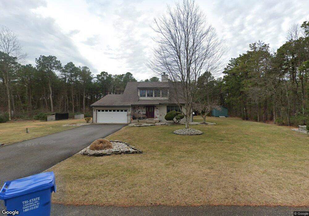
1941 Camden Ave Whiting, NJ 08759
Manchester Township NeighborhoodEstimated Value: $598,681 - $656,000
4
Beds
3
Baths
2,189
Sq Ft
$287/Sq Ft
Est. Value
About This Home
This home is located at 1941 Camden Ave, Whiting, NJ 08759 and is currently estimated at $628,420, approximately $287 per square foot. 1941 Camden Ave is a home located in Ocean County with nearby schools including Manchester Township High School.
Ownership History
Date
Name
Owned For
Owner Type
Purchase Details
Closed on
Oct 16, 2023
Sold by
Desimone Jeffrey W and Desimone Lisa A
Bought by
Mcmahon Thomas and Mcmahon Alison
Current Estimated Value
Home Financials for this Owner
Home Financials are based on the most recent Mortgage that was taken out on this home.
Original Mortgage
$201,900
Interest Rate
7.29%
Mortgage Type
New Conventional
Purchase Details
Closed on
Oct 12, 1989
Bought by
Desimone Jeffrey W and Desimone Lisa A
Create a Home Valuation Report for This Property
The Home Valuation Report is an in-depth analysis detailing your home's value as well as a comparison with similar homes in the area
Home Values in the Area
Average Home Value in this Area
Purchase History
| Date | Buyer | Sale Price | Title Company |
|---|---|---|---|
| Mcmahon Thomas | $601,900 | Realsafe Title | |
| Redacted Upon Request | $601,900 | Realsafe Title | |
| Desimone Jeffrey W | $30,000 | -- |
Source: Public Records
Mortgage History
| Date | Status | Borrower | Loan Amount |
|---|---|---|---|
| Previous Owner | Redacted Upon Request | $201,900 |
Source: Public Records
Tax History Compared to Growth
Tax History
| Year | Tax Paid | Tax Assessment Tax Assessment Total Assessment is a certain percentage of the fair market value that is determined by local assessors to be the total taxable value of land and additions on the property. | Land | Improvement |
|---|---|---|---|---|
| 2025 | $8,293 | $597,900 | $195,000 | $402,900 |
| 2024 | $7,871 | $337,800 | $85,000 | $252,800 |
| 2023 | $7,482 | $337,800 | $85,000 | $252,800 |
| 2022 | $7,482 | $337,800 | $85,000 | $252,800 |
| 2021 | $7,320 | $337,800 | $85,000 | $252,800 |
| 2020 | $7,128 | $337,800 | $85,000 | $252,800 |
| 2019 | $7,959 | $310,300 | $85,000 | $225,300 |
| 2018 | $7,928 | $310,300 | $85,000 | $225,300 |
| 2017 | $7,959 | $310,300 | $85,000 | $225,300 |
| 2016 | $7,863 | $310,300 | $85,000 | $225,300 |
| 2015 | $7,717 | $310,300 | $85,000 | $225,300 |
| 2014 | $7,559 | $310,300 | $85,000 | $225,300 |
Source: Public Records
Map
Nearby Homes
- 1901 Chilvers Ave
- 1751 Chilvers Ave
- 1130 Monroe Ave
- 1901 Baltimore Ave
- 151 Adams St
- 70 Norwalk Ave Unit 73
- 22 Hummingbird Ln Unit 73
- 9 Apple Ln
- 11 Hartford Rd Unit 70
- 85 Falmouth Ave Unit 72
- 23 Brentwood St Unit 73
- 1 Chelsea Dr
- 81 Falmouth Ave Unit 72
- 81 Falmouth Ave
- 69 Chelsea Dr Unit 72
- 74 Chelsea Dr
- 43 S Chestnut Ave Unit 72
- 58 St John Place Unit C
- 53 St John Place Unit B
- 2 Verbena Ct Unit B
- 1961 Camden Ave
- 1921 Camden Ave
- 1940 Camden Ave
- 1960 Camden Ave
- 1920 Camden Ave
- 1301 Coolidge Ave
- 1980 Camden Ave
- 1251 Coolidge Ave
- 1921 Trenton Ave
- 1961 Trenton Ave
- 1940 New York Ave
- 1960 New York Ave
- 1920 New York Ave
- 2000 Roosevelt Blvd
- 1901 Trenton Ave
- 1300 Coolidge Ave
- 1251 Bloomfield Ave
- 1900 New York Ave
- 1980 New York Ave
- 1250 Coolidge Ave