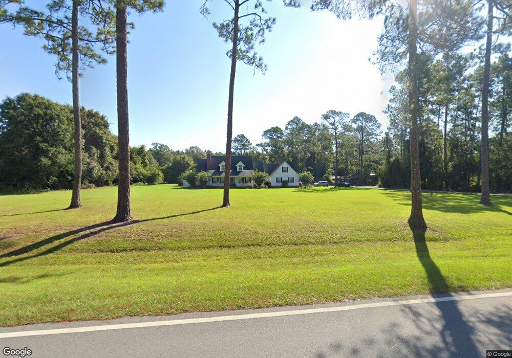
1941 Cogdell Hwy Pearson, GA 31642
Estimated Value: $158,000 - $343,000
--
Bed
--
Bath
3,672
Sq Ft
$75/Sq Ft
Est. Value
About This Home
This home is located at 1941 Cogdell Hwy, Pearson, GA 31642 and is currently estimated at $275,616, approximately $75 per square foot. 1941 Cogdell Hwy is a home with nearby schools including Pearson Elementary School, Willacoochee Elementary School, and Atkinson County High School.
Ownership History
Date
Name
Owned For
Owner Type
Purchase Details
Closed on
May 13, 2005
Sold by
Castellaw Christopher Todd
Bought by
Mathews Henry Edward and Mathews Cynthia S
Current Estimated Value
Home Financials for this Owner
Home Financials are based on the most recent Mortgage that was taken out on this home.
Original Mortgage
$100,000
Interest Rate
5.8%
Mortgage Type
New Conventional
Purchase Details
Closed on
Dec 3, 2003
Sold by
Mathews Henry E
Bought by
Castellaw Christoper Tod
Purchase Details
Closed on
Feb 15, 1994
Bought by
Mathews Henry E
Create a Home Valuation Report for This Property
The Home Valuation Report is an in-depth analysis detailing your home's value as well as a comparison with similar homes in the area
Home Values in the Area
Average Home Value in this Area
Purchase History
| Date | Buyer | Sale Price | Title Company |
|---|---|---|---|
| Mathews Henry Edward | $118,000 | -- | |
| Castellaw Christopher Todd | -- | -- | |
| Castellaw Christoper Tod | $100,000 | -- | |
| Mathews Henry E | -- | -- |
Source: Public Records
Mortgage History
| Date | Status | Borrower | Loan Amount |
|---|---|---|---|
| Closed | Castellaw Christopher Todd | $100,000 |
Source: Public Records
Tax History Compared to Growth
Tax History
| Year | Tax Paid | Tax Assessment Tax Assessment Total Assessment is a certain percentage of the fair market value that is determined by local assessors to be the total taxable value of land and additions on the property. | Land | Improvement |
|---|---|---|---|---|
| 2024 | $2,231 | $74,936 | $3,396 | $71,540 |
| 2023 | $1,680 | $74,936 | $3,396 | $71,540 |
| 2022 | $2,221 | $74,936 | $3,396 | $71,540 |
| 2021 | $2,343 | $74,936 | $3,396 | $71,540 |
| 2020 | $2,345 | $74,936 | $3,396 | $71,540 |
| 2019 | $2,346 | $74,936 | $3,396 | $71,540 |
| 2018 | $2,422 | $74,936 | $3,396 | $71,540 |
| 2017 | $2,174 | $69,573 | $3,396 | $66,177 |
| 2016 | $2,174 | $69,573 | $3,396 | $66,177 |
| 2015 | -- | $69,573 | $3,396 | $66,177 |
| 2014 | -- | $69,574 | $3,396 | $66,177 |
Source: Public Records
Map
Nearby Homes
- 00 Cogdell Hwy
- 00 Us-441 S
- 110 Shortrun Ln
- 0 Honeysuckle Ln Unit 10623320
- 684 Columbus Rd
- Tbd Lazy Nine Rd
- 00 Branch Farm Rd
- 149 Red Bluff Rd
- 35 Fawn Ln
- 53 Apple Blossom Rd
- N/A Fernwood Dr
- 76 Bocage Dr
- 6923 Willacoochee Hwy
- 00 Harvey Vickers Rd
- 1398 Adventure Trail
- 166 Tempa Ln
- 389 Pine Valley Rd
- 104 Tempa Ln
- 1635 Logan Dr
- 609 Main St E
- 1887 Cogdell Hwy
- 1906 Cogdell Hwy
- 2017 Cogdell Hwy
- 1874 Cogdell Hwy
- 145 Sears Pond Ln
- 1820 Cogdell Hwy
- 2053 Cogdell Hwy
- 15 Sears Pond Ln
- 1634 Cogdell Hwy
- 2335 Cogdell Hwy
- 338 Old Tower Ln
- 1557 Cogdell Hwy
- 2401 Cogdell Hwy
- 1437 Cogdell Hwy
- 2484 Cogdell Hwy
- 2356 Cogdell Hwy Unit n/a
- 2356 Cogdell Hwy
- 1355 Cogdell Hwy
- 6136 Boone Rd
- 6193 Boone Rd