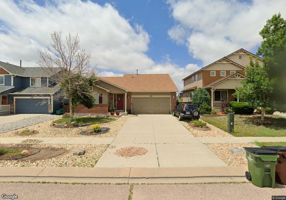
1941 Dewhirst Dr Colorado Springs, CO 80951
Estimated Value: $426,226 - $465,000
3
Beds
2
Baths
1,694
Sq Ft
$262/Sq Ft
Est. Value
About This Home
This home is located at 1941 Dewhirst Dr, Colorado Springs, CO 80951 and is currently estimated at $443,307, approximately $261 per square foot. 1941 Dewhirst Dr is a home located in El Paso County with nearby schools including Evans International Elementary School, Coldwater Canyon Elementary, and Clover Avenue Elementary School.
Ownership History
Date
Name
Owned For
Owner Type
Purchase Details
Closed on
Dec 3, 2021
Sold by
Michael Mckasson
Bought by
Rodriguez Ashley
Current Estimated Value
Purchase Details
Closed on
Sep 22, 2017
Sold by
Meyer John M and Meyer Marion Gow
Bought by
Mckasson Michael and Rodriguez Ashley
Home Financials for this Owner
Home Financials are based on the most recent Mortgage that was taken out on this home.
Original Mortgage
$259,218
Interest Rate
4.87%
Mortgage Type
FHA
Purchase Details
Closed on
Aug 11, 2006
Sold by
Meyer John M
Bought by
Meyer John M and Meyer Marion Gow
Purchase Details
Closed on
Dec 23, 2005
Sold by
Melody Homes Inc
Bought by
Meyer John M
Home Financials for this Owner
Home Financials are based on the most recent Mortgage that was taken out on this home.
Original Mortgage
$159,078
Interest Rate
6.25%
Mortgage Type
Fannie Mae Freddie Mac
Create a Home Valuation Report for This Property
The Home Valuation Report is an in-depth analysis detailing your home's value as well as a comparison with similar homes in the area
Home Values in the Area
Average Home Value in this Area
Purchase History
| Date | Buyer | Sale Price | Title Company |
|---|---|---|---|
| Rodriguez Ashley | -- | None Listed On Document | |
| Mckasson Michael | $264,000 | Land Title Guarantee Co | |
| Meyer John M | -- | None Available | |
| Meyer John M | $198,848 | Land Title Guarantee Company |
Source: Public Records
Mortgage History
| Date | Status | Borrower | Loan Amount |
|---|---|---|---|
| Previous Owner | Mckasson Michael | $259,218 | |
| Previous Owner | Meyer John M | $159,078 |
Source: Public Records
Tax History Compared to Growth
Tax History
| Year | Tax Paid | Tax Assessment Tax Assessment Total Assessment is a certain percentage of the fair market value that is determined by local assessors to be the total taxable value of land and additions on the property. | Land | Improvement |
|---|---|---|---|---|
| 2025 | $2,032 | $30,510 | -- | -- |
| 2024 | $1,928 | $30,910 | $5,290 | $25,620 |
| 2023 | $1,928 | $30,910 | $5,290 | $25,620 |
| 2022 | $2,049 | $21,340 | $4,170 | $17,170 |
| 2021 | $2,125 | $21,950 | $4,290 | $17,660 |
| 2020 | $1,891 | $19,480 | $3,580 | $15,900 |
| 2019 | $1,987 | $19,480 | $3,580 | $15,900 |
| 2018 | $1,635 | $15,850 | $3,560 | $12,290 |
| 2017 | $1,541 | $15,850 | $3,560 | $12,290 |
| 2016 | $1,487 | $15,670 | $3,580 | $12,090 |
| 2015 | $1,488 | $15,670 | $3,580 | $12,090 |
| 2014 | $1,398 | $14,530 | $3,580 | $10,950 |
Source: Public Records
Map
Nearby Homes
- 1925 Dewhirst Dr
- 2034 Lillian Way
- 1874 Sandtoft Heights
- 1729 Sandtoft Heights
- 7820 Parsonage Ln
- 8163 Postrock Dr
- 1768 Reilly Grove
- 1974 Capital Dr
- 1725 Bucolo Ave
- 1998 Lattern Ct
- 1985 Reed Grass Way
- 1822 Bulrush Way
- 2215 Reed Grass Way
- 7340 Grama Grass Ct
- 2245 Reed Grass Way
- 1898 Woodpark Dr
- 2524 Obsidian Forest View
- 2421 Fruited Plains Ct
- 1095 Western 623-L Dr Unit 623-L
- 7225 Poteae Dr
- 1933 Dewhirst Dr
- 1949 Dewhirst Dr
- 1957 Dewhirst Dr
- 1965 Dewhirst Dr
- 1917 Dewhirst Dr
- 1898 Walton Dr
- 1899 Walton Dr
- 1973 Dewhirst Dr
- 1909 Dewhirst Dr
- 2012 Dewhirst Dr
- 1882 Walton Dr
- 1883 Walton Dr
- 1901 Dewhirst Dr
- 2020 Dewhirst Dr
- 1866 Walton Dr
- 1867 Walton Dr
- 1878 Sheringham Dr
- 1989 Dewhirst Dr
- 1677 Silver Meadow Cir
- 2028 Dewhirst Dr