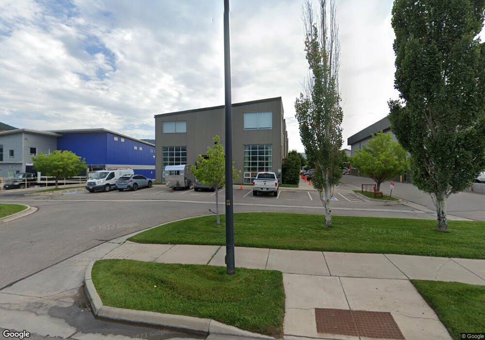
1941 Dolores Way Unit C-6 Carbondale, CO 81623
Carbondale NeighborhoodEstimated Value: $479,410
--
Bed
1
Bath
864
Sq Ft
$555/Sq Ft
Est. Value
About This Home
This home is located at 1941 Dolores Way Unit C-6, Carbondale, CO 81623 and is currently estimated at $479,410, approximately $554 per square foot. 1941 Dolores Way Unit C-6 is a home located in Garfield County with nearby schools including Carbondale Community Charter School, Ross Montessori School, and Colorado Rocky Mountain School.
Ownership History
Date
Name
Owned For
Owner Type
Purchase Details
Closed on
Oct 7, 2024
Sold by
Bartron-Miscione Stephanie
Bought by
1941 Dolores Offices Llc
Current Estimated Value
Purchase Details
Closed on
Mar 28, 2024
Sold by
Delores Holdings Llc
Bought by
Bartron-Miscione Stephanie
Purchase Details
Closed on
Mar 7, 2018
Sold by
Lockrem Robert A and Lockrem Kimberly C
Bought by
Delores Holdings Llc
Purchase Details
Closed on
Jan 10, 2008
Sold by
Cleaver & Edelman Land Planning & Develo
Bought by
Lockrem Robert A and Lockrem Kimberly C
Create a Home Valuation Report for This Property
The Home Valuation Report is an in-depth analysis detailing your home's value as well as a comparison with similar homes in the area
Home Values in the Area
Average Home Value in this Area
Purchase History
| Date | Buyer | Sale Price | Title Company |
|---|---|---|---|
| 1941 Dolores Offices Llc | -- | None Listed On Document | |
| Bartron-Miscione Stephanie | $410,000 | None Listed On Document | |
| Delores Holdings Llc | $205,000 | Title Co The Rockies | |
| Lockrem Robert A | $320,000 | Stewart Title |
Source: Public Records
Tax History Compared to Growth
Tax History
| Year | Tax Paid | Tax Assessment Tax Assessment Total Assessment is a certain percentage of the fair market value that is determined by local assessors to be the total taxable value of land and additions on the property. | Land | Improvement |
|---|---|---|---|---|
| 2024 | $5,940 | $73,660 | $0 | $73,660 |
| 2023 | $5,940 | $73,660 | $0 | $73,660 |
| 2022 | $6,174 | $70,770 | $0 | $70,770 |
| 2021 | $6,085 | $70,770 | $0 | $70,770 |
| 2020 | $5,224 | $63,910 | $0 | $63,910 |
| 2019 | $5,267 | $63,910 | $0 | $63,910 |
| 2018 | $4,194 | $51,500 | $0 | $51,500 |
| 2017 | $3,906 | $51,500 | $0 | $51,500 |
| 2016 | $4,620 | $59,820 | $0 | $59,820 |
| 2015 | $4,684 | $59,820 | $0 | $59,820 |
| 2014 | -- | $60,810 | $0 | $60,810 |
Source: Public Records
Map
Nearby Homes
- 1945 Dolores Way
- 88 Pine St
- 938 County Road 106
- 491 Morrison St
- 570 Redstone Ave
- 123 Village Ln
- 169 Village Ln
- 762 Lincoln Ave Unit 762
- 296 N 7th St
- 155 Main St
- 640 Lincoln Ave Unit 630 Lincoln Ave
- 610 Colorado Ave
- 718 Main St Unit 718
- 228 Midland Point Rd
- 579 Main St
- 29 Spirit Mtn Rd
- 29 Spirit Mtn Rd
- 311 Main St Unit STE 300
- 1188 Cr 106
- 584 Grace Dr
- 1941 Dolores Way Unit 1941 And 1945
- 1941 Dolores Way
- 1941 Dolores Way Unit C-6
- 1949 Dolores Way Unit C-7
- 1929 Dolores Way Unit C-9
- 1929 Dolores Way Unit C-9
- 1929 Dolores Way
- 1925 Dolores Way Unit C-4
- 1925 Dolores Way
- 1913 Dolores Way Unit C-8
- 1913 Dolores Way
- 1905 Dolores Way Unit R1
- 1917 Dolores Way Unit C3
- 2261 Dolores Way Unit 6
- 1921 Dolores Way Unit R2
- 1909 Dolores Way Unit 2
- 1909 Dolores Way
- 2251 Dolores Way Unit 5
- 2251 Dolores Way
- 2100 Dolores Way