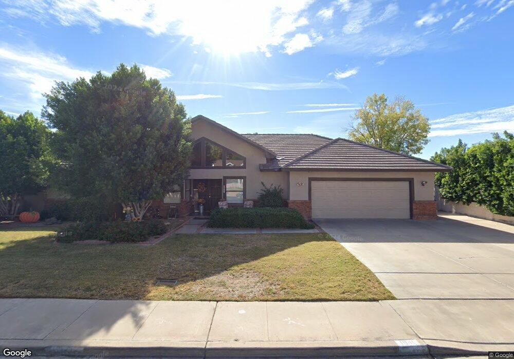
1941 E Enrose St Mesa, AZ 85203
North Central Mesa NeighborhoodEstimated Value: $466,000 - $613,000
Studio
3
Baths
2,660
Sq Ft
$203/Sq Ft
Est. Value
About This Home
This home is located at 1941 E Enrose St, Mesa, AZ 85203 and is currently estimated at $540,981, approximately $203 per square foot. 1941 E Enrose St is a home located in Maricopa County with nearby schools including Michael T. Hughes Elementary School, Franklin at Brimhall Elementary School, and Franklin West Elementary School.
Ownership History
Date
Name
Owned For
Owner Type
Purchase Details
Closed on
Dec 22, 1994
Sold by
Rudd Vernon and Rudd Patsy
Bought by
Kempton Charles D and Kempton Joy Ann
Current Estimated Value
Create a Home Valuation Report for This Property
The Home Valuation Report is an in-depth analysis detailing your home's value as well as a comparison with similar homes in the area
Home Values in the Area
Average Home Value in this Area
Purchase History
| Date | Buyer | Sale Price | Title Company |
|---|---|---|---|
| Kempton Charles D | -- | Chicago Title Insurance Co | |
| Rudd Vernon | -- | Chicago Title Insurance Co | |
| Reyna Cheyney Ray | -- | Chicago Title Insurance Co |
Source: Public Records
Tax History
| Year | Tax Paid | Tax Assessment Tax Assessment Total Assessment is a certain percentage of the fair market value that is determined by local assessors to be the total taxable value of land and additions on the property. | Land | Improvement |
|---|---|---|---|---|
| 2025 | $1,828 | $22,012 | -- | -- |
| 2024 | $1,848 | $20,964 | -- | -- |
| 2023 | $1,848 | $40,160 | $8,030 | $32,130 |
| 2022 | $1,807 | $31,550 | $6,310 | $25,240 |
| 2021 | $1,857 | $28,910 | $5,780 | $23,130 |
| 2020 | $1,832 | $27,370 | $5,470 | $21,900 |
| 2019 | $1,697 | $23,850 | $4,770 | $19,080 |
| 2018 | $1,621 | $21,770 | $4,350 | $17,420 |
| 2017 | $1,570 | $20,950 | $4,190 | $16,760 |
| 2016 | $1,541 | $20,100 | $4,020 | $16,080 |
| 2015 | $1,455 | $18,500 | $3,700 | $14,800 |
Source: Public Records
Map
Nearby Homes
- 1934 E Enrose St
- 715 N Gilbert Rd
- 2062 E Downing St
- 748 N 22nd St
- 655 N Gentry Cir
- 2041 E Des Moines St
- 823 N Hill Cir
- 2059 E Brown Rd Unit 30
- 1712 E Fairfield St
- 2301 E Enrose St
- 2322 E Evergreen St
- 2214 E Contessa Cir
- 536 N Hall
- 505 N Williams
- 1808 E Glencove St
- 2011 E Gary Cir
- 2267 E Caballero Cir
- 1934 E Gary St
- 2435 E Evergreen St
- 1618 E Greenway St
- 1951 E Enrose St
- 1933 E Enrose St
- 1948 E Ellis Cir
- 1938 E Ellis Cir
- 1942 E Enrose St
- 1956 E Ellis Cir
- 1930 E Ellis Cir
- 1954 E Enrose St
- 1959 E Enrose St
- 1925 E Enrose St
- 1928 E Enrose St
- 1964 E Enrose St
- 1962 E Ellis Cir
- 1937 E Ellis Cir
- 1947 E Ellis Cir
- 1929 E Ellis Cir
- 1916 E Enrose St
- 1955 E Ellis Cir
- 1911 E Ellis Cir
- 1934 E Elmwood Cir
Your Personal Tour Guide
Ask me questions while you tour the home.