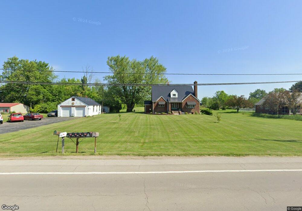
1941 E State Rd Port Clinton, OH 43452
Estimated Value: $234,000 - $385,000
3
Beds
3
Baths
1,868
Sq Ft
$158/Sq Ft
Est. Value
About This Home
This home is located at 1941 E State Rd, Port Clinton, OH 43452 and is currently estimated at $295,284, approximately $158 per square foot. 1941 E State Rd is a home located in Ottawa County with nearby schools including Bataan Memorial Primary School, Bataan Memorial Intermediate School, and Port Clinton Middle School.
Ownership History
Date
Name
Owned For
Owner Type
Purchase Details
Closed on
Nov 24, 2010
Sold by
Hersberger Marguerite A and Coyle Sue Ann Van Rensselaer
Bought by
Capodice Matthew A
Current Estimated Value
Home Financials for this Owner
Home Financials are based on the most recent Mortgage that was taken out on this home.
Original Mortgage
$126,704
Outstanding Balance
$82,956
Interest Rate
4.12%
Mortgage Type
FHA
Estimated Equity
$212,328
Create a Home Valuation Report for This Property
The Home Valuation Report is an in-depth analysis detailing your home's value as well as a comparison with similar homes in the area
Home Values in the Area
Average Home Value in this Area
Purchase History
| Date | Buyer | Sale Price | Title Company |
|---|---|---|---|
| Capodice Matthew A | $130,400 | Hartung Title |
Source: Public Records
Mortgage History
| Date | Status | Borrower | Loan Amount |
|---|---|---|---|
| Open | Capodice Matthew A | $126,704 |
Source: Public Records
Tax History
| Year | Tax Paid | Tax Assessment Tax Assessment Total Assessment is a certain percentage of the fair market value that is determined by local assessors to be the total taxable value of land and additions on the property. | Land | Improvement |
|---|---|---|---|---|
| 2024 | $2,307 | $70,060 | $23,237 | $46,823 |
| 2023 | $2,356 | $42,784 | $9,464 | $33,320 |
| 2022 | $1,562 | $42,784 | $9,464 | $33,320 |
| 2021 | $1,560 | $42,780 | $9,460 | $33,320 |
| 2020 | $1,625 | $42,780 | $9,460 | $33,320 |
| 2019 | $1,597 | $42,780 | $9,460 | $33,320 |
| 2018 | $1,546 | $42,780 | $9,460 | $33,320 |
| 2017 | $1,550 | $42,200 | $9,460 | $32,740 |
| 2016 | $1,553 | $42,200 | $9,460 | $32,740 |
| 2015 | $1,560 | $42,200 | $9,460 | $32,740 |
| 2014 | $715 | $38,350 | $9,460 | $28,890 |
| 2013 | $1,433 | $38,350 | $9,460 | $28,890 |
Source: Public Records
Map
Nearby Homes
- 2650 E Harbor Rd
- 0 E Harbor Rd
- 199 Morningside Dr
- 19 N Beach St
- 1807 E Perry St Unit 69
- 111 Morningside Dr
- 188 Driftwood Dr
- 164 Driftwood Dr
- 183 Driftwood Dr
- 1801 E Perry St Unit 22
- 1801 E Perry St Unit 28
- 1630 Waters Edge Dr
- 311 Walnut St
- 1506 E Perry St
- 116 Walnut St
- 35 N Beach St
- 29 N Beach St
- 232 Beech St
- 1011 E 2nd St
- 1990 E Lockwood Rd
- 1947 E State Rd
- 1925 E State Rd
- 1925 E State St
- 1950 E State Rd
- 1940 E State Rd
- 1944 E State Rd
- 1907 E State Rd
- 1910 E State Rd
- 1908 E State Rd
- 1904 E State Rd
- 2004 E State Rd
- 1903 E State Rd
- 1902 E State Rd
- 2003 E State Rd
- 553 S Liz Ln
- 1882 E State Rd
- 2006 E State Rd
- 563 S Liz Ln
- 0 E State Rd Unit 20231887
- 0 E State Rd Unit 20220204
Your Personal Tour Guide
Ask me questions while you tour the home.