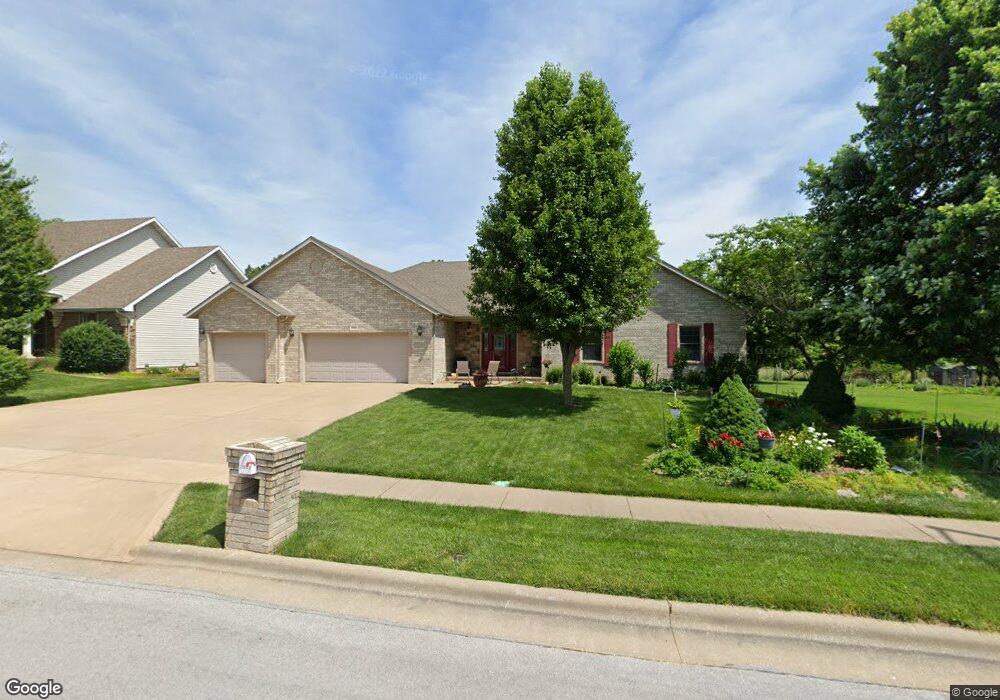
1941 E Wheatridge Dr Springfield, MO 65803
Estimated Value: $258,000 - $310,000
3
Beds
2
Baths
1,888
Sq Ft
$156/Sq Ft
Est. Value
About This Home
This home is located at 1941 E Wheatridge Dr, Springfield, MO 65803 and is currently estimated at $294,497, approximately $155 per square foot. 1941 E Wheatridge Dr is a home located in Greene County with nearby schools including Pleasant View K-8 School, Hillcrest High School, and Dayspring Christian School.
Ownership History
Date
Name
Owned For
Owner Type
Purchase Details
Closed on
Jun 14, 2011
Sold by
Secretary Of Hud
Bought by
Bryngelson Harlin
Current Estimated Value
Purchase Details
Closed on
Feb 2, 2007
Sold by
Fittro Delores J
Bought by
Bryngelson Harlin and Bryngelson La June
Home Financials for this Owner
Home Financials are based on the most recent Mortgage that was taken out on this home.
Original Mortgage
$33,500
Interest Rate
6.13%
Mortgage Type
Future Advance Clause Open End Mortgage
Create a Home Valuation Report for This Property
The Home Valuation Report is an in-depth analysis detailing your home's value as well as a comparison with similar homes in the area
Purchase History
| Date | Buyer | Sale Price | Title Company |
|---|---|---|---|
| Bryngelson Harlin | -- | Northwest Title Agency | |
| Bryngelson Harlin | -- | None Available |
Source: Public Records
Mortgage History
| Date | Status | Borrower | Loan Amount |
|---|---|---|---|
| Previous Owner | Bryngelson Harlin | $33,500 |
Source: Public Records
Tax History
| Year | Tax Paid | Tax Assessment Tax Assessment Total Assessment is a certain percentage of the fair market value that is determined by local assessors to be the total taxable value of land and additions on the property. | Land | Improvement |
|---|---|---|---|---|
| 2025 | $2,440 | $45,110 | $7,700 | $37,410 |
| 2024 | $2,295 | $39,650 | $5,700 | $33,950 |
| 2023 | $2,284 | $39,650 | $5,700 | $33,950 |
| 2022 | $2,006 | $34,140 | $5,700 | $28,440 |
| 2021 | $1,919 | $34,140 | $5,700 | $28,440 |
| 2020 | $1,941 | $32,790 | $5,700 | $27,090 |
| 2019 | $1,887 | $32,790 | $5,700 | $27,090 |
| 2018 | $1,867 | $32,280 | $5,320 | $26,960 |
| 2017 | $1,850 | $32,280 | $5,320 | $26,960 |
| 2016 | $1,847 | $32,280 | $5,320 | $26,960 |
| 2015 | $1,833 | $32,280 | $5,320 | $26,960 |
| 2014 | $1,810 | $31,900 | $5,320 | $26,580 |
Source: Public Records
Map
Nearby Homes
- 1923 E Valley Water Mill Rd
- 3839 N Stewart Ave
- 3975 N Stewart Ave
- 3424 N Darwin Ave
- 2393 E Valley Water Mill Rd
- 4260 N State Highway H
- 3749 N Pickwick Ave
- 3753 N Pickwick Ave
- 3983 N Courtney Cir
- 1349 E Stoneridge St
- 3333 N Delaware Ave
- Tract C N Farm Road 173
- 4541b N Lanier Ln
- 4541 N Lanier Ln
- 1270 E Ogorman Ct
- 3957 N Springlawn Ave
- 3969 N Springlawn Ave
- 1255 E Bonaire Dr
- 1626 E Farm Road 92
- 1502 E McClernon St
- 1935 E Wheatridge Dr
- 1953 E Wheatridge Dr
- 3767 N Wilden Ave
- 1948 E Wheatridge Dr
- 1929 E Wheatridge Dr
- 1959 E Wheatridge Dr
- 1954 E Wheatridge Dr
- 3755 N Wilden Ave
- 3802 N Monarch Ave
- 3754 N Wilden Ave
- 1923 E Wheatridge Dr
- 3751 N Monarch Ave
- 3761 N Nias Ave
- 1965 E Wheatridge Dr
- 3743 N Wilden Ave
- 3742 N Wilden Ave
- 1964 E Burntwood Dr
- 1930 E Wheatridge Dr
- 1917 E Wheatridge Dr
- 3749 N Nias Ave
Your Personal Tour Guide
Ask me questions while you tour the home.