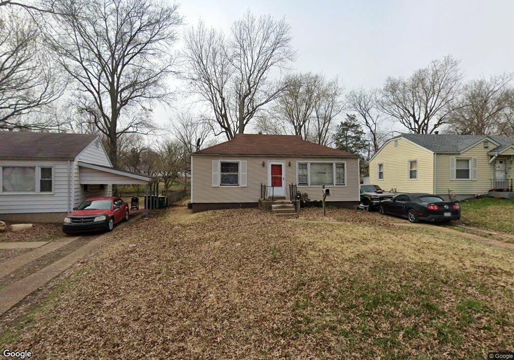
1941 Falcon Dr Saint Louis, MO 63133
Estimated Value: $74,000 - $321,000
2
Beds
1
Bath
984
Sq Ft
$159/Sq Ft
Est. Value
About This Home
This home is located at 1941 Falcon Dr, Saint Louis, MO 63133 and is currently estimated at $156,600, approximately $159 per square foot. 1941 Falcon Dr is a home located in St. Louis County with nearby schools including Normandy High School, The Leadership School, and Christ The King Catholic School.
Ownership History
Date
Name
Owned For
Owner Type
Purchase Details
Closed on
Sep 20, 2017
Sold by
Bck Real Estate Investments Corp
Bought by
Guliker Martijn
Current Estimated Value
Purchase Details
Closed on
Jun 26, 2013
Sold by
Lewis Mitchel Co
Bought by
Bck Real Estate Investments Corp
Purchase Details
Closed on
Apr 21, 2011
Sold by
Hicks Peggy
Bought by
The Bank Of New York Mellon
Create a Home Valuation Report for This Property
The Home Valuation Report is an in-depth analysis detailing your home's value as well as a comparison with similar homes in the area
Home Values in the Area
Average Home Value in this Area
Purchase History
| Date | Buyer | Sale Price | Title Company |
|---|---|---|---|
| Guliker Martijn | -- | None Available | |
| Bck Real Estate Investments Corp | $37,500 | Continental Title Company | |
| Lewis Mitchell Co | $32,500 | Continental Title Company | |
| The Bank Of New York Mellon | $9,529 | None Available |
Source: Public Records
Tax History
| Year | Tax Paid | Tax Assessment Tax Assessment Total Assessment is a certain percentage of the fair market value that is determined by local assessors to be the total taxable value of land and additions on the property. | Land | Improvement |
|---|---|---|---|---|
| 2025 | $1,604 | $17,080 | $2,240 | $14,840 |
| 2024 | $1,604 | $17,080 | $2,240 | $14,840 |
| 2023 | $1,675 | $17,080 | $2,240 | $14,840 |
| 2022 | $1,188 | $10,220 | $1,880 | $8,340 |
| 2021 | $1,140 | $10,220 | $1,880 | $8,340 |
| 2020 | $1,212 | $10,030 | $1,880 | $8,150 |
| 2019 | $1,185 | $10,030 | $1,880 | $8,150 |
| 2018 | $1,141 | $9,050 | $1,180 | $7,870 |
| 2017 | $1,149 | $9,050 | $1,180 | $7,870 |
| 2016 | $800 | $5,990 | $1,180 | $4,810 |
Source: Public Records
Map
Nearby Homes
- 1944 Falcon Dr
- 2018 Raven Dr
- 7804 Utica Dr
- 2037 Bainbridge Dr
- 7752 Mallard Dr
- 1901 Owen Dr
- 7401 Haywood Dr
- 7952 Monroe Dr
- 8000 Washington St
- 7369 Trenton Ave
- 7231 Teal Ave
- 8008 Monroe Ave
- 7331 Wayne Ave
- 7410 Liberty Ave
- 8103 Madison Ave
- 7430 Trenton Ave
- 2163 Wageley Place
- 7525 Cory Place
- 7449 Wayne Ave
- 1208 Verl Place
Your Personal Tour Guide
Ask me questions while you tour the home.