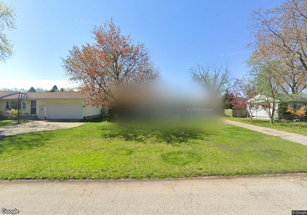
1941 Furhman Rd Norton Shores, MI 49441
Estimated Value: $230,641 - $238,000
3
Beds
1
Bath
960
Sq Ft
$244/Sq Ft
Est. Value
About This Home
This home is located at 1941 Furhman Rd, Norton Shores, MI 49441 and is currently estimated at $233,910, approximately $243 per square foot. 1941 Furhman Rd is a home located in Muskegon County with nearby schools including Mona Shores High School, Muskegon Montessori Academy for Environmental Change, and St. Francis De Sales Elementary School.
Ownership History
Date
Name
Owned For
Owner Type
Purchase Details
Closed on
Feb 24, 2022
Sold by
Otera Webb Trust
Bought by
Brewer Amanda K
Current Estimated Value
Home Financials for this Owner
Home Financials are based on the most recent Mortgage that was taken out on this home.
Original Mortgage
$178,703
Outstanding Balance
$166,255
Interest Rate
3.55%
Mortgage Type
FHA
Estimated Equity
$67,655
Purchase Details
Closed on
Aug 27, 2020
Sold by
Webb Otera and Otera Webb Trust
Bought by
Webb Otera and Otera Webb Trust
Purchase Details
Closed on
Apr 8, 2019
Sold by
Webb Otera and Webb Thomas Edward
Bought by
Webb Otera and Otera Webb Trust
Purchase Details
Closed on
Aug 31, 2009
Sold by
Webb Roy H and Webb Oteria
Bought by
Webb Roy H and Webb Otera
Create a Home Valuation Report for This Property
The Home Valuation Report is an in-depth analysis detailing your home's value as well as a comparison with similar homes in the area
Home Values in the Area
Average Home Value in this Area
Purchase History
| Date | Buyer | Sale Price | Title Company |
|---|---|---|---|
| Brewer Amanda K | $182,000 | None Listed On Document | |
| Webb Otera | -- | None Available | |
| Webb Otera | -- | None Available | |
| Webb Roy H | -- | None Available |
Source: Public Records
Mortgage History
| Date | Status | Borrower | Loan Amount |
|---|---|---|---|
| Open | Brewer Amanda K | $178,703 |
Source: Public Records
Tax History Compared to Growth
Tax History
| Year | Tax Paid | Tax Assessment Tax Assessment Total Assessment is a certain percentage of the fair market value that is determined by local assessors to be the total taxable value of land and additions on the property. | Land | Improvement |
|---|---|---|---|---|
| 2025 | $3,011 | $89,900 | $0 | $0 |
| 2024 | $2,361 | $81,700 | $0 | $0 |
| 2023 | $2,255 | $72,000 | $0 | $0 |
| 2022 | $1,803 | $61,800 | $0 | $0 |
| 2021 | $1,752 | $57,100 | $0 | $0 |
| 2020 | $1,732 | $54,700 | $0 | $0 |
| 2019 | $1,701 | $49,800 | $0 | $0 |
| 2018 | $1,661 | $48,200 | $0 | $0 |
| 2017 | $1,622 | $46,800 | $0 | $0 |
| 2016 | $1,256 | $43,700 | $0 | $0 |
| 2015 | -- | $41,900 | $0 | $0 |
| 2014 | $1,507 | $41,800 | $0 | $0 |
| 2013 | -- | $39,000 | $0 | $0 |
Source: Public Records
Map
Nearby Homes
- 1936 Lawnel Ave
- 3283 Mccracken St
- 1733 Woodside Rd
- 1744 W Norton Ave
- 1752 Bonneville Dr
- 1689 Bonneville Dr
- 2263 Lawnel Ave
- 1582 Haverhill Rd
- 2280 Arbor Ave
- 2278 Reneer Ave
- 1650 Bonneville Dr
- 1480 Marlboro Rd
- 3658 Lake Harbor Rd
- 2059 Garland Dr
- 2881 Cornell Ct
- 2115 Garland Dr
- 1448 Marlboro Rd
- 2715 Liberty Rd
- 1947 Spencer Dr
- 1521 Cornell Rd
- 1929 Furhman St
- 1953 Furhman Rd
- 1929 Furhman Rd
- 1965 Furhman St
- 1965 Furhman Rd
- 1948 Lawnel Ave
- 1930 Furhman Rd
- 1962 Lawnel Ave
- 1930 Furhman St
- 1954 Furhman St
- 1917 Furhman Rd
- 1942 Furhman Rd
- 1954 Furhman Rd
- 1918 Furhman Rd
- 1977 Furhman Rd
- 1905 Furhman St
- 1977 Furhman St
- 1922 Lawnel Ave
- 1974 Lawnel Ave
- 1966 Furhman Rd