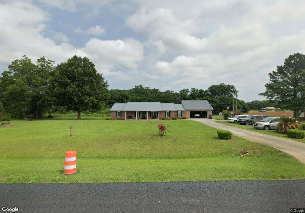
1941 Ga Highway 27 E Leslie, GA 31764
Estimated Value: $295,093 - $464,000
3
Beds
2
Baths
2,888
Sq Ft
$131/Sq Ft
Est. Value
About This Home
This home is located at 1941 Ga Highway 27 E, Leslie, GA 31764 and is currently estimated at $378,523, approximately $131 per square foot. 1941 Ga Highway 27 E is a home located in Sumter County with nearby schools including Sumter County Primary School, Sumter County Elementary School, and Sumter County Middle School.
Ownership History
Date
Name
Owned For
Owner Type
Purchase Details
Closed on
Oct 28, 2022
Sold by
Cooper Effie J
Bought by
Walton Clifford and Walton Helen J
Current Estimated Value
Home Financials for this Owner
Home Financials are based on the most recent Mortgage that was taken out on this home.
Original Mortgage
$280,000
Outstanding Balance
$271,270
Interest Rate
6.92%
Mortgage Type
VA
Estimated Equity
$107,253
Purchase Details
Closed on
Jun 1, 1971
Sold by
Cooper L S
Bought by
Cooper Eddie Lee
Create a Home Valuation Report for This Property
The Home Valuation Report is an in-depth analysis detailing your home's value as well as a comparison with similar homes in the area
Home Values in the Area
Average Home Value in this Area
Purchase History
| Date | Buyer | Sale Price | Title Company |
|---|---|---|---|
| Walton Clifford | $280,000 | -- | |
| Cooper Eddie Lee | -- | -- |
Source: Public Records
Mortgage History
| Date | Status | Borrower | Loan Amount |
|---|---|---|---|
| Open | Walton Clifford | $280,000 |
Source: Public Records
Tax History Compared to Growth
Tax History
| Year | Tax Paid | Tax Assessment Tax Assessment Total Assessment is a certain percentage of the fair market value that is determined by local assessors to be the total taxable value of land and additions on the property. | Land | Improvement |
|---|---|---|---|---|
| 2024 | $2,341 | $67,600 | $4,000 | $63,600 |
| 2023 | $2,508 | $67,600 | $4,000 | $63,600 |
| 2022 | $465 | $67,600 | $4,000 | $63,600 |
| 2021 | $465 | $67,600 | $4,000 | $63,600 |
| 2020 | $465 | $65,080 | $4,000 | $61,080 |
| 2019 | $390 | $65,080 | $4,000 | $61,080 |
| 2018 | $390 | $65,080 | $4,000 | $61,080 |
| 2017 | $390 | $65,080 | $4,000 | $61,080 |
| 2016 | $390 | $65,080 | $4,000 | $61,080 |
| 2015 | $390 | $57,840 | $2,000 | $55,840 |
| 2014 | $390 | $57,840 | $2,000 | $55,840 |
| 2013 | -- | $57,840 | $2,000 | $55,840 |
Source: Public Records
Map
Nearby Homes
- 240 Drayton Woods Rd
- N/A Mclean Dr SE
- 0 Drayton Loop
- 800 Drayton Loop
- 134 Drayton Ln
- 554 Flathead Dr
- 182 Redbreast Dr
- 1020 Flathead Dr
- 404 District Line Rd
- 101 Bass Rd
- 104 Redbreast Dr
- 18 Redbreast Dr
- TBD District Line Rd
- 121 E Entrekin Rd
- TBD Sawdust Trail
- 107 Oakridge Dr
- 0 N A Unit 10613160
- 139 E Allen St