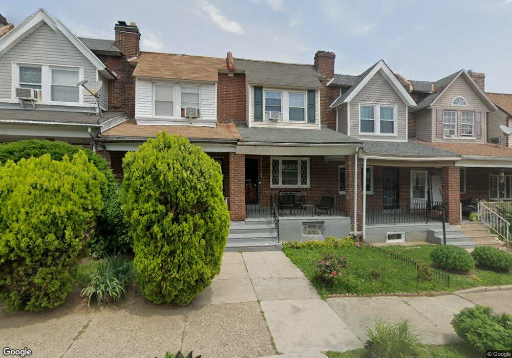
1941 Independence St Philadelphia, PA 19138
West Oak Lane NeighborhoodEstimated Value: $175,917 - $199,000
3
Beds
1
Bath
1,032
Sq Ft
$179/Sq Ft
Est. Value
About This Home
This home is located at 1941 Independence St, Philadelphia, PA 19138 and is currently estimated at $184,229, approximately $178 per square foot. 1941 Independence St is a home located in Philadelphia County with nearby schools including William Rowen School, Gen. Louis Wagner Middle School, and Martin Luther King High School.
Ownership History
Date
Name
Owned For
Owner Type
Purchase Details
Closed on
Dec 4, 2012
Sold by
Gittens Questa Gardene and Walcott-Shepherd Questa Q
Bought by
Gittens Winston R and Gittens Questa Gerdene
Current Estimated Value
Purchase Details
Closed on
Jul 31, 1995
Sold by
Bookhart Ronald C
Bought by
Walcott Shepherd Questa G
Create a Home Valuation Report for This Property
The Home Valuation Report is an in-depth analysis detailing your home's value as well as a comparison with similar homes in the area
Home Values in the Area
Average Home Value in this Area
Purchase History
| Date | Buyer | Sale Price | Title Company |
|---|---|---|---|
| Gittens Winston R | -- | None Available | |
| Walcott Shepherd Questa G | $40,000 | -- |
Source: Public Records
Tax History Compared to Growth
Tax History
| Year | Tax Paid | Tax Assessment Tax Assessment Total Assessment is a certain percentage of the fair market value that is determined by local assessors to be the total taxable value of land and additions on the property. | Land | Improvement |
|---|---|---|---|---|
| 2025 | $1,767 | $154,000 | $30,800 | $123,200 |
| 2024 | $1,767 | $154,000 | $30,800 | $123,200 |
| 2023 | $1,767 | $126,200 | $25,240 | $100,960 |
| 2022 | $669 | $81,200 | $25,240 | $55,960 |
| 2021 | $1,299 | $0 | $0 | $0 |
| 2020 | $1,299 | $0 | $0 | $0 |
| 2019 | $1,356 | $0 | $0 | $0 |
| 2018 | $808 | $0 | $0 | $0 |
| 2017 | $1,228 | $0 | $0 | $0 |
| 2016 | $808 | $0 | $0 | $0 |
| 2015 | $725 | $0 | $0 | $0 |
| 2014 | -- | $84,100 | $8,014 | $76,086 |
| 2012 | -- | $11,520 | $2,188 | $9,332 |
Source: Public Records
Map
Nearby Homes
- 6732 Ogontz Ave
- 2056 Eastburn Ave
- 6731 N Woodstock St
- 6733 N Woodstock St
- 6600 N Opal St
- 6625 Ogontz Ave
- 2022 66th Ave
- 6869 Forrest Ave
- 6603 Ogontz Ave
- 1816 67th Ave
- 2061 Independence St
- 6558 Limekiln Pike
- 6629 N Gratz St
- 6838 Ogontz Ave
- 2070 E Haines St
- 6609 N Gratz St
- 1733 67th Ave
- 6518 Ogontz Ave
- 6905 Forrest Ave
- 1731 67th Ave
- 1939 Independence Ave
- 1943 Independence St
- 1937 Independence St
- 1945 Independence St
- 1935 Independence St
- 1947 Independence Ave
- 1947 Independence St
- 1935 Independence Ave
- 1933 Independence Ave
- 1931 Independence St
- 1929 Independence St
- 1929 Independence Ave
- 1927 Independence St
- 1936 68th Ave
- 1938 68th Ave
- 1938 Independence St
- 1925 Independence St
- 1944 Independence St
- 1934 68th Ave
- 1946 Independence St