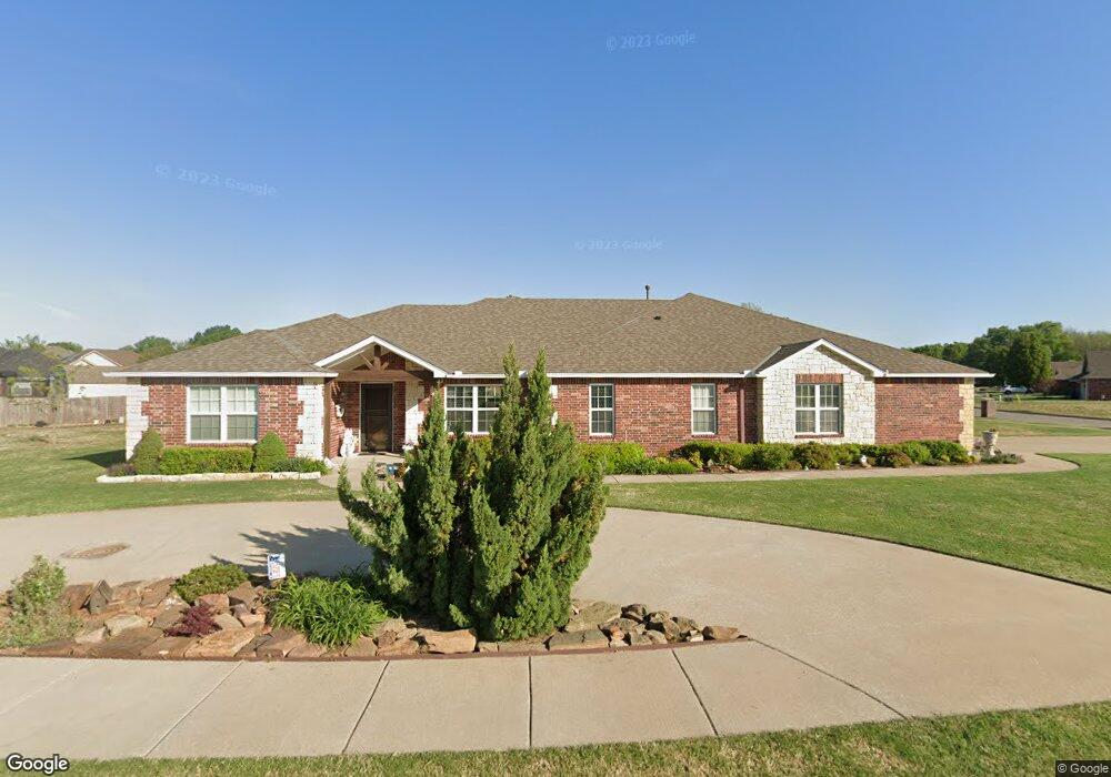
1941 Lester Ave Bartlesville, OK 74006
Estimated Value: $327,000 - $343,000
3
Beds
2
Baths
2,496
Sq Ft
$134/Sq Ft
Est. Value
About This Home
This home is located at 1941 Lester Ave, Bartlesville, OK 74006 and is currently estimated at $334,104, approximately $133 per square foot. 1941 Lester Ave is a home with nearby schools including Wayside Elementary School, Central Middle School, and Bartlesville High School.
Ownership History
Date
Name
Owned For
Owner Type
Purchase Details
Closed on
Nov 8, 2011
Sold by
Hicks Donald Gene and Hicks Karen Jo
Bought by
Hicks Donald Gene and Hicks Karen Jo
Current Estimated Value
Home Financials for this Owner
Home Financials are based on the most recent Mortgage that was taken out on this home.
Original Mortgage
$185,000
Outstanding Balance
$125,567
Interest Rate
4%
Mortgage Type
Adjustable Rate Mortgage/ARM
Estimated Equity
$208,537
Purchase Details
Closed on
Sep 22, 2011
Sold by
Grand Bank
Bought by
Hicks Donald Gene and Hicks Karen Jo
Home Financials for this Owner
Home Financials are based on the most recent Mortgage that was taken out on this home.
Original Mortgage
$185,000
Outstanding Balance
$125,567
Interest Rate
4%
Mortgage Type
Adjustable Rate Mortgage/ARM
Estimated Equity
$208,537
Create a Home Valuation Report for This Property
The Home Valuation Report is an in-depth analysis detailing your home's value as well as a comparison with similar homes in the area
Home Values in the Area
Average Home Value in this Area
Purchase History
| Date | Buyer | Sale Price | Title Company |
|---|---|---|---|
| Hicks Donald Gene | -- | -- | |
| Hicks Donald Gene | $30,000 | -- |
Source: Public Records
Mortgage History
| Date | Status | Borrower | Loan Amount |
|---|---|---|---|
| Open | Hicks Donald Gene | $185,000 |
Source: Public Records
Tax History Compared to Growth
Tax History
| Year | Tax Paid | Tax Assessment Tax Assessment Total Assessment is a certain percentage of the fair market value that is determined by local assessors to be the total taxable value of land and additions on the property. | Land | Improvement |
|---|---|---|---|---|
| 2025 | $3,061 | $27,285 | $3,559 | $23,726 |
| 2024 | $3,061 | $26,491 | $3,456 | $23,035 |
| 2023 | $3,061 | $25,718 | $3,445 | $22,273 |
| 2022 | $2,871 | $24,969 | $3,445 | $21,524 |
| 2021 | $2,815 | $24,969 | $3,445 | $21,524 |
| 2020 | $2,878 | $24,969 | $3,445 | $21,524 |
| 2019 | $2,879 | $24,969 | $3,445 | $21,524 |
| 2018 | $2,865 | $24,969 | $3,445 | $21,524 |
| 2017 | $2,875 | $24,500 | $3,445 | $21,055 |
| 2016 | $2,698 | $24,500 | $3,445 | $21,055 |
| 2015 | $2,730 | $24,500 | $3,445 | $21,055 |
| 2014 | $2,764 | $24,500 | $3,445 | $21,055 |
Source: Public Records
Map
Nearby Homes
- 2104 SE Lester
- 5205 Charleston Dr
- 2112 SE Lester
- 5301 Barnett Ave
- 1912 Lester Ave
- 5300 Charleston Dr
- 1 Barnett Ave
- 2 Barnett Ave
- 4821 SE Barlow Dr
- 1935 Putnam Dr
- 4908 SE Barlow Dr
- 1801 Rolling Hills Place
- 5239 Nowata Rd Unit H102
- 5269 Nowata Rd Unit O102
- 5229 Nowata Rd Unit F101
- 0 Stonehenge Dr
- 4607 Rolling Hills Dr
- 5217 Nowata Rd Unit 203C
- 5217 Nowata Rd Unit C204
- 4222 Fairview Rd
- 1937 Lester Ave
- 2004 Stanford Dr
- 2000 Stanford Dr
- 1933 Lester Ave
- 4948 Fairview Rd
- 4943 Barnett Ave
- 2108 Lester Ave
- 2108 Lester Ave
- 1929 Lester Ave
- 4944 Fairview Rd
- 1924 Lester Ave
- 2005 Stanford Dr
- 2001 Stanford Dr
- 2009 Stanford Dr
- 4939 Barnett Ave
- 1925 Lester Ave
- 5205 Barnett Ave
- 4940 Fairview Rd
- 1920 Lester Ave
- 1925 Barnett Place