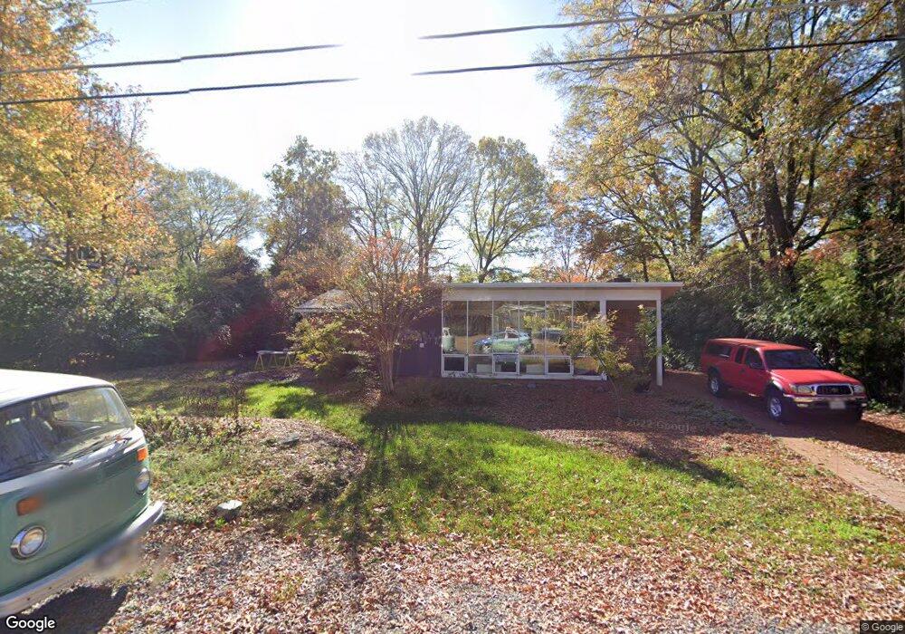
1941 Marthas Rd Alexandria, VA 22307
Estimated Value: $834,559 - $1,088,000
2
Beds
1
Bath
1,302
Sq Ft
$760/Sq Ft
Est. Value
About This Home
This home is located at 1941 Marthas Rd, Alexandria, VA 22307 and is currently estimated at $989,140, approximately $759 per square foot. 1941 Marthas Rd is a home located in Fairfax County with nearby schools including Hollin Meadows Elementary School, Sandburg Middle, and West Potomac High School.
Ownership History
Date
Name
Owned For
Owner Type
Purchase Details
Closed on
Mar 15, 1999
Sold by
Bohling Carolyn A
Bought by
Jenkins Jeffrey B
Current Estimated Value
Home Financials for this Owner
Home Financials are based on the most recent Mortgage that was taken out on this home.
Original Mortgage
$184,000
Outstanding Balance
$44,456
Interest Rate
6.73%
Estimated Equity
$944,684
Create a Home Valuation Report for This Property
The Home Valuation Report is an in-depth analysis detailing your home's value as well as a comparison with similar homes in the area
Home Values in the Area
Average Home Value in this Area
Purchase History
| Date | Buyer | Sale Price | Title Company |
|---|---|---|---|
| Jenkins Jeffrey B | $230,000 | -- |
Source: Public Records
Mortgage History
| Date | Status | Borrower | Loan Amount |
|---|---|---|---|
| Open | Jenkins Jeffrey B | $184,000 |
Source: Public Records
Tax History Compared to Growth
Tax History
| Year | Tax Paid | Tax Assessment Tax Assessment Total Assessment is a certain percentage of the fair market value that is determined by local assessors to be the total taxable value of land and additions on the property. | Land | Improvement |
|---|---|---|---|---|
| 2025 | $9,935 | $882,560 | $466,000 | $416,560 |
| 2024 | $9,935 | $809,700 | $424,000 | $385,700 |
| 2023 | $9,542 | $802,140 | $424,000 | $378,140 |
| 2022 | $9,376 | $778,400 | $404,000 | $374,400 |
| 2021 | $8,397 | $681,490 | $338,000 | $343,490 |
| 2020 | $7,838 | $631,050 | $313,000 | $318,050 |
| 2019 | $7,747 | $615,810 | $304,000 | $311,810 |
| 2018 | $7,082 | $615,810 | $304,000 | $311,810 |
| 2017 | $7,246 | $587,810 | $276,000 | $311,810 |
| 2016 | $7,234 | $587,810 | $276,000 | $311,810 |
| 2015 | $6,800 | $570,730 | $268,000 | $302,730 |
| 2014 | $6,272 | $532,310 | $244,000 | $288,310 |
Source: Public Records
Map
Nearby Homes
- 1911 Marthas Rd
- 7404 Rippon Rd
- 1804 Mason Hill Dr
- 7533 Hollindale Ct
- 1616 Sherwood Hall Ln
- 7105 Fort Hunt Rd
- 7214 Rebecca Dr
- 7409 Range Rd
- 2111 Rollins Dr
- 7128 Devonshire Rd
- 2441 Windbreak Dr
- 1502 Middlebury Dr
- 2604 Windbreak Dr
- 2501 Toron Ct
- 141 Shannon Ct
- 6918 Randolph Macon Dr
- 7508 Milway Dr
- 6905 Radcliffe Dr
- 1211 Wake Forest Dr
- 2605 Popkins Ln
- 1939 Marthas Rd
- 1943 Marthas Rd
- 1714 Hollinwood Dr
- 1942 Marthas Rd
- 1940 Marthas Rd
- 1718 Hollinwood Dr
- 1712 Hollinwood Dr
- 1944 Marthas Rd
- 1938 Marthas Rd
- 1947 Marthas Rd
- 1702 Hollinwood Dr
- 1706 Hollinwood Dr
- 1946 Marthas Rd
- 1935 Marthas Rd
- 1720 Hollinwood Dr
- 1936 Marthas Rd
- 1920 Marthas Rd
- 1922 Marthas Rd
- 1916 Marthas Rd
- 1948 Marthas Rd