Estimated Value: $49,823 - $168,000
Studio
--
Bath
1,456
Sq Ft
$79/Sq Ft
Est. Value
About This Home
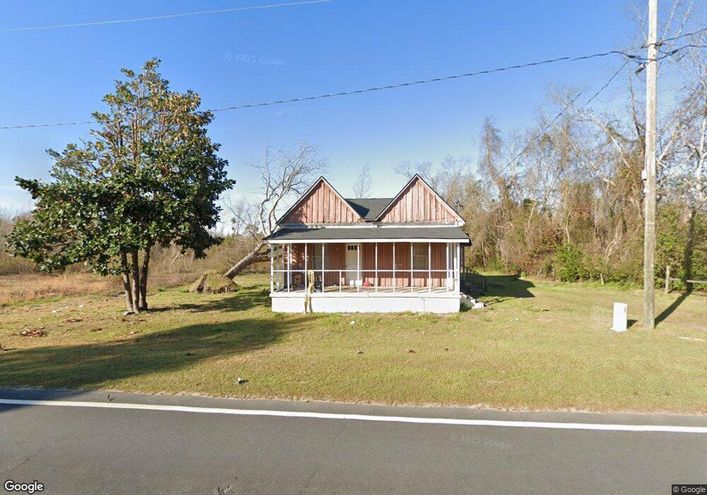
This home is located at 1941 Montgomery St, Kite, GA 31049 and is currently estimated at $114,456, approximately $78 per square foot. 1941 Montgomery St is a home with nearby schools including Johnson County Elementary School, Johnson County Middle School, and Johnson County High School.
Ownership History
Date
Name
Owned For
Owner Type
Purchase Details
Closed on
Dec 30, 2020
Sold by
Hooks Alton G
Bought by
Mt Royal Homes Llc
Current Estimated Value
Purchase Details
Closed on
Mar 4, 2016
Sold by
Thomas Robert
Bought by
Hooks Alton G and Hooks Justin Kyle
Home Financials for this Owner
Home Financials are based on the most recent Mortgage that was taken out on this home.
Original Mortgage
$18,145
Interest Rate
3.72%
Mortgage Type
New Conventional
Purchase Details
Closed on
Oct 16, 2003
Sold by
Citifinancial Services Inc
Bought by
Thomas Robert
Purchase Details
Closed on
Feb 4, 2003
Sold by
Myers Clarence T and Myers Sandra J
Bought by
Citifinancial Services Inc
Purchase Details
Closed on
Jul 6, 1999
Sold by
Buffin Vernon W
Bought by
Myers Clarence T and Myers Sandra J
Purchase Details
Closed on
Jul 18, 1995
Sold by
Batts Doris
Bought by
Buffin Vernon W
Create a Home Valuation Report for This Property
The Home Valuation Report is an in-depth analysis detailing your home's value as well as a comparison with similar homes in the area
Purchase History
| Date | Buyer | Sale Price | Title Company |
|---|---|---|---|
| Mt Royal Homes Llc | $15,000 | -- | |
| Hooks Alton G | $19,000 | -- | |
| Thomas Robert | $10,000 | -- | |
| Citifinancial Services Inc | $13,500 | -- | |
| Myers Clarence T | -- | -- | |
| Buffin Vernon W | $26,500 | -- |
Source: Public Records
Mortgage History
| Date | Status | Borrower | Loan Amount |
|---|---|---|---|
| Previous Owner | Hooks Alton G | $18,145 |
Source: Public Records
Tax History
| Year | Tax Paid | Tax Assessment Tax Assessment Total Assessment is a certain percentage of the fair market value that is determined by local assessors to be the total taxable value of land and additions on the property. | Land | Improvement |
|---|---|---|---|---|
| 2025 | $500 | $17,247 | $1,000 | $16,247 |
| 2024 | $488 | $12,515 | $1,000 | $11,515 |
| 2023 | $396 | $12,515 | $1,000 | $11,515 |
| 2022 | $396 | $13,591 | $1,000 | $12,591 |
| 2021 | $392 | $10,580 | $1,000 | $9,580 |
| 2020 | $320 | $10,580 | $1,000 | $9,580 |
| 2019 | $313 | $10,005 | $1,000 | $9,005 |
| 2018 | $371 | $10,005 | $1,000 | $9,005 |
| 2017 | $229 | $10,005 | $1,000 | $9,005 |
| 2016 | $371 | $10,005 | $1,000 | $9,005 |
| 2015 | -- | $11,266 | $1,000 | $10,266 |
| 2014 | -- | $11,266 | $1,000 | $10,266 |
| 2013 | -- | $11,266 | $1,000 | $10,266 |
Source: Public Records
Map
Nearby Homes
- 55 Hatcher St
- 2195 Montgomery St
- 151 Brantley Midas Rd
- 1952 Jump N Run Rd
- 0 Sardis Church Rd Unit 10688482
- 600 Alton Lawson Rd
- 181 Faith Tabernacle Rd
- 0 Pinetucky Rd Unit 10692445
- 240 Emery Price Rd
- 380 Jonah Hall Rd
- 0 Old Dellwood Rd Unit 10726058
- 0 Dukes Rd Unit 56614
- 0 Dukes Rd Unit 10727271
- 114 Ohoopee Rd
- 0 Liberty Grove Church Rd Unit 10640718
- 241 Foskey Cemetery Rd
- 0 Old Wadley Rd Unit TRACT 9
- 0 Old Wadley Rd Unit TRACT 7
- 0 Cypress Creek Rd Unit 10711872
- 0 Cypress Creek Rd Unit 26600988
- 528 Us Highway 221 St S
- 221 Montgomery St
- 1938 Montgomery St
- 511 Us Highway 221 S
- 511 Montgomery St
- 68 Ohoopee St
- 1963 Montgomery St
- 47 Jackson St
- 53 Jackson St
- 1901 Montgomery St
- 1893 Montgomery St
- 7 Ohoopee St
- 1893 Us Highway 221 S
- 1999 Montgomery St
- 92 College St
- 517 College St
- 312 Railroad St
- 18 College St
- 106 Church St
- 39 Cemetary St
Your Personal Tour Guide
Ask me questions while you tour the home.