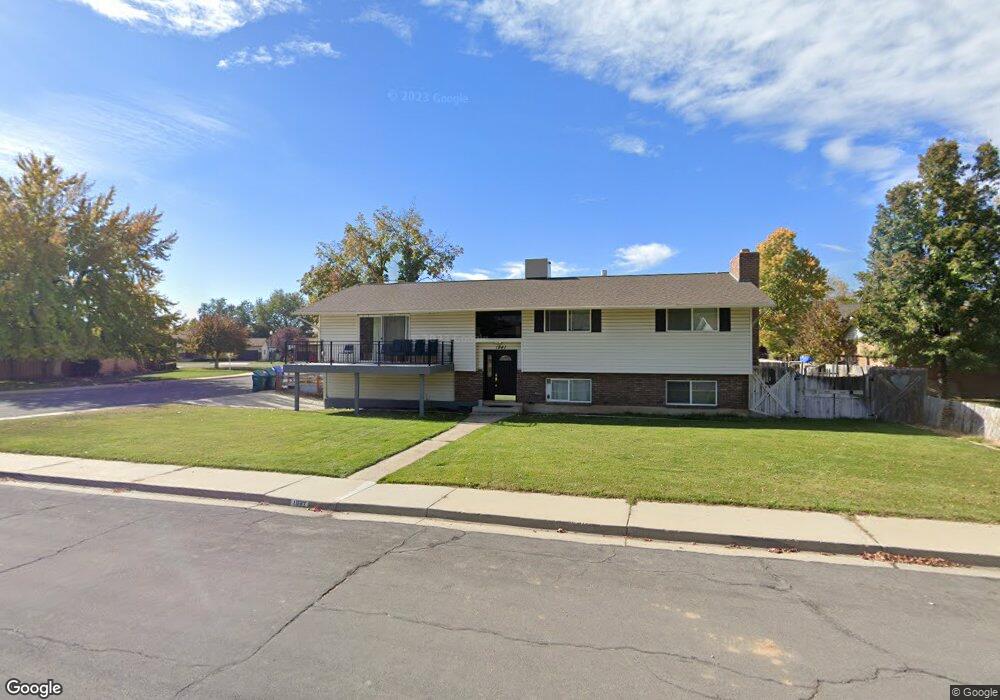
1941 N 520 W Orem, UT 84057
Northridge NeighborhoodEstimated Value: $541,572 - $570,000
5
Beds
3
Baths
2,398
Sq Ft
$231/Sq Ft
Est. Value
About This Home
This home is located at 1941 N 520 W, Orem, UT 84057 and is currently estimated at $554,893, approximately $231 per square foot. 1941 N 520 W is a home located in Utah County with nearby schools including Northridge Elementary School, Oak Canyon Junior High School, and Timpanogos High School.
Ownership History
Date
Name
Owned For
Owner Type
Purchase Details
Closed on
Jan 10, 2023
Sold by
Harris Jordan and Harris Rachel
Bought by
1941 Orem Trust
Current Estimated Value
Purchase Details
Closed on
Feb 28, 2022
Sold by
Robert Lowry
Bought by
Harris Jordan and Harris Rachel
Home Financials for this Owner
Home Financials are based on the most recent Mortgage that was taken out on this home.
Original Mortgage
$405,000
Interest Rate
3.92%
Mortgage Type
New Conventional
Purchase Details
Closed on
Oct 14, 2016
Sold by
A Team Investment Group Llc
Bought by
Rockworks Land Llc
Purchase Details
Closed on
Apr 17, 2014
Sold by
Silver Liege Development Llc
Bought by
Lowry Robert and Lowry Debra
Home Financials for this Owner
Home Financials are based on the most recent Mortgage that was taken out on this home.
Original Mortgage
$209,877
Interest Rate
3.87%
Mortgage Type
FHA
Purchase Details
Closed on
Nov 25, 2013
Sold by
Steed Blaine Ronald and Steed Elizabeth
Bought by
Silver Liege Developments Llc
Purchase Details
Closed on
Jan 17, 2002
Sold by
Steed Maurine Robins
Bought by
Steed Blaine Ronald
Purchase Details
Closed on
Jul 16, 1999
Sold by
Allen Katherine Kaye
Bought by
Allen Gary Steven
Purchase Details
Closed on
Jul 12, 1999
Sold by
Icardi Charlotte Ann and Icardi Michael Slade
Bought by
Allen Gary Steven
Create a Home Valuation Report for This Property
The Home Valuation Report is an in-depth analysis detailing your home's value as well as a comparison with similar homes in the area
Home Values in the Area
Average Home Value in this Area
Purchase History
| Date | Buyer | Sale Price | Title Company |
|---|---|---|---|
| 1941 Orem Trust | -- | -- | |
| Harris Jordan | -- | Inwest Title | |
| Rockworks Land Llc | -- | Title West | |
| Lowry Robert | -- | Backman Title Services Ltd | |
| Silver Liege Developments Llc | -- | Accommodation | |
| Steed Blaine Ronald | -- | -- | |
| Allen Gary Steven | -- | Security Title & Abstract | |
| Allen Gary Steven | -- | Security Title & Abstract |
Source: Public Records
Mortgage History
| Date | Status | Borrower | Loan Amount |
|---|---|---|---|
| Previous Owner | Harris Jordan | $405,000 | |
| Previous Owner | Lowry Robert | $209,877 |
Source: Public Records
Tax History Compared to Growth
Tax History
| Year | Tax Paid | Tax Assessment Tax Assessment Total Assessment is a certain percentage of the fair market value that is determined by local assessors to be the total taxable value of land and additions on the property. | Land | Improvement |
|---|---|---|---|---|
| 2025 | $2,135 | $273,570 | $251,200 | $246,200 |
| 2024 | $2,135 | $261,085 | $0 | $0 |
| 2023 | $1,998 | $262,625 | $0 | $0 |
| 2022 | $2,032 | $258,775 | $0 | $0 |
| 2021 | $1,775 | $342,400 | $150,000 | $192,400 |
| 2020 | $1,628 | $308,600 | $120,000 | $188,600 |
| 2019 | $1,441 | $284,000 | $120,000 | $164,000 |
| 2018 | $1,412 | $265,900 | $113,100 | $152,800 |
| 2017 | $1,157 | $116,710 | $0 | $0 |
| 2016 | $1,255 | $116,710 | $0 | $0 |
| 2015 | -- | $115,610 | $0 | $0 |
| 2014 | $1,307 | $114,455 | $0 | $0 |
Source: Public Records
Map
Nearby Homes
- 856 W 1840 N
- 129 S 630 E
- 1991 N 920 W
- 1961 N 85 W
- 613 W 1550 N
- 170 N 400 E
- 276 E 200 N
- 1527 N 275 St W Unit 4
- 1543 N 275 St W Unit 2
- 1531 N 275 St W Unit 3
- 1570 N 275 St W
- 1557 N 275 St W Unit 1
- 1542 N 275 St W Unit 5
- 1556 N 275 St W Unit 5
- 1545 N State St Unit 11
- 1561 N 740 W
- 1482 N 550 St W Unit 18
- 130 E 800 N
- 170 E 800 N Unit 3
- 150 E 800 N