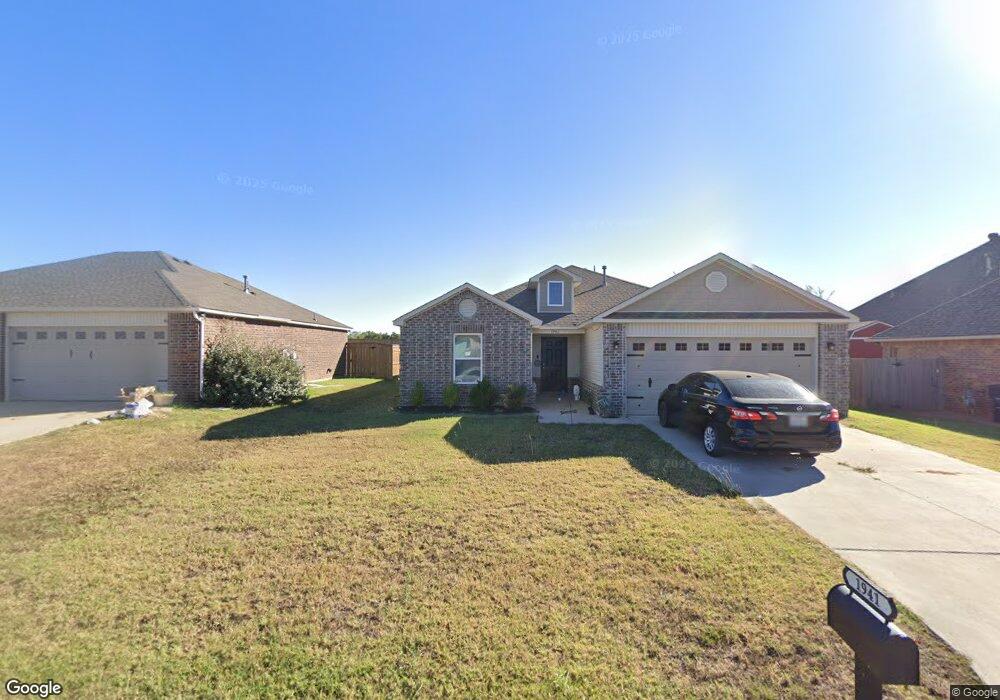
1941 Timber Dale Dr Shawnee, OK 74804
Estimated Value: $177,000 - $234,000
3
Beds
2
Baths
1,622
Sq Ft
$133/Sq Ft
Est. Value
About This Home
This home is located at 1941 Timber Dale Dr, Shawnee, OK 74804 and is currently estimated at $216,489, approximately $133 per square foot. 1941 Timber Dale Dr is a home with nearby schools including Will Rogers Elementary School, Shawnee Middle School, and Shawnee High School.
Ownership History
Date
Name
Owned For
Owner Type
Purchase Details
Closed on
Dec 24, 2020
Sold by
Rausch Coleman Homes Okc Llc
Bought by
Blythe Austin Kade
Current Estimated Value
Home Financials for this Owner
Home Financials are based on the most recent Mortgage that was taken out on this home.
Original Mortgage
$162,011
Interest Rate
2.9%
Mortgage Type
FHA
Purchase Details
Closed on
Mar 21, 1996
Sold by
Krapff-Reynolds Const Inc
Bought by
Belterre Devleopment Co
Purchase Details
Closed on
Feb 14, 1995
Sold by
Sheriff
Bought by
Krapff-Reynolds Constr In
Create a Home Valuation Report for This Property
The Home Valuation Report is an in-depth analysis detailing your home's value as well as a comparison with similar homes in the area
Home Values in the Area
Average Home Value in this Area
Purchase History
| Date | Buyer | Sale Price | Title Company |
|---|---|---|---|
| Blythe Austin Kade | $165,000 | Multiple | |
| Belterre Devleopment Co | $340,000 | -- | |
| Krapff-Reynolds Constr In | -- | -- |
Source: Public Records
Mortgage History
| Date | Status | Borrower | Loan Amount |
|---|---|---|---|
| Previous Owner | Blythe Austin Kade | $162,011 |
Source: Public Records
Tax History Compared to Growth
Tax History
| Year | Tax Paid | Tax Assessment Tax Assessment Total Assessment is a certain percentage of the fair market value that is determined by local assessors to be the total taxable value of land and additions on the property. | Land | Improvement |
|---|---|---|---|---|
| 2025 | $2,221 | $22,634 | $126 | $22,508 |
| 2024 | $2,252 | $21,556 | $120 | $21,436 |
| 2023 | $2,252 | $21,556 | $120 | $21,436 |
| 2022 | $2,212 | $21,556 | $120 | $21,436 |
| 2021 | $12 | $120 | $120 | $0 |
| 2020 | $12 | $120 | $120 | $0 |
| 2019 | $13 | $120 | $120 | $0 |
| 2018 | $12 | $120 | $120 | $0 |
| 2017 | $12 | $120 | $120 | $0 |
| 2016 | $12 | $120 | $120 | $0 |
| 2015 | $12 | $120 | $120 | $0 |
| 2014 | $12 | $120 | $120 | $0 |
Source: Public Records
Map
Nearby Homes
- 1900 Timber Dale Dr
- 1828 W Federal St
- 1902 Oak Tree Ct
- 2227 Whispering Pine Blvd
- 1914 Oak Tree Ct
- 1933 Rain Tree Dr
- 2418 Ellis Dr
- 1821 W Wiley St
- 37614 W Macarthur St
- 801 W Franklin St
- 1522 W Wheeler St
- 2106 N Aydelotte Ave
- 000 W Locust St
- 29 Timber Creek Way
- 1012 N Chapman Ave
- 1925 N Park Ave
- 216 W Georgia St
- 202 W Franklin St
- 7 N Tawana Dr
- 1000 W 45th St
- 1921 Timber Dale Dr
- 1945 Timber Dale Dr
- 2102 Whispering Pine Blvd
- 1917 Timber Dale Dr
- 2105 Crooked Oak Dr
- 2105 Crooked Oak Dr
- 1929 Timber Dale Dr
- 2109 Crooked Oak Dr
- 1925 Timber Dale Dr
- 1950 Timber Dale Dr
- 1913 Timber Dale Dr
- 1924 Timber Dale Dr
- 1957 Timber Dale Dr
- 1927 Twisted Oak Ct
- 2114 Whispering Pine Blvd
- 2117 Crooked Oak Dr
- 1923 Twisted Oak Ct
- 1955 Cedar Ct
- 1951 Cedar Ct
- 1959 Cedar Ct