Estimated Value: $352,089 - $497,000
4
Beds
2
Baths
2,560
Sq Ft
$164/Sq Ft
Est. Value
About This Home
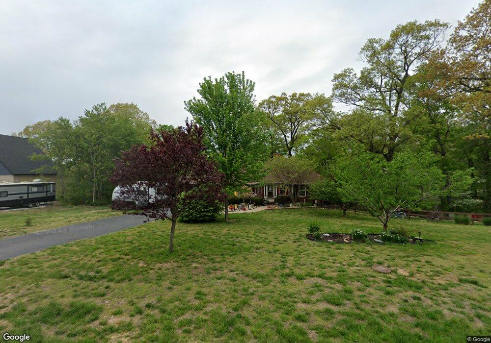
This home is located at 1941 W Ranch Rd, Nixa, MO 65714 and is currently estimated at $420,022, approximately $164 per square foot. 1941 W Ranch Rd is a home located in Stone County with nearby schools including Mathews Elementary School, Queens Gateway to Health Sciences Secondary School, and Nicholas A. Inman Intermediate School.
Ownership History
Date
Name
Owned For
Owner Type
Purchase Details
Closed on
Nov 1, 2010
Sold by
Barbour Shawn R and Barbour Tina L
Bought by
Belsky Martha and Noble Cindy
Current Estimated Value
Purchase Details
Closed on
Oct 24, 2007
Sold by
Daues Joseph M and Daues Christine A
Bought by
Barbour Shawn R and Barbour Tina L
Home Financials for this Owner
Home Financials are based on the most recent Mortgage that was taken out on this home.
Original Mortgage
$184,300
Interest Rate
6.32%
Mortgage Type
New Conventional
Purchase Details
Closed on
Feb 28, 2005
Sold by
Vanderbrink Jason R and Vanderbrink Heidi A
Bought by
Daues Joseph M and Daues Christine A
Home Financials for this Owner
Home Financials are based on the most recent Mortgage that was taken out on this home.
Original Mortgage
$26,475
Interest Rate
5.2%
Mortgage Type
Stand Alone Second
Create a Home Valuation Report for This Property
The Home Valuation Report is an in-depth analysis detailing your home's value as well as a comparison with similar homes in the area
Home Values in the Area
Average Home Value in this Area
Purchase History
| Date | Buyer | Sale Price | Title Company |
|---|---|---|---|
| Belsky Martha | -- | -- | |
| Barbour Shawn R | -- | None Available | |
| Daues Joseph M | -- | -- |
Source: Public Records
Mortgage History
| Date | Status | Borrower | Loan Amount |
|---|---|---|---|
| Previous Owner | Barbour Shawn R | $184,300 | |
| Previous Owner | Daues Joseph M | $26,475 | |
| Previous Owner | Daues Joseph M | $141,200 |
Source: Public Records
Tax History Compared to Growth
Tax History
| Year | Tax Paid | Tax Assessment Tax Assessment Total Assessment is a certain percentage of the fair market value that is determined by local assessors to be the total taxable value of land and additions on the property. | Land | Improvement |
|---|---|---|---|---|
| 2025 | $1,733 | $29,600 | -- | -- |
| 2024 | $1,731 | $29,600 | -- | -- |
| 2023 | $1,731 | $29,600 | $0 | $0 |
| 2022 | $1,725 | $29,600 | $0 | $0 |
| 2021 | $1,739 | $29,600 | $0 | $0 |
| 2020 | $1,803 | $29,600 | $0 | $0 |
| 2019 | $1,801 | $29,600 | $0 | $0 |
| 2018 | $1,681 | $29,600 | $0 | $0 |
| 2017 | $1,667 | $29,600 | $0 | $0 |
| 2016 | $1,637 | $29,600 | $0 | $0 |
| 2015 | $1,642 | $29,600 | $0 | $0 |
| 2014 | $1,634 | $29,790 | $0 | $0 |
| 2012 | -- | $29,790 | $0 | $0 |
Source: Public Records
Map
Nearby Homes
- 1945 W Ranch Rd
- 2341 Melton Dr
- 1736 W Riverfork Dr
- 1781 W Riverdale Dr
- 1734 Yoachum Dr
- 202 N Cheyenne Valley Rd
- 506 N Cheyenne Valley Rd
- 504 N Cheyenne Valley Rd
- 206 N Cheyenne Valley Rd
- 404 N Cheyenne Valley Rd
- 411 Lake Branch Rd
- 176 Shooting Star Ln
- 000 M-100
- 469 Valley Creek Rd
- 32 Freida Ln
- 269 Old Tory Ln
- 614 State Highway U
- 996 Seveno Ridge Rd
- 411 M-120
- 000 Hidden Valley Rd
- 0 W Ranch Rd Unit 10808317
- 0 W Ranch Rd Unit 10908249
- 0 W Ranch Rd Unit 11002282
- 0 W Ranch Rd Unit 11102731
- 0 W Ranch Rd
- Lot 22 W Ranch Rd
- 000 W Ranch Rd
- 1944 W Ranch Rd
- 1939 W Ranch Rd
- 1942 W Ranch Rd
- 1947 W Ranch Rd
- 1923 W Ranch Rd
- 1948 W Ranch Rd
- 1934 W Ranch Rd
- 1951 W Ranch Rd
- 1915 W Ranch Rd
- 1950 W Ranch Rd
- 1930 W Ranch Rd
- 1922 W Ranch Rd
- 1953 W Ranch Rd