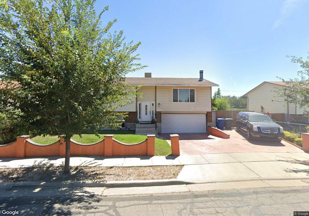
1941 Zachary Dr Salt Lake City, UT 84116
Westpointe NeighborhoodEstimated Value: $374,000 - $454,000
2
Beds
1
Bath
988
Sq Ft
$417/Sq Ft
Est. Value
About This Home
This home is located at 1941 Zachary Dr, Salt Lake City, UT 84116 and is currently estimated at $411,544, approximately $416 per square foot. 1941 Zachary Dr is a home located in Salt Lake County with nearby schools including Escalante Elementary School, Northwest Middle School, and West High.
Ownership History
Date
Name
Owned For
Owner Type
Purchase Details
Closed on
Aug 5, 2004
Sold by
Granados Susana
Bought by
Tellez Alma Susana
Current Estimated Value
Purchase Details
Closed on
May 4, 2001
Sold by
Granados Gabriel
Bought by
Granados Susana
Create a Home Valuation Report for This Property
The Home Valuation Report is an in-depth analysis detailing your home's value as well as a comparison with similar homes in the area
Home Values in the Area
Average Home Value in this Area
Purchase History
| Date | Buyer | Sale Price | Title Company |
|---|---|---|---|
| Tellez Alma Susana | -- | -- | |
| Granados Susana | -- | Guardian Title |
Source: Public Records
Tax History Compared to Growth
Tax History
| Year | Tax Paid | Tax Assessment Tax Assessment Total Assessment is a certain percentage of the fair market value that is determined by local assessors to be the total taxable value of land and additions on the property. | Land | Improvement |
|---|---|---|---|---|
| 2025 | -- | $368,600 | $121,300 | $247,300 |
| 2024 | -- | $322,700 | $114,800 | $207,900 |
| 2023 | $1,690 | $310,800 | $110,400 | $200,400 |
| 2022 | $1,828 | $315,500 | $108,200 | $207,300 |
| 2021 | $1,623 | $253,600 | $86,800 | $166,800 |
| 2020 | $1,550 | $230,500 | $77,500 | $153,000 |
| 2019 | $1,416 | $198,100 | $53,100 | $145,000 |
| 2018 | $1,285 | $175,100 | $53,100 | $122,000 |
| 2017 | $1,362 | $173,900 | $53,100 | $120,800 |
| 2016 | $1,297 | $157,200 | $44,700 | $112,500 |
| 2015 | $1,204 | $138,300 | $43,800 | $94,500 |
| 2014 | $1,180 | $134,500 | $50,900 | $83,600 |
Source: Public Records
Map
Nearby Homes
- 825 Star Crest Dr W
- 1978 Sir Robert Dr
- 555 N Starcrest Dr Unit B28
- 1860 W 500 N Unit 20
- 1860 W 500 N Unit 13
- 1860 W 500 N Unit 15
- 1860 W 500 N Unit 7
- 949 Libby Way
- 1827 Omni Ave
- 768 N Redwood Rd Unit 1
- 768 N Redwood Rd Unit 19
- 1004 N Sir Michael Dr
- 1989 Sir Timothy Ave
- 475 N Redwood Rd #58 Rd
- 548 N Redwood Rd
- 475 N Redwood Rd Unit 49
- 475 N Redwood Rd Unit 30
- 475 N Redwood Rd Unit 31
- 558 N Redwood Rd Unit 3
- 558 N Redwood Rd Unit 1
- 1947 Zachary Dr
- 1953 Zachary Dr
- 1935 Zachary Dr
- 617 Sir Patrick Dr W
- 1953 W Zachary Dr
- 1942 W Zachary Dr
- 1942 Zachary Dr
- 745 Sir Patrick Dr
- 745 N Sir Patrick Dr
- 1923 Zachary Dr
- 1950 Zachary Dr
- 1950 W Zachary Dr
- 1963 Zachary Dr
- 1915 Zachary Dr
- 1943 Wildflower Dr
- 1943 W Wildflower Dr
- 1960 Zachary Dr
- 1960 W Zachary Dr
- 1940 Sir James Dr
- 1948 Sir James Dr