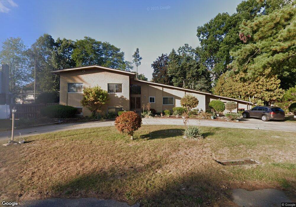
19412 Starlane St Southfield, MI 48075
Estimated Value: $305,924 - $459,000
--
Bed
4
Baths
3,286
Sq Ft
$116/Sq Ft
Est. Value
About This Home
This home is located at 19412 Starlane St, Southfield, MI 48075 and is currently estimated at $381,981, approximately $116 per square foot. 19412 Starlane St is a home located in Oakland County with nearby schools including Dr. Joseph F. Pollack Academic Center Of Excellence, Agbu Alex-Marie Manoogian School, and Corpus Christi.
Ownership History
Date
Name
Owned For
Owner Type
Purchase Details
Closed on
Aug 26, 2003
Sold by
Corley Delores A
Bought by
Corley Delores A and Delores Ann Corley Trust #1
Current Estimated Value
Purchase Details
Closed on
Dec 16, 2002
Sold by
Corley Delores A
Bought by
Delores Ann Corley Tr
Purchase Details
Closed on
Mar 31, 1998
Sold by
Corley James Willie
Bought by
Corley Delores Ann
Home Financials for this Owner
Home Financials are based on the most recent Mortgage that was taken out on this home.
Original Mortgage
$92,350
Interest Rate
7.19%
Mortgage Type
Purchase Money Mortgage
Create a Home Valuation Report for This Property
The Home Valuation Report is an in-depth analysis detailing your home's value as well as a comparison with similar homes in the area
Home Values in the Area
Average Home Value in this Area
Purchase History
| Date | Buyer | Sale Price | Title Company |
|---|---|---|---|
| Corley Delores A | -- | Titlequest Insurance Agency | |
| Corley Delores A | -- | Guarantee Title & Trust Co | |
| Delores Ann Corley Tr | -- | -- | |
| Corley Delores Ann | -- | -- |
Source: Public Records
Mortgage History
| Date | Status | Borrower | Loan Amount |
|---|---|---|---|
| Previous Owner | Corley Delores Ann | $92,350 |
Source: Public Records
Tax History Compared to Growth
Tax History
| Year | Tax Paid | Tax Assessment Tax Assessment Total Assessment is a certain percentage of the fair market value that is determined by local assessors to be the total taxable value of land and additions on the property. | Land | Improvement |
|---|---|---|---|---|
| 2022 | $4,025 | $134,080 | $13,360 | $120,720 |
| 2021 | $4,161 | $130,200 | $13,310 | $116,890 |
| 2020 | $3,620 | $134,570 | $13,310 | $121,260 |
| 2018 | $4,286 | $84,260 | $13,310 | $70,950 |
| 2015 | -- | $64,040 | $0 | $0 |
| 2014 | -- | $60,880 | $0 | $0 |
| 2011 | -- | $66,530 | $0 | $0 |
Source: Public Records
Map
Nearby Homes
- 19633 Mahon St
- 0000 W Nine Mile
- 19780 Mahon St
- 19880 Hazelhurst St
- 19910 Albany Ave
- 19368 Midway Rd
- 19100 Dorset St
- 18656 Midway Ave
- 21450 Evergreen Rd
- 20286 Woodburn Dr
- 19025 Melrose Ave
- 24139 Philip Dr
- 20450 Midway Ave
- 20980 Evergreen Rd
- 20210 Westhampton Ave
- 18252 Westland Ave
- 17581 Roxbury Ave
- 24153 Evergreen Rd Unit 30
- 24393 Evergreen Rd
- 21145 Frazer Ave
- 19419 Silvercrest St
- 19434 Starlane St
- 19401 Silvercrest St
- 19338 Starlane St
- 19439 Silvercrest St
- 19411 Starlane St
- 19433 Starlane St
- 19339 Starlane St
- 19333 Silvercrest St
- 19314 Starlane St
- 19323 Starlane St
- 19515 Saxton Ave
- 19221 Albany Ave
- 19402 Silvercrest St
- 19420 Silvercrest St
- 19330 Birchridge St
- 19428 Birchridge St
- 19520 Albany Ave
- 19311 Silvercrest St
- 19334 Silvercrest St Unit 31