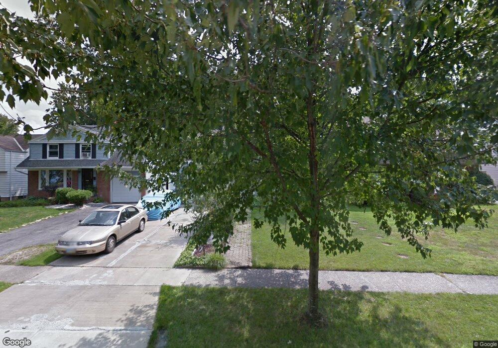
19414 Shakerwood Rd Warrensville Heights, OH 44122
Estimated Value: $119,996 - $145,000
3
Beds
1
Bath
1,529
Sq Ft
$89/Sq Ft
Est. Value
About This Home
This home is located at 19414 Shakerwood Rd, Warrensville Heights, OH 44122 and is currently estimated at $136,749, approximately $89 per square foot. 19414 Shakerwood Rd is a home located in Cuyahoga County with nearby schools including John Dewey Elementary School, Warrensville Heights Middle School, and Warrensville Heights High School.
Ownership History
Date
Name
Owned For
Owner Type
Purchase Details
Closed on
Jul 17, 1998
Sold by
Joseph Mitchell
Bought by
Mitchell Dale W
Current Estimated Value
Home Financials for this Owner
Home Financials are based on the most recent Mortgage that was taken out on this home.
Original Mortgage
$33,100
Interest Rate
7.13%
Purchase Details
Closed on
Jul 28, 1993
Sold by
Linton Thomas L
Bought by
Mitchell Dale W
Purchase Details
Closed on
Sep 30, 1988
Sold by
Dallas Timothy J
Bought by
Linton Thomas L
Purchase Details
Closed on
Sep 1, 1978
Sold by
Owens Walter L and Owens Sherrill
Bought by
Dallas Timothy J
Purchase Details
Closed on
Jan 1, 1975
Bought by
Owens Walter L and Owens Sherrill
Create a Home Valuation Report for This Property
The Home Valuation Report is an in-depth analysis detailing your home's value as well as a comparison with similar homes in the area
Home Values in the Area
Average Home Value in this Area
Purchase History
| Date | Buyer | Sale Price | Title Company |
|---|---|---|---|
| Mitchell Dale W | -- | Tower City Title Agency Inc | |
| Mitchell Dale W | $66,000 | -- | |
| Linton Thomas L | $54,900 | -- | |
| Dallas Timothy J | $37,500 | -- | |
| Owens Walter L | -- | -- |
Source: Public Records
Mortgage History
| Date | Status | Borrower | Loan Amount |
|---|---|---|---|
| Closed | Mitchell Dale W | $33,100 |
Source: Public Records
Tax History Compared to Growth
Tax History
| Year | Tax Paid | Tax Assessment Tax Assessment Total Assessment is a certain percentage of the fair market value that is determined by local assessors to be the total taxable value of land and additions on the property. | Land | Improvement |
|---|---|---|---|---|
| 2024 | $2,269 | $44,835 | $7,770 | $37,065 |
| 2023 | $1,671 | $29,020 | $5,990 | $23,030 |
| 2022 | $1,715 | $29,020 | $5,990 | $23,030 |
| 2021 | $2,417 | $29,020 | $5,990 | $23,030 |
| 2020 | $2,353 | $24,780 | $5,110 | $19,670 |
| 2019 | $2,301 | $70,800 | $14,600 | $56,200 |
| 2018 | $2,319 | $24,780 | $5,110 | $19,670 |
| 2017 | $2,167 | $22,830 | $3,610 | $19,220 |
| 2016 | $2,057 | $21,920 | $3,610 | $18,310 |
| 2015 | $2,290 | $21,920 | $3,610 | $18,310 |
| 2014 | $2,290 | $25,480 | $4,200 | $21,280 |
Source: Public Records
Map
Nearby Homes
- 19302 Shakerwood Rd
- 19110 Lanbury Ave
- 19901 Lanbury Ave
- 19912 Lanbury Ave
- 19112 Kings Hwy
- 3696 Tolland Rd
- 19615 Harvard Ave
- 3676 Rawnsdale Rd
- 19819 Harvard Ave
- 3905 Warrensville Center Rd
- 20511 Balfour Rd
- 3651 Rawnsdale Rd
- 20516 Amherst Rd
- 3635 Tolland Rd
- 3717 Gridley Rd
- 3609 Stoer Rd
- 20614 Kings Hwy
- 19024 Lomond Blvd
- 3656 Latimore Rd
- 19617 Lomond Blvd
- 19500 Shakerwood Rd
- 19410 Shakerwood Rd
- 19504 Shakerwood Rd
- 19406 Shakerwood Rd
- 19400 Shakerwood Rd
- 19508 Shakerwood Rd
- 19512 Shakerwood Rd
- 19316 Shakerwood Rd
- 19415 Shakerwood Rd
- 19419 Shakerwood Rd
- 19417 Gladstone Rd
- 19411 Shakerwood Rd
- 19411 Gladstone Rd
- 19501 Gladstone Rd
- 19505 Shakerwood Rd
- 19407 Shakerwood Rd
- 19405 Gladstone Rd
- 19505 Gladstone Rd
- 19518 Shakerwood Rd
- 19312 Shakerwood Rd