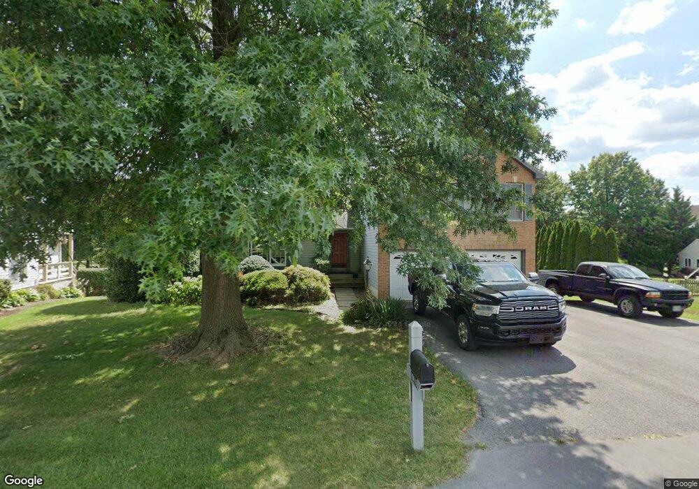
19416 Portsmouth Dr Hagerstown, MD 21742
Estimated Value: $501,671 - $540,000
4
Beds
3
Baths
3,108
Sq Ft
$166/Sq Ft
Est. Value
About This Home
This home is located at 19416 Portsmouth Dr, Hagerstown, MD 21742 and is currently estimated at $516,168, approximately $166 per square foot. 19416 Portsmouth Dr is a home located in Washington County with nearby schools including Paramount Elementary School, Otsego West Campus High School, and Northern Middle School.
Ownership History
Date
Name
Owned For
Owner Type
Purchase Details
Closed on
Jun 22, 2011
Sold by
Mcentee Fujiko and Mcentee Michelle
Bought by
Mcentee Michele
Current Estimated Value
Purchase Details
Closed on
Oct 30, 2009
Sold by
Mcentee Fujiko and Mcentee Michele
Bought by
Mcentee Michele
Purchase Details
Closed on
Jan 4, 2007
Sold by
Norman Litten
Bought by
Litten Norman S and Litten Janet Y
Purchase Details
Closed on
Jul 21, 1997
Sold by
Rogosch Dennis K
Bought by
Norman Litten
Create a Home Valuation Report for This Property
The Home Valuation Report is an in-depth analysis detailing your home's value as well as a comparison with similar homes in the area
Home Values in the Area
Average Home Value in this Area
Purchase History
| Date | Buyer | Sale Price | Title Company |
|---|---|---|---|
| Mcentee Michele | -- | -- | |
| Mcentee Michele | -- | None Available | |
| Mcentee Michele | -- | None Available | |
| Mcentee Michele | -- | -- | |
| Litten Norman S | -- | -- | |
| Norman Litten | $194,000 | -- |
Source: Public Records
Tax History Compared to Growth
Tax History
| Year | Tax Paid | Tax Assessment Tax Assessment Total Assessment is a certain percentage of the fair market value that is determined by local assessors to be the total taxable value of land and additions on the property. | Land | Improvement |
|---|---|---|---|---|
| 2025 | $3,694 | $392,767 | $0 | $0 |
| 2024 | $3,694 | $357,800 | $81,900 | $275,900 |
| 2023 | $3,519 | $341,233 | $0 | $0 |
| 2022 | $3,351 | $324,667 | $0 | $0 |
| 2021 | $3,200 | $308,100 | $81,900 | $226,200 |
| 2020 | $3,200 | $303,267 | $0 | $0 |
| 2019 | $3,163 | $298,433 | $0 | $0 |
| 2018 | $3,112 | $293,600 | $81,900 | $211,700 |
| 2017 | $3,053 | $288,033 | $0 | $0 |
| 2016 | -- | $282,467 | $0 | $0 |
| 2015 | $3,213 | $276,900 | $0 | $0 |
| 2014 | $3,213 | $276,900 | $0 | $0 |
Source: Public Records
Map
Nearby Homes
- 19703 Portsmouth Dr
- 19702 Portsmouth Dr
- 19446 Sapphire Dr
- 13336 Marquise Dr
- 13350 Diamond Pointe Dr Unit V227
- 20111 Regent Cir
- 20122 Regent Cir
- 0 Diamond Pointe Dr Unit V120
- TBD Turquoise Dr Unit V221
- 13116 Blue Ridge Rd
- 13511 Cherry Tree Cir
- 19554 Turquoise Dr Unit V219
- 13366 Marquise Dr
- 13335 Keener Rd
- 13336 Keener Rd
- 13343 Keener Rd
- 19310 Smallwood Terrace
- 13028 Woodburn Dr
- 12930 Oak Hill Ave
- 13347 Keener Rd
- 19412 Portsmouth Dr
- 19420 Portsmouth Dr
- 19427 Portsmouth Dr
- 13212 Johnnycake Ln
- 19411 Portsmouth Dr
- 19503 Portsmouth Dr
- 13208 Johnnycake Ln
- 13207 Postrider Ct
- 19512 Portsmouth Dr
- 19407 Portsmouth Dr
- 19507 Portsmouth Dr
- 13204 Johnnycake Ln
- 13215 Gentry Dr
- 13206 Postrider Ct
- 0 Jonny Cake Ln Unit WA2067595
- 13211 Postrider Ct
- 19410 Portsmouth Dr
- 19511 Portsmouth Dr
- 19403 Portsmouth Dr
- 19516 Portsmouth Dr