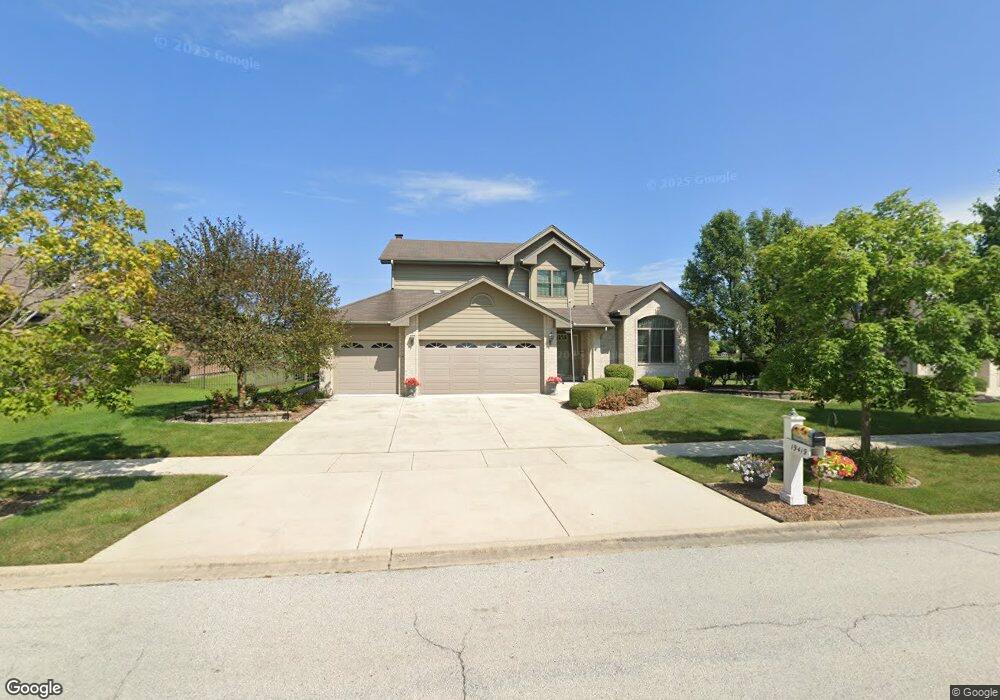
19419 Mayfield Place Unit 6 Tinley Park, IL 60487
Brookside Glen NeighborhoodEstimated Value: $516,418 - $539,000
4
Beds
4
Baths
2,658
Sq Ft
$199/Sq Ft
Est. Value
About This Home
This home is located at 19419 Mayfield Place Unit 6, Tinley Park, IL 60487 and is currently estimated at $529,605, approximately $199 per square foot. 19419 Mayfield Place Unit 6 is a home located in Will County with nearby schools including Walker Intermediate School, Summit Hill Junior High School, and Lincoln-Way East High School.
Ownership History
Date
Name
Owned For
Owner Type
Purchase Details
Closed on
Sep 12, 2003
Sold by
Marquette Bank
Bought by
Nowicki Donald L and Nowicki Toni
Current Estimated Value
Home Financials for this Owner
Home Financials are based on the most recent Mortgage that was taken out on this home.
Original Mortgage
$235,000
Interest Rate
6.04%
Mortgage Type
Stand Alone First
Create a Home Valuation Report for This Property
The Home Valuation Report is an in-depth analysis detailing your home's value as well as a comparison with similar homes in the area
Home Values in the Area
Average Home Value in this Area
Purchase History
| Date | Buyer | Sale Price | Title Company |
|---|---|---|---|
| Nowicki Donald L | $332,000 | Atg |
Source: Public Records
Mortgage History
| Date | Status | Borrower | Loan Amount |
|---|---|---|---|
| Previous Owner | Nowicki Donald L | $235,000 |
Source: Public Records
Tax History Compared to Growth
Tax History
| Year | Tax Paid | Tax Assessment Tax Assessment Total Assessment is a certain percentage of the fair market value that is determined by local assessors to be the total taxable value of land and additions on the property. | Land | Improvement |
|---|---|---|---|---|
| 2024 | $11,627 | $151,368 | $32,912 | $118,456 |
| 2023 | $11,627 | $135,187 | $29,394 | $105,793 |
| 2022 | $12,134 | $123,132 | $26,773 | $96,359 |
| 2021 | $10,282 | $115,195 | $25,047 | $90,148 |
| 2020 | $10,199 | $111,948 | $24,341 | $87,607 |
| 2019 | $9,919 | $108,952 | $23,690 | $85,262 |
| 2018 | $9,295 | $105,820 | $23,009 | $82,811 |
| 2017 | $9,276 | $103,350 | $22,472 | $80,878 |
| 2016 | $9,151 | $99,807 | $21,702 | $78,105 |
| 2015 | $9,036 | $102,167 | $20,938 | $81,229 |
| 2014 | $9,036 | $101,456 | $20,792 | $80,664 |
| 2013 | $9,036 | $102,772 | $21,062 | $81,710 |
Source: Public Records
Map
Nearby Homes
- 7905 Richardson Ln
- 7959 Brookside Glen Dr Unit VI
- 7928 Trinity Cir Unit 2SW
- 7928 Trinity Cir Unit 3NW
- 7716 Greenway Blvd Unit 1SW
- 8036 Highfield Ct
- 8026 Bradley Dr
- 8025 Stonegate Dr
- 8124 Glenbrook Place Unit 1
- 7407 Ridgefield Ln
- 19708 S Skye Dr
- 8131 W Evergreen Dr
- 20027 S Jessica Ln
- 19642 S Edinburgh Ln
- 7758 W Kingston Dr
- 19558 S Harlem Ave
- 7800 W Kingston Dr
- 8500 Brookside Glen Dr
- 20137 S Hampton Ct Unit A
- 20130 S Frankfort Square Rd
- 19427 Mayfield Place Unit 6
- 19411 Mayfield Place
- 19435 Mayfield Place Unit VI
- 19403 Mayfield Place
- 19420 Mayfield Place Unit 6
- 19410 Mayfield Place Unit 6
- 19435 Southfield Ln Unit VI
- 7759 Brookside Glen Dr Unit VI
- 19428 Mayfield Place Unit 6
- 19443 Mayfield Place
- 7833 Brookside Glen Dr Unit 6
- 7830 Dunree Ct
- 7753 Brookside Glen Dr
- 19451 Mayfield Place
- 7844 Dunree Ct Unit VI
- 7828 Brookside Glen Dr Unit 6
- 7822 Brookside Glen Dr
- 7841 Brookside Glen Dr Unit 6
- 7834 Brookside Glen Dr Unit VI
- 7816 Brookside Glen Dr Unit 6