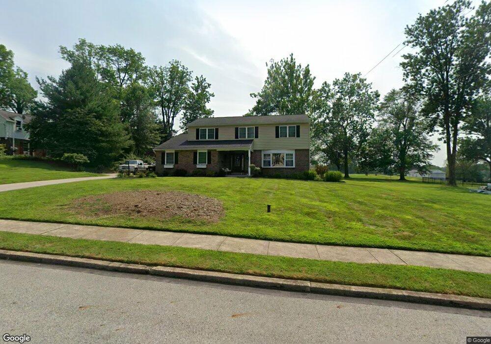
1942 Brandon Rd Norristown, PA 19403
Estimated Value: $526,000 - $606,000
4
Beds
3
Baths
2,336
Sq Ft
$243/Sq Ft
Est. Value
About This Home
This home is located at 1942 Brandon Rd, Norristown, PA 19403 and is currently estimated at $568,515, approximately $243 per square foot. 1942 Brandon Rd is a home located in Montgomery County with nearby schools including Charles Blockson Middle School, Paul V Fly Elementary School, and East Norriton Middle School.
Ownership History
Date
Name
Owned For
Owner Type
Purchase Details
Closed on
Nov 25, 2005
Sold by
Wheeler Christina Marie and Cannon Raymond J
Bought by
Profrock Christopher A and Profrock Marybeth
Current Estimated Value
Home Financials for this Owner
Home Financials are based on the most recent Mortgage that was taken out on this home.
Original Mortgage
$280,000
Outstanding Balance
$155,543
Interest Rate
6.17%
Estimated Equity
$412,972
Create a Home Valuation Report for This Property
The Home Valuation Report is an in-depth analysis detailing your home's value as well as a comparison with similar homes in the area
Home Values in the Area
Average Home Value in this Area
Purchase History
| Date | Buyer | Sale Price | Title Company |
|---|---|---|---|
| Profrock Christopher A | $350,000 | -- |
Source: Public Records
Mortgage History
| Date | Status | Borrower | Loan Amount |
|---|---|---|---|
| Open | Profrock Christopher A | $280,000 |
Source: Public Records
Tax History Compared to Growth
Tax History
| Year | Tax Paid | Tax Assessment Tax Assessment Total Assessment is a certain percentage of the fair market value that is determined by local assessors to be the total taxable value of land and additions on the property. | Land | Improvement |
|---|---|---|---|---|
| 2025 | $8,061 | $165,010 | $50,160 | $114,850 |
| 2024 | $8,061 | $165,010 | $50,160 | $114,850 |
| 2023 | $7,970 | $165,010 | $50,160 | $114,850 |
| 2022 | $7,919 | $165,010 | $50,160 | $114,850 |
| 2021 | $7,871 | $165,010 | $50,160 | $114,850 |
| 2020 | $7,636 | $165,010 | $50,160 | $114,850 |
| 2019 | $7,466 | $165,010 | $50,160 | $114,850 |
| 2018 | $5,845 | $165,010 | $50,160 | $114,850 |
| 2017 | $7,048 | $165,010 | $50,160 | $114,850 |
| 2016 | $6,984 | $165,010 | $50,160 | $114,850 |
| 2015 | $6,470 | $165,010 | $50,160 | $114,850 |
| 2014 | $6,470 | $165,010 | $50,160 | $114,850 |
Source: Public Records
Map
Nearby Homes
- 1992 Keswick Way
- 1914 Yorktown S
- 2060 Yorktown S
- 618 Brandon Rd
- 443 Brandon Rd
- 1924 Juniata Rd
- 143 Riversedge Dr Unit CONDO 143
- 121 Woodstream Dr Unit CONDO 121
- 2044 Mill Rd
- 391 Rittenhouse Blvd
- 68 Jefferson Ave
- 0 Roosevelt Blvd
- 37 Burnside Ave
- 32 Miami Rd
- 2055 W Marshall St
- 392 Joseph St
- 278 Stone Ridge Dr
- 1633 Williams Way
- 253 Stone Ridge Dr Unit 253
- 348 Glenn Rose Cir
- 1938 Brandon Rd
- 1946 Brandon Rd
- 1939 Brandon Rd
- 1934 Brandon Rd
- 1950 Brandon Rd
- 1935 Brandon Rd
- 280 School Ln
- 1931 Brandon Rd
- 1930 Brandon Rd
- 2010 Virginia Ln
- 1954 Brandon Rd
- 2004 Virginia Ln
- 281 School Ln
- 2016 Virginia Ln
- 1998 Virginia Ln
- 1927 Brandon Rd
- 1992 Virginia Ln
- 271 School Ln
- 1986 Virginia Ln
- 1958 Brandon Rd