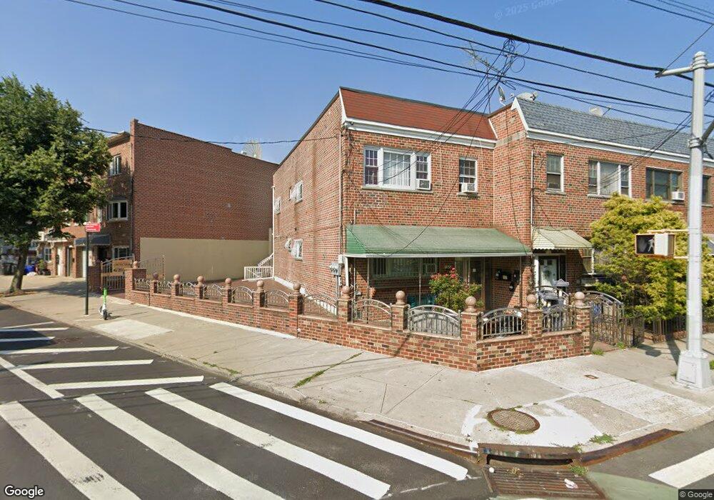
1942 Bronxdale Ave Bronx, NY 10462
Morris Park NeighborhoodEstimated Value: $736,072 - $986,000
Studio
--
Bath
1,880
Sq Ft
$466/Sq Ft
Est. Value
About This Home
This home is located at 1942 Bronxdale Ave, Bronx, NY 10462 and is currently estimated at $875,268, approximately $465 per square foot. 1942 Bronxdale Ave is a home located in Bronx County with nearby schools including P.S. 083 The Donald Hertz School, Bronx Excellence 2, and Bronx Charter School For Excellence 2.
Ownership History
Date
Name
Owned For
Owner Type
Purchase Details
Closed on
Nov 20, 2023
Sold by
1942 Bronxdale Llc
Bought by
Senata Pond Realty Llc
Current Estimated Value
Purchase Details
Closed on
Oct 18, 2019
Sold by
Choudhry Zahida S
Bought by
1942 Bronxdale Llc
Purchase Details
Closed on
Sep 21, 1999
Sold by
Diaz Carlos
Bought by
Chaudhry Zanida S
Home Financials for this Owner
Home Financials are based on the most recent Mortgage that was taken out on this home.
Original Mortgage
$200,800
Interest Rate
8.99%
Mortgage Type
Purchase Money Mortgage
Create a Home Valuation Report for This Property
The Home Valuation Report is an in-depth analysis detailing your home's value as well as a comparison with similar homes in the area
Home Values in the Area
Average Home Value in this Area
Purchase History
| Date | Buyer | Sale Price | Title Company |
|---|---|---|---|
| Senata Pond Realty Llc | -- | -- | |
| 1942 Bronxdale Llc | -- | -- | |
| Chaudhry Zanida S | $251,000 | First American Title Ins Co |
Source: Public Records
Mortgage History
| Date | Status | Borrower | Loan Amount |
|---|---|---|---|
| Previous Owner | Chaudhry Zanida S | $200,800 |
Source: Public Records
Tax History
| Year | Tax Paid | Tax Assessment Tax Assessment Total Assessment is a certain percentage of the fair market value that is determined by local assessors to be the total taxable value of land and additions on the property. | Land | Improvement |
|---|---|---|---|---|
| 2025 | $6,304 | $33,270 | $4,903 | $28,367 |
| 2024 | $6,304 | $31,387 | $5,086 | $26,301 |
| 2023 | $6,014 | $29,611 | $4,341 | $25,270 |
| 2022 | $5,577 | $43,140 | $7,020 | $36,120 |
| 2021 | $5,879 | $39,060 | $7,020 | $32,040 |
| 2020 | $5,869 | $39,540 | $7,020 | $32,520 |
| 2019 | $5,472 | $35,820 | $7,020 | $28,800 |
| 2018 | $5,030 | $24,676 | $5,499 | $19,177 |
| 2017 | $4,746 | $23,280 | $7,020 | $16,260 |
| 2016 | $5,200 | $26,012 | $6,718 | $19,294 |
| 2015 | $3,024 | $24,540 | $7,800 | $16,740 |
| 2014 | $3,024 | $24,360 | $7,800 | $16,560 |
Source: Public Records
Map
Nearby Homes
- 1916 Barnes Ave
- 1913 Barnes Ave
- 1961 Wallace Ave
- 1914 Holland Ave
- 1858 Wallace Ave
- 928 Rhinelander Ave
- 1839 Matthews Ave
- 2004 Bogart Ave
- 1925 Radcliff Ave
- 1918 Hunt Ave
- 733 Rhinelander Ave
- 762 Brady Ave Unit 221
- 986 Neill Ave
- 758 Brady Ave Unit 214
- 758 Brady Ave Unit 411
- 760 Brady Ave Unit 417
- 760 Brady Ave Unit 217
- 754 Brady Ave Unit 303
- 756 Brady Ave Unit 507
- 2037 Radcliff Ave
- 1940 Bronxdale Ave
- 1960 Matthews Ave
- 1938 Bronxdale Ave
- 1962 Matthews Ave
- 1936 Bronxdale Ave
- 1964 Matthews Ave
- 1966 Matthews Ave
- 1934 Bronxdale Ave
- 1968 Matthews Ave
- 1950 Bronxdale Ave
- 1932 Bronxdale Ave
- 1932 Daly Ave
- 1917 Muliner Ave
- 1915 Muliner Ave
- 1919 Muliner Ave
- 1919 Muliner Ave Unit 2
- 1913 Muliner Ave
- 1952 Bronxdale Ave
- 1921 Muliner Ave
- 1930 Bronxdale Ave
Your Personal Tour Guide
Ask me questions while you tour the home.