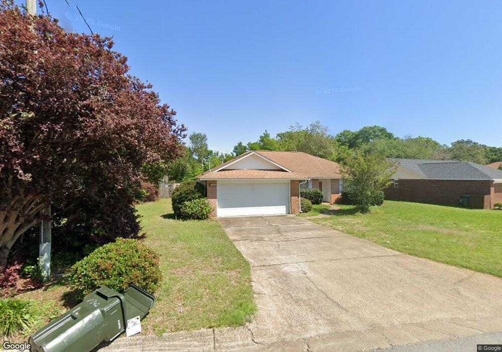
1942 Coral Island Rd Pensacola, FL 32506
Southwest Pensacola NeighborhoodEstimated Value: $259,000 - $293,000
--
Bed
2
Baths
1,739
Sq Ft
$159/Sq Ft
Est. Value
About This Home
This home is located at 1942 Coral Island Rd, Pensacola, FL 32506 and is currently estimated at $276,474, approximately $158 per square foot. 1942 Coral Island Rd is a home located in Escambia County with nearby schools including Pleasant Grove Elementary School, Jim C. Bailey Middle School, and Escambia High School.
Ownership History
Date
Name
Owned For
Owner Type
Purchase Details
Closed on
Jun 20, 2025
Sold by
Carol A Barwick Living Trust and Cross Mary B
Bought by
Bolls Cecil Alan
Current Estimated Value
Purchase Details
Closed on
Oct 31, 2023
Sold by
Barwick Carol Jeanne Archer and Barwick Carol A
Bought by
Carol A Barwick Living Trust and Barwick
Purchase Details
Closed on
May 5, 2004
Sold by
Dean Jeffrey R and Dean Dawn M
Bought by
Barwick Joseph T and Barwick Carol A
Purchase Details
Closed on
Mar 9, 1998
Sold by
C C Family Ltd Ptnr
Bought by
Dean Jeffery R and Dean Dawn M
Home Financials for this Owner
Home Financials are based on the most recent Mortgage that was taken out on this home.
Original Mortgage
$81,400
Interest Rate
6.99%
Mortgage Type
VA
Create a Home Valuation Report for This Property
The Home Valuation Report is an in-depth analysis detailing your home's value as well as a comparison with similar homes in the area
Home Values in the Area
Average Home Value in this Area
Purchase History
| Date | Buyer | Sale Price | Title Company |
|---|---|---|---|
| Bolls Cecil Alan | $250,000 | First International Title | |
| Bolls Cecil Alan | $250,000 | First International Title | |
| Carol A Barwick Living Trust | $100 | None Listed On Document | |
| Carol A Barwick Living Trust | $100 | None Listed On Document | |
| Barwick Joseph T | $125,500 | Lawyers Title Agenct Of Nort | |
| Dean Jeffery R | $93,400 | -- |
Source: Public Records
Mortgage History
| Date | Status | Borrower | Loan Amount |
|---|---|---|---|
| Previous Owner | Dean Jeffery R | $81,400 |
Source: Public Records
Tax History Compared to Growth
Tax History
| Year | Tax Paid | Tax Assessment Tax Assessment Total Assessment is a certain percentage of the fair market value that is determined by local assessors to be the total taxable value of land and additions on the property. | Land | Improvement |
|---|---|---|---|---|
| 2024 | $1,176 | $125,169 | -- | -- |
| 2023 | $1,176 | $121,524 | $0 | $0 |
| 2022 | $1,202 | $117,985 | $0 | $0 |
| 2021 | $1,191 | $114,549 | $0 | $0 |
| 2020 | $1,162 | $112,968 | $0 | $0 |
| 2019 | $1,137 | $110,429 | $0 | $0 |
| 2018 | $1,130 | $108,370 | $0 | $0 |
| 2017 | $1,123 | $106,142 | $0 | $0 |
| 2016 | $1,108 | $103,959 | $0 | $0 |
| 2015 | $1,090 | $103,237 | $0 | $0 |
| 2014 | $1,079 | $102,418 | $0 | $0 |
Source: Public Records
Map
Nearby Homes
- 911 Vonna Jo Cir
- 940 Vonna Jo Cir
- 1958 Coral Island Rd
- 1978 Coral Reef Rd
- 1101 Antigua Cir
- 1060 Antigua Cir
- The Alabaster Plan at Martin Preserve
- The Camilla Plan at Martin Preserve
- The Delilah Plan at Martin Preserve
- 9787 Cobblebrook Dr
- 1914 Coral Island Rd
- 2041 Marquesas Ln
- 9907 Starling Dr
- 9854 Starling Dr
- 9903 Starling Dr
- 9865 Starling Dr
- 9750 Brookstone Way
- 9839 Starling Dr
- 9827 Starling Dr
- 9835 Starling Dr
- 1940 Coral Island Rd
- 1944 Coral Island Rd
- 1946 Coral Island Rd
- 915 Vonna Jo Cir
- 919 Vonna Jo Cir
- 1936 Coral Island Rd
- 1948 Coral Island Rd
- 1949 Coral Island Rd
- 1947 Coral Island Rd
- 1945 Coral Island Rd
- 1951 Coral Island Rd
- 1943 Coral Island Rd
- 923 Vonna Jo Cir
- 1953 Coral Island Rd
- 1934 Coral Island Rd
- 1950 Coral Island Rd
- 1941 Coral Island Rd
- 1955 Coral Island Rd
- 927 Vonna Jo Cir
- 1939 Coral Island Rd