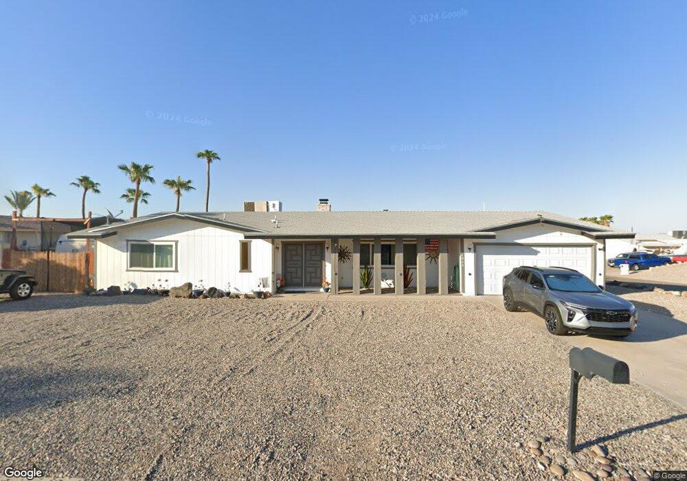
1942 Daytona Ave Lake Havasu City, AZ 86403
Estimated Value: $430,000 - $524,000
3
Beds
2
Baths
1,826
Sq Ft
$269/Sq Ft
Est. Value
About This Home
This home is located at 1942 Daytona Ave, Lake Havasu City, AZ 86403 and is currently estimated at $491,019, approximately $268 per square foot. 1942 Daytona Ave is a home located in Mohave County with nearby schools including Starline Elementary School, Thunderbolt Middle School, and Lake Havasu High School.
Ownership History
Date
Name
Owned For
Owner Type
Purchase Details
Closed on
May 2, 2005
Sold by
Amato Mary Anna
Bought by
Lacey Chad and Lacey Donna
Current Estimated Value
Home Financials for this Owner
Home Financials are based on the most recent Mortgage that was taken out on this home.
Original Mortgage
$192,000
Outstanding Balance
$100,110
Interest Rate
5.84%
Mortgage Type
New Conventional
Estimated Equity
$390,909
Purchase Details
Closed on
Oct 18, 2003
Sold by
Amato Mary Anna and Schroeder Mary Jo
Bought by
Amato Mary Anna
Purchase Details
Closed on
Nov 9, 2001
Sold by
Amato Mary Anna
Bought by
Amato Mary Anna and Schroeder Mary Jo
Purchase Details
Closed on
Oct 4, 2001
Sold by
Schroeder Lloyd T
Bought by
Schroeder Mary J
Purchase Details
Closed on
Aug 14, 2001
Sold by
Walker James W
Bought by
Walker Delfina
Create a Home Valuation Report for This Property
The Home Valuation Report is an in-depth analysis detailing your home's value as well as a comparison with similar homes in the area
Home Values in the Area
Average Home Value in this Area
Purchase History
| Date | Buyer | Sale Price | Title Company |
|---|---|---|---|
| Lacey Chad | $240,000 | Capital Title Agency Inc | |
| Amato Mary Anna | -- | -- | |
| Amato Mary Anna | -- | -- | |
| Schroeder Mary J | -- | -- | |
| Walker Delfina | -- | -- |
Source: Public Records
Mortgage History
| Date | Status | Borrower | Loan Amount |
|---|---|---|---|
| Open | Lacey Chad | $192,000 |
Source: Public Records
Tax History Compared to Growth
Tax History
| Year | Tax Paid | Tax Assessment Tax Assessment Total Assessment is a certain percentage of the fair market value that is determined by local assessors to be the total taxable value of land and additions on the property. | Land | Improvement |
|---|---|---|---|---|
| 2026 | $555 | -- | -- | -- |
| 2025 | $1,125 | $34,390 | $0 | $0 |
| 2024 | $1,125 | $47,803 | $0 | $0 |
| 2023 | $1,125 | $33,107 | $0 | $0 |
| 2022 | $1,083 | $28,083 | $0 | $0 |
| 2021 | $1,265 | $23,759 | $0 | $0 |
| 2019 | $1,204 | $18,970 | $0 | $0 |
| 2018 | $1,165 | $18,450 | $0 | $0 |
| 2017 | $1,146 | $16,773 | $0 | $0 |
| 2016 | $1,020 | $14,417 | $0 | $0 |
| 2015 | $994 | $13,291 | $0 | $0 |
Source: Public Records
Map
Nearby Homes
- 190 Aspen Dr
- 160 Aspen Dr
- 1958 Montana Vista Unit D
- 1962 Cliffrose Dr
- 220 White Oak Dr
- 371 Cottonwood Dr
- 1852 Montana Vista Unit B
- 1939 Pine Ln
- 1884 Montana Vista Unit 63B
- 2042 Swanson Ave Unit A
- 2042 Swanson Ave Unit H
- 72 Mariposa Dr Unit D
- 1840 Montana Vista Unit D
- 1838 Montana Vista Unit C
- 1827 Combat Dr
- 1824 Montana Vista Unit D
- 2080 Swanson Ave Unit F
- 2080 Swanson Ave Unit C
- 2080 Swanson Ave Unit D
- 2080 Swanson Ave Unit I
- 201 Greentree Dr
- 210 Aspen Dr
- 211 Greentree Dr
- 1936 Daytona Ave
- 197 Greentree Dr
- 211 Aspen Dr
- 220 Aspen Dr
- 181 Aspen Dr
- 221 Greentree Dr
- 180 Aspen Dr
- 1930 Daytona Ave
- 1954 Daytona Ave
- 221 Aspen Dr
- 193 Greentree Dr
- 210 Cottonwood Dr
- 210 Greentree Dr
- 171 Aspen Dr
- 180 Cottonwood Dr
- 198 Greentree Dr
- 170 Aspen Dr