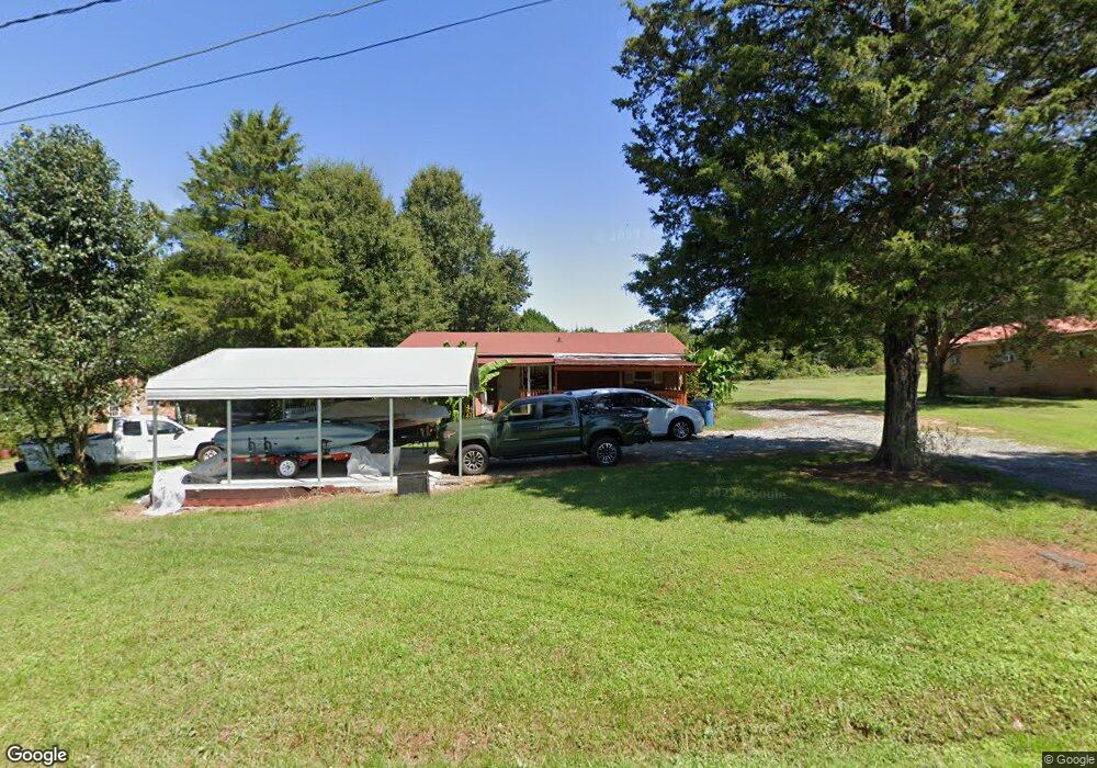
1942 Imperial St Conover, NC 28613
Estimated Value: $195,635 - $215,000
3
Beds
1
Bath
960
Sq Ft
$214/Sq Ft
Est. Value
About This Home
This home is located at 1942 Imperial St, Conover, NC 28613 and is currently estimated at $205,659, approximately $214 per square foot. 1942 Imperial St is a home located in Catawba County with nearby schools including Claremont Elementary School, River Bend Middle School, and Bunker Hill High School.
Ownership History
Date
Name
Owned For
Owner Type
Purchase Details
Closed on
Aug 14, 2009
Sold by
Sutherland Edward E
Bought by
Vang Billy
Current Estimated Value
Home Financials for this Owner
Home Financials are based on the most recent Mortgage that was taken out on this home.
Original Mortgage
$65,786
Outstanding Balance
$42,849
Interest Rate
5.19%
Mortgage Type
FHA
Estimated Equity
$162,810
Purchase Details
Closed on
Dec 13, 1999
Purchase Details
Closed on
Oct 1, 1994
Create a Home Valuation Report for This Property
The Home Valuation Report is an in-depth analysis detailing your home's value as well as a comparison with similar homes in the area
Home Values in the Area
Average Home Value in this Area
Purchase History
| Date | Buyer | Sale Price | Title Company |
|---|---|---|---|
| Vang Billy | $67,000 | None Available | |
| -- | $69,900 | -- | |
| -- | $52,000 | -- |
Source: Public Records
Mortgage History
| Date | Status | Borrower | Loan Amount |
|---|---|---|---|
| Open | Vang Billy | $65,786 |
Source: Public Records
Tax History Compared to Growth
Tax History
| Year | Tax Paid | Tax Assessment Tax Assessment Total Assessment is a certain percentage of the fair market value that is determined by local assessors to be the total taxable value of land and additions on the property. | Land | Improvement |
|---|---|---|---|---|
| 2025 | $796 | $159,300 | $9,100 | $150,200 |
| 2024 | $796 | $159,300 | $9,100 | $150,200 |
| 2023 | $796 | $159,300 | $9,100 | $150,200 |
| 2022 | $589 | $81,200 | $9,100 | $72,100 |
| 2021 | $572 | $81,200 | $9,100 | $72,100 |
| 2020 | $572 | $81,200 | $9,100 | $72,100 |
| 2019 | $564 | $81,200 | $0 | $0 |
| 2018 | $448 | $64,400 | $9,400 | $55,000 |
| 2017 | $428 | $0 | $0 | $0 |
| 2016 | $428 | $0 | $0 | $0 |
| 2015 | $436 | $64,400 | $9,400 | $55,000 |
| 2014 | $436 | $72,600 | $9,100 | $63,500 |
Source: Public Records
Map
Nearby Homes
- 1462 Farmington Hills Dr
- 1641 Farmington Hills Dr
- 1470 Farmington Hills Dr
- 1632 Farmington Hills Dr
- 1611 Mayfair Dr
- 0000 Burris Rd
- 1502 Farmington Hills Dr
- 1925 Maius Dr Unit 30
- 1592 Farmington Hills Dr
- 206 Rowal St SE
- 712 Mount Olive Church Rd
- 710 Mount Olive Church Rd
- 1605 3rd St NE
- 304 Parlier Ave NE
- 1106 3rd Street Dr SE
- The Braselton II Plan at Rowe Crossing
- The Harrington Plan at Rowe Crossing
- The Coleman Plan at Rowe Crossing
- The Piedmont Plan at Rowe Crossing
- The Reynolds Plan at Rowe Crossing
- 1948 Imperial St
- 1936 Imperial St
- 1954 Imperial St
- 1937 Imperial St
- 2032 Crown Dr
- 1924 Imperial St
- 1962 Imperial St
- 2036 Crown Dr
- 1967 Prestige Heights Dr
- 1966 Prestige Heights Dr
- 2006 Crown Dr
- 2038 Crown Dr
- 1957 Prestige Heights Dr
- 1984 Crown Dr
- 1956 Prestige Heights Dr
- 1986 Crown Dr
- 1986 Crown Dr Unit 3595338
- 1976 Crown Dr
- 1975 Crown Dr
- 1947 Prestige Hgts Dr