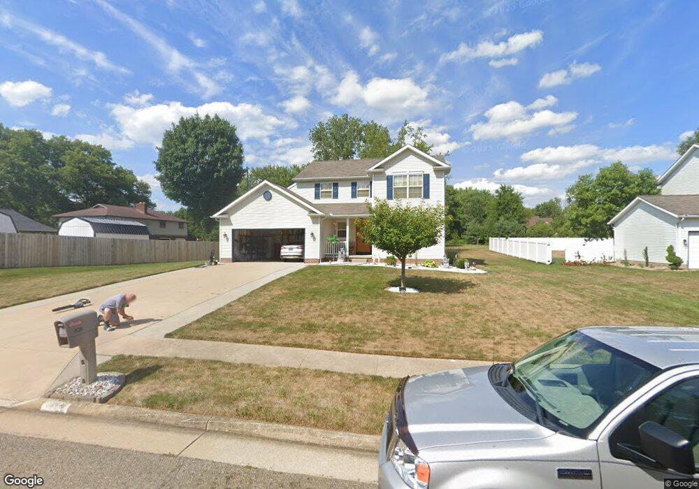
1942 Liberty Dr NE Louisville, OH 44641
Estimated Value: $264,000 - $305,000
3
Beds
3
Baths
1,736
Sq Ft
$165/Sq Ft
Est. Value
About This Home
This home is located at 1942 Liberty Dr NE, Louisville, OH 44641 and is currently estimated at $285,949, approximately $164 per square foot. 1942 Liberty Dr NE is a home located in Stark County with nearby schools including Louisville High School and St. Thomas Aquinas High School & Middle School.
Ownership History
Date
Name
Owned For
Owner Type
Purchase Details
Closed on
Mar 29, 2006
Sold by
21St Homes Inc
Bought by
Haren Jennifer D
Current Estimated Value
Home Financials for this Owner
Home Financials are based on the most recent Mortgage that was taken out on this home.
Original Mortgage
$136,000
Outstanding Balance
$78,245
Interest Rate
6.38%
Mortgage Type
Fannie Mae Freddie Mac
Estimated Equity
$207,704
Purchase Details
Closed on
Sep 7, 2004
Sold by
Alpine Design & Development Corp
Bought by
21St Homes Inc
Home Financials for this Owner
Home Financials are based on the most recent Mortgage that was taken out on this home.
Original Mortgage
$2,200,000
Interest Rate
6.17%
Mortgage Type
Purchase Money Mortgage
Purchase Details
Closed on
Dec 12, 2003
Sold by
C & M Development Inc
Bought by
Alpine Design & Development Corp
Home Financials for this Owner
Home Financials are based on the most recent Mortgage that was taken out on this home.
Original Mortgage
$1,610,000
Interest Rate
6.01%
Mortgage Type
Purchase Money Mortgage
Create a Home Valuation Report for This Property
The Home Valuation Report is an in-depth analysis detailing your home's value as well as a comparison with similar homes in the area
Home Values in the Area
Average Home Value in this Area
Purchase History
| Date | Buyer | Sale Price | Title Company |
|---|---|---|---|
| Haren Jennifer D | $170,000 | None Available | |
| 21St Homes Inc | -- | -- | |
| Alpine Design & Development Corp | $1,610,000 | Land America/Lawyers Title |
Source: Public Records
Mortgage History
| Date | Status | Borrower | Loan Amount |
|---|---|---|---|
| Open | Haren Jennifer D | $136,000 | |
| Previous Owner | 21St Homes Inc | $2,200,000 | |
| Previous Owner | Alpine Design & Development Corp | $1,610,000 |
Source: Public Records
Tax History Compared to Growth
Tax History
| Year | Tax Paid | Tax Assessment Tax Assessment Total Assessment is a certain percentage of the fair market value that is determined by local assessors to be the total taxable value of land and additions on the property. | Land | Improvement |
|---|---|---|---|---|
| 2025 | -- | $90,830 | $18,340 | $72,490 |
| 2024 | -- | $90,830 | $18,340 | $72,490 |
| 2023 | $2,565 | $59,680 | $14,070 | $45,610 |
| 2022 | $2,571 | $59,680 | $14,070 | $45,610 |
| 2021 | $2,578 | $59,680 | $14,070 | $45,610 |
| 2020 | $2,185 | $54,950 | $12,670 | $42,280 |
| 2019 | $2,194 | $56,880 | $12,670 | $44,210 |
| 2018 | $2,262 | $56,880 | $12,670 | $44,210 |
| 2017 | $1,914 | $46,420 | $8,160 | $38,260 |
| 2016 | $1,953 | $46,420 | $8,160 | $38,260 |
| 2015 | $1,959 | $46,420 | $8,160 | $38,260 |
| 2014 | $236 | $49,290 | $8,650 | $40,640 |
| 2013 | $1,122 | $49,290 | $8,650 | $40,640 |
Source: Public Records
Map
Nearby Homes
- 1639 Horizon Dr
- 1702 View Pointe Ave
- 908 Sand Lot Cir
- 6969 Georgetown St NE
- 822 Sand Lot Cir
- 510 S Bauman Ct
- 204 E Broad St
- 107 E Broad St
- 4060 Hambleton Ave NE
- 728 E Broad St
- 201 Indiana Ave
- 520 S Silver St
- 641 S Nickelplate St
- 2425 Miday Ave NE
- 248 Menegay Rd
- 6416 15th St NE
- 8225 Georgetown St
- 308 Superior St
- 325 Lincoln Ave
- 1715 High St
- 1952 Liberty Dr NE
- 1932 Ravenna Ave
- 1914 Ravenna Ave
- 1962 Liberty Dr NE
- 1944 Pleasure Ct Unit 9
- 1944 Pleasure Ct Unit 9
- 1950 Pleasure Ct Unit 8
- 822 Overlook St
- Lot 2 Overlook Dr
- 1960 Pleasure Ct Unit 6
- 1956 Pleasure Ct Unit 7
- 1972 Liberty Dr NE
- 1966 Pleasure Ct Unit 5
- 715 Overlook St
- 1947 Pleasure Ct
- 3492 Ravenna Ave
- 823 Overlook St
- 0 Pleasure Ct
- 1984 Liberty Dr NE
- 1971 Pleasure Ct Unit 14