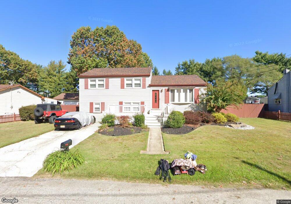
1942 Melvina Rd Woodbury, NJ 08096
Deptford Township NeighborhoodEstimated Value: $256,000 - $370,000
--
Bed
--
Bath
1,584
Sq Ft
$196/Sq Ft
Est. Value
About This Home
This home is located at 1942 Melvina Rd, Woodbury, NJ 08096 and is currently estimated at $310,281, approximately $195 per square foot. 1942 Melvina Rd is a home located in Gloucester County with nearby schools including Deptford Township High School and St. Teresa Regional School.
Ownership History
Date
Name
Owned For
Owner Type
Purchase Details
Closed on
Nov 18, 1998
Sold by
Wells Mary and Wells Mary E
Bought by
Samuel Kate L
Current Estimated Value
Home Financials for this Owner
Home Financials are based on the most recent Mortgage that was taken out on this home.
Original Mortgage
$73,600
Outstanding Balance
$16,362
Interest Rate
6.8%
Mortgage Type
FHA
Estimated Equity
$293,919
Create a Home Valuation Report for This Property
The Home Valuation Report is an in-depth analysis detailing your home's value as well as a comparison with similar homes in the area
Home Values in the Area
Average Home Value in this Area
Purchase History
| Date | Buyer | Sale Price | Title Company |
|---|---|---|---|
| Samuel Kate L | $77,500 | -- |
Source: Public Records
Mortgage History
| Date | Status | Borrower | Loan Amount |
|---|---|---|---|
| Open | Samuel Kate L | $73,600 |
Source: Public Records
Tax History Compared to Growth
Tax History
| Year | Tax Paid | Tax Assessment Tax Assessment Total Assessment is a certain percentage of the fair market value that is determined by local assessors to be the total taxable value of land and additions on the property. | Land | Improvement |
|---|---|---|---|---|
| 2025 | $5,887 | $164,200 | $33,800 | $130,400 |
| 2024 | $5,698 | $164,200 | $33,800 | $130,400 |
| 2023 | $5,698 | $164,200 | $33,800 | $130,400 |
| 2022 | $5,657 | $164,200 | $33,800 | $130,400 |
| 2021 | $5,576 | $164,200 | $33,800 | $130,400 |
| 2020 | $5,512 | $164,200 | $33,800 | $130,400 |
| 2019 | $5,407 | $164,200 | $33,800 | $130,400 |
| 2018 | $5,286 | $164,200 | $33,800 | $130,400 |
| 2017 | $5,144 | $164,200 | $33,800 | $130,400 |
| 2016 | $5,039 | $164,200 | $33,800 | $130,400 |
| 2015 | $4,883 | $164,200 | $33,800 | $130,400 |
| 2014 | $4,757 | $164,200 | $33,800 | $130,400 |
Source: Public Records
Map
Nearby Homes
- 1284 Hurffville Rd
- 240 Deer Ln
- 1602 Almonesson Rd
- 2029 Konrad Ave
- 47 Jones Ave
- 51 Linden Dr
- 9 Birch Ct
- 0 Ethel Ave
- 405 Melvin Ave
- 1905 Bellevue Ave
- 571 Almonesson Rd
- 420 Zane Ave
- 2 Katherine Ct
- 1924 Rosemore Ave
- 200 W Landing Rd
- 924 W Evesham Rd
- 301 Castlewood Way
- 212 Summit Ave
- 341 Chancellor Dr
- 1228 Burlington Ave
- 1950 Melvina Rd
- 1930 Melvina Rd
- 1954 Melvina Rd
- 1933 Melvina Rd
- 1951 Melvina Rd
- 1966 Melvina Rd
- 1963 Melvina Rd
- 1976 Melvina Rd
- 1971 Melvina Rd
- 1982 Melvina Rd
- 1979 Melvina Rd
- 1934 Mckee Ave
- 1948 Mckee Ave
- 1914 Melvina Rd
- 1920 Mckee Ave
- 1988 Melvina Rd
- 1989 Melvina Rd
- 1966 Mckee Ave
- 276 Roberts Ave
- 1994 Melvina Rd